Data- Tropical Storm Nate -Datos de la Tormenta tropical Nate
Tropical Storm Nate contributed 17% of our annual rainfall – in just two days
---La tormenta tropical Nate contribuyó con el 17% de nuestra precipitación anual, en solo dos días.
In English, para español favor de bajar, gracias.
By: Debra Hamilton and Luisa Moreno
Monteverde Institute
One prediction of global climate change is an intensification of weather events. While the rigorous scientific process does not permit a single event to constitute a conclusion, Tropical Storm Nate should be included in the accounts of multiple anomalies that are occurring throughout the world. Here we would like to share the precipitation and wind data from our weather station at the Monteverde Institute.
Tropical Storm Nate began on Wednesday, October 4th with a rainfall of 155.4 mm (6.12 inches) for that day. The precipitation amount for Thursday, October 5th was 364.0 mm (14.33”) for a total rainfall of 519.4 mm (20.45”) over the two days of the storm. This rainfall was accompanied by winds of 35.4 km/hour from the west on the 4th and 45.1 km per hour from the WNW on the 5th. The following day, October 6th, was relatively dry with 17 mm of precipitation but still windy with 37 km/hour winds, then coming from the ESE.
This rain fell on soils that were already saturated from the 687.1 mm (27.05 inches) of rain received in the month of September and the 102.3mm that fell between October 1st and the 3rd.

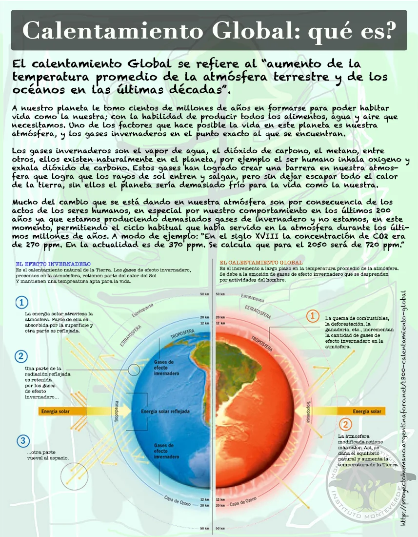
A tropical depression is seen off the Atlantic coast of Central America in an infrared satellite image captured at 1:15 p.m. ET on Oct. 4, 2017. NOAA (https://www.cbsnews.com/news/tropical-storm-nate-depression-hurricane-us-gulf-coast/)
Annual precipitation in the zone ranges roughly between 3000-4500 mm of precipitation. We would expect the lower end of the rainfall at 1400m of elevation, meaning that Tropical Storm Nate contributed 17% of our annual rainfall – in just two days. Total rainfall from September 1st through October 7th was 1.33 meters of precipitation.
Since October 7th, we have only received a total of 18.9 mm – another unusual situation possibly related to the Madden-Julian oscillation. This eastward moving oscillation has an effect that increases rain on one side (rising air side) and suppresses the rain potential on the back side (falling air side) (https://www.climate.gov/news-features/blogs/enso/what-mjo-and-why-do-we-care). At the moment, we are in the suppressed rain stage. By late October, however, the oscillation will have moved from the Caribbean and will not be a factor for decreased precipitation (http://www.cpc.ncep.noaa.gov/products/precip/CWlink/MJO/mjoupdate.pdf).
Impermeable clay layers in our terrain become slippery slopes as rain penetrates through the top layers of our soil. Small particles act as ball bearings as the water moves laterally across the clay layer, carrying the complete upper soil and vegetation down in landslides. Many areas have been greatly affected. Karen Gordon described the San Luis Valley as an area where a giant cat with long nails scratched the mountain slopes as it walked through.
We applaud all of the individuals and organizations that worked diligently during this storm to restore the well-being of the communities, we commend the residents of the zone for their collaboration and resilience, and we hold close to our hearts all those that lost property and income in this event.
En español, para inglés favor de subir.
Datos – Tormenta Tropical Nate
Por: Debra Hamilton and Luisa Moreno
Monteverde Institute
Una predicción del cambio climático global es una intensificación de los fenómenos meteorológicos. Si bien el riguroso proceso científico no permite que un solo evento represente una conclusión, la Tormenta Tropical Nate debería incluirse en las cuentas de múltiples anomalías que ocurren en todo el mundo. Aquí nos gustaría compartir los datos de precipitación y viento de nuestra estación meteorológica en el Instituto Monteverde.
La tormenta tropical Nate comenzó el miércoles 4 de octubre con una precipitación de 155,4 mm (6,1 pulgadas) para ese día. La cantidad de precipitación para el jueves 5 de octubre fue de 364.0 mm (14.33 ") para una precipitación total de 519.4 mm (20.45") durante los dos días de la tormenta. Esta lluvia fue acompañada por vientos de 35.4 km/ hora desde el oeste el 4 y 45.1 km por hora desde el ONO el día 5. El día siguiente, 6 de octubre, fue relativamente seco con 17 mm de precipitación, pero todavía con vientos de 37 km / hora, luego procedente del ESE.
Esta lluvia cayó sobre suelos que ya estaban saturados de agua de los 687.1 mm (27.05 pulgadas) de lluvia recibidas en el mes de septiembre y los 102.3 mm que cayeron entre el 1 y el 3 de octubre.

A tropical depression is seen off the Atlantic coast of Central America in an infrared satellite image captured at 1:15 p.m. ET on Oct. 4, 2017. NOAA (https://www.cbsnews.com/news/tropical-storm-nate-depression-hurricane-us-gulf-coast/)
La precipitación anual en la zona varía aproximadamente entre los 3000-4500 m. Es de esperar que la parte inferior de la lluvia llegue a 1400 m de elevación, lo que significa que la tormenta tropical Nate contribuyó con el 17% de nuestra precipitación anual, en solo dos días. La precipitación total desde el 1 de septiembre hasta el 7 de octubre fue de 1,33 metros de precipitación.
Desde el 7 de octubre, solo hemos recibido un total de 18.9 mm, otra situación inusual posiblemente relacionada con la oscilación Madden-Julian. Esta oscilación en movimiento hacia el este tiene un efecto que aumenta la lluvia en un lado (lado del aire ascendente) y suprime el potencial de lluvia en el lado posterior (lado del aire que cae) (https://www.climate.gov/news-features/blogs/enso / what-mjo-and-why-do-we-care). Por el momento, estamos en la etapa de lluvia reprimida. A fines de octubre, sin embargo, la oscilación se habrá movido desde el Caribe y no será un factor de disminución de la precipitación (http://www.cpc.ncep.noaa.gov/products/precip/CWlink/MJO/mjoupdate.pdf).
Las capas de arcilla impermeables en nuestro terreno se vuelven pendientes resbaladizas a medida que la lluvia penetra a través de las capas superiores de nuestro suelo. Las partículas pequeñas actúan como cojinetes de bolas a medida que el agua se mueve lateralmente a través de la capa de arcilla, llevando la capa de tierra superior completa y la vegetación hacia abajo en deslizamientos de tierra. Muchas áreas se han visto muy afectadas. Karen Gordon describió el Valle de San Luis como un área donde un gato gigante con largas uñas arañaba las laderas de las montañas mientras caminaba.
Aplaudimos a todos los individuos y organizaciones que trabajaron diligentemente durante esta tormenta para restaurar el bienestar de las comunidades, felicitamos a los residentes de la zona por su colaboración y capacidad de recuperación, y tenemos cerca de nuestros corazones a todos aquellos que perdieron propiedades y ingresos en este evento.
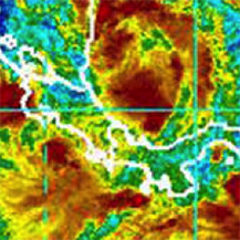
Dr. Thomas Simon - Climate Change and Disappearing States - Cambio Climático y Estados en Desaparición
El Dr. Thomas Simon dará la charla “Estados en Desaparición"
---Dr. Thomas Simon will give the lecture “Disappearing States"
The talk will be in English with simultáneos translation into Spanish. / Charla en inglés con traducción simultánea al español.
Para descripción en español favor de bajar:
Description:
Dr. Thomas Simon will give the lecture “Disappearing States: Ecological Canaries in the Coalmines of the Seas?” on Monday, December 8th, at 11:00am in the Monteverde Institute auditorium.
Dr. Thomas Simon is professor of International Law at the Johns Hopkins University Center for Chinese and American Studies. He has also acted as Professor of International Studies, Philosophy, and Legal Studies at various institutions. In addition to his work as a professor, Dr. Simon is the author of six books and countless articles on the subjects of peace, social justice, discrimination, minorities´ rights, genocide, and torture. The Monteverde Institute is proud to host him for this talk on political and social impacts of climate change.
ABSTRACT
The disappearing nation of the Maldives and its sister island states (Kiribati and Tuvalu) pose a challenge to philosophy, policy, and law. Many of those who take a holistic ecological perspective see these, much like the canaries in the coalmines, as early warnings signs of the cataclysmic effects of climate change. The current international system is based on the creation of states with fixed populations and defined territories. International law has no mechanisms for dealing with the extinction of states. Drastic problems call for drastic solutions such as recognizing states without territories. Policy makers should not treat nuclear war as gang violence. Similarly, they should not approach climate change as if it were like pollution.
Yet, a piecemeal, environmental approach does provide a solution to disappearing states. Amending the Law of the Sea Convention to freeze baselines at current levels would have an enormous impact since it would assure these states as well as those with threatened coastal communities with rights to the living and nonliving resources within their Exclusive Economic Zones (EEZ). Kiribati has nearly the same size EEZ as Japan and nearly four times the EEZ size of China, which, in turn, has about the same size EEZ as the Maldives and Tuvalu. International refugee law would not have to find a new classification for the environmentally displaced citizens of these islands. With funds from selling the rights to these resources, these citizens would have sufficient funds to relocate almost anywhere.
The canary in the coalmine does not symbolize a dire warning of ecological catastrophe but rather a potent warning of how fear conjured by over-dramatizing challenges turns us into meek canaries.
A big thank you to Cabañas los Pinos in Monteverde hosting Dr. Thomas Simon.
Español:
El Dr. Thomas Simon dará la charla “Estados en Desaparición: Indicadores del Porvenir de los Mares?” el lunes 8 de diciembre a las 11:00am en el auditorio del Instituto Monteverde.
El Dr. Thomas Simon es profesor de derecho internacional en el Centro para Estudios Chinos y Americanos de la Universidad de Johns Hopkins. También ha sido profesor de estudios internacionales, filosofía y estudios legales en varias instituciones. Además de su trabajo como profesor, el Dr. Simon es el autor de seis libros y numerosos artículos en los temas de paz, justicia social, discriminación, derechos de minorías y tortura. Al Instituto Monteverde le da orgullo ser anfitrión para su charla sobre impactos políticos y sociales del cambio climático.
Esta charla presenta el caso de naciones y estados (que se presumen tener poblaciones fijas y territorios definidos, por ejemplo las Maldivas) en desaparición debido a niveles marinos crecientes provocados por el cambio climático. Leyes internacionales no tienen mecanismos para lidiar con la desaparición de estados. El Dr. Simon propone una solución que definiría linderos que garantizan los derechos a recursos para poblaciones destinadas a volverse refugiados climáticos.
n agradecimiento muy grande a Cabañas los Pinos por hospedar al Dr. Thomas Simon.
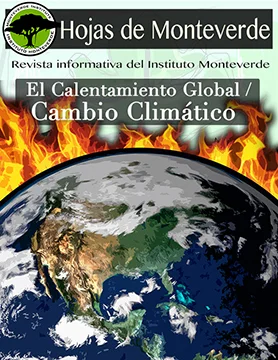
Hojas de Monteverde - Climate Change - Cambio Climático
Hojas de Monteverde - Cambio Climático -Climate Change - Revista Informativa del Instituto Monteverde.
English: Every 3 months the Monteverde Institute makes a newsletter for the community, on this occasion the theme is Climate Change. This is a Spanish only publication, but if you would like to know more information please contact us: communications@mvinstitute.org. (Please scroll down to see the newsletter, for a hard copy please stop by and visit us).
Thank you.
Español: Cada tres meses el Instituto Monteverde hace un folleto informativo para la comunidad de Monteverde. En esta ocasión trabajamos con el tema de cambio Climático. Les invitamos a verlo, si quiere una copia impresa puede pasar por el Instituto y con gusto le damos una.
Muchas Gracias.