
Ciencia Ciudadana en el Instituto Monteverde
Adopt-a-Stream is a citizen science (or community-based) program which started in 2009 to gather information about the streams in the Monteverde area and to involve students in the process.
Adopte-una-Quebrada es un programa de ciencia ciudadana (basada en la comunidad) que comenzó en 2009 para recopilar información sobre las corrientes en el área de Monteverde, involucrando a estudiantes en el proceso

Adopt-a-Stream is a citizen science (or community-based) program which started in 2009 to gather information about the streams in the Monteverde area and to involve students in the process. With their help, once every two months we monitor the health of the following streams: Quebrada Cuecha, Quebrada La Máquina, Quebrada Sucia, Quebrada La Saca, Río Negro and the unnamed quebrada behind the Santa Elena High School.
We work with the public high school in Santa Elena and two local private high schools, presenting introductory experiences in gathering and using information about the health of our fluvial community. Each year about three dozen students from the schools meet with our coordinator. After an introductory session, they will visit research sites.
In addition, DukeEngage, various interns, volunteers and Institute students work with the Adopt-a-Stream program coordinator to make observations and take measurements at other times of the year when school is not in session.
Each class takes samples from the same stream at two different locations. In the Rio Negro, for instance, one area is very close to the springs from which the waterway forms. The second is only about 500 meters downstream but located below a farm. The students collect and identify many types of macro-invertebrates found and learn how each type indicates something about the water’s quality. In the process they use scientific instruments to study water and air temperature, pH, turbidity, flow, nitrate and phosphate content, etc. This information is available to community groups and researchers and has proven useful in making decisions to protect the local waterways.
At the local high school many of the students add to this by participating in a Saturday program with the Santa Elena Preserve. The Adopt-a-Stream activity is one of several they work with in the preserve. Each year five students from the school who have demonstrated a high level of interest and achievement are selected for a special trip to the United States. Working with researchers in Rocky Mountain National Park near Estes Park, Colorado (Monteverde’s Sister City), students study the high mountain streams. When they return the students make a presentation to the school and the community about what they have learned. It’s a life-changing experience for many of these students, who share what they have learned with their classmates and other students.
In October of 2017, Tropical Storm Nate dumped 36” of rainfall in two days, mostly on the Pacific side of the Continental Divide. Hundreds of landslides poured downhill and the debris choked and polluted many streams. The Adopt-a-Stream program was useful in discovering how quickly the waterways recovered.
In the forest uphill from the Institute, the Quebrada Maquina filled its banks. By the time it crossed the road by the area known as La Cascada, it was literally that, a cascade that destroyed three homes beside it and cut a fifty foot wide gully across the road, isolating Monteverde for more than a week.
Measurements had been carried out in July and again after the storm had passed. It was more than four months before the water quality began returning to its normal healthy condition (Fig. 1)
For more information about the Adopt-a-Stream, other water quality studies, or if you are interested in an internship at the Institute, contact:
Luisa Moreno Scott, Research and Internship Coordinator
www.monteverde-institute.org
(506) 2645-5053, Ext 119

The red dots indicate the sites that we are currently sampling.
Los puntos rojos indican los sitios de muestreo que estamos actualmente visitando.
Adopte-una-Quebrada es un programa de ciencia ciudadana (basada en la comunidad) que comenzó en 2009 para recopilar información sobre las quebradas en el área de Monteverde, involucrando a estudiantes en el proceso. Con su ayuda, una vez cada dos meses monitoreamos la calidad de agua de las siguientes quebradas: Quebrada Cuecha, Quebrada La Máquina, Quebrada Sucia, Quebrada La Saca, Río Negro y la quebrada sin nombre detrás de la Escuela Secundaria Santa Elena.
Trabajamos con la escuela secundaria pública en Santa Elena y dos colegios privados locales, propiciando experiencias introductorias en la recopilación y el uso de información sobre la calidad de nuestra comunidad de ríos. Cada año, unas tres docenas de estudiantes de las escuelas se reúnen con nuestra coordinadora y después de una sesión introductoria, visitamos los sitios de investigación.
Además de DukeEngage, varios pasantes, voluntarios y estudiantes del Instituto trabajan con la coordinadora del programa Adopte-una-Quebrada para hacer observaciones y tomar mediciones en otros momentos del año cuando la escuela no se encuentra en días lectivos.
Cada clase toma muestras de la misma quebrada en dos ubicaciones diferentes. En el Río Negro, por ejemplo, un sitio de estudio que está cerca de las nacientes donde se forma el caudal. El otro está a solo unos 500 metros río abajo pero ubicado después de una finca. Los estudiantes recopilan e identifican muchos tipos de macro-invertebrados encontrados y aprenden cómo cada tipo indica algo sobre la calidad del agua. En el proceso, utilizan instrumentos científicos para estudiar la temperatura del agua y el aire, el pH, la turbidez, el flujo, la cantidad de nitrato y fosfato, etc. Esta información está disponible para los grupos de la comunidad e investigadores y ha demostrado ser útil para tomar decisiones con respecto a la protección de quebradas específicas.
En la escuela secundaria local, muchos de los estudiantes se suman a esta iniciativa por medio de un programa de sábado con la Reserva de Santa Elena. La actividad Adopte-una-Quebrada es uno de varios proyectos que realiza la reserva con los estudiantes. Cada año, cinco estudiantes de secundaria que han demostrado un alto nivel de interés y logros son seleccionados para un viaje especial a los Estados Unidos. Trabajando con investigadores en el Parque Nacional Rocky Mountain cerca de Estes Park, Colorado (Ciudad Hermana de Monteverde), los adolescentes estudian varios arroyos de esta gran montaña. Cuando regresan, los estudiantes hacen una presentación a la escuela y a la comunidad sobre lo que han aprendido. Es una experiencia que cambia la vida de muchos participantes, quienes comparten lo que han aprendido con sus compañeros de clase y otros colegas.
En octubre del 2017, la Tormenta Tropical Nate impactó Monteverde con casi un metro de lluvia en dos días, principalmente en el lado del Pacífico de la División Continental. Cientos de deslizamientos de tierra cayeron cuesta abajo y muchos sedimentos contaminaron las quebradas. El programa Adopte-una-Quebrada fue útil para monitorear qué tan rápido se recuperaron los cursos de agua.
En el bosque que se encuentra arriba del Instituto, la Quebrada Maquina llenó sus caudales. Al pasar por el sector de Monteverde conocido como “La Cascada”, el agua iba con tanta fuerza que destruyó tres casas y abrió un barranco de varios metros de ancho que interrumpió el acceso a Monteverde por más de una semana.
Las mediciones se llevaron a cabo en julio y nuevamente después de la tormenta. Pasaron más de cuatro meses antes de que la calidad del agua volviera a su estado normal de salud (Fig. 1)
Para obtener más información sobre Adopte-una-Quebrada, otros estudios de calidad del agua o si está interesado en una pasantía en el Instituto, comuníquese con:
Luisa Moreno Scott, Coordinadora de Investigación y Pasantías.
www.monteverde-institute.org
(506) 2645-5053, Ext. 119
Reforestation Program at the Monteverde Institute
Since 1998 the Monteverde Institute has been at the forefront of reforestation in the forests of Costa Rica and we have planted more than 250,000 trees. Learn about our Reforestation Program.
Since 1998 the Monteverde Institute has been at the forefront of reforestation in the forests of Costa Rica. In that effort we have planted more than 250,000 trees. Each year our two nurseries provide around 14,000 young trees to the local communities and preserves as well as an additional 3,000+ to several research forests that the Institute manages. We have produced more than 140 different species to replant in our forest, but have given special attention to several endemic trees that are critically endangered.
More than thirty years ago the Costa Rica Ministry of Agriculture encouraged landowners to cut down forests and to plant replacement forests of pine and cipres (to produce wood that was marketable as lumber). One of the most important uses they recommended, which has proven beneficial, is that they were planted as windbreaks. The windbreaks provide valuable wildlife corridors. The problem with the nonnative species, however, is that they do not support the local ecosystems, which suffered. Now those non native forests are being cut down, used as lumber, firewood, etc, and we and others are in the process of rebuilding those threatened ecosystems.
Our Recovery Story
Costa Rica has been the most successful country in the world in recovering their forests. Originally the forests covered 85% of the country, but largely because of this ill-advised policy, by the 1970s Costa Rica was only 35% forested; as of 2017 we have about 52% forest cover. But we have a long way to go.
Many of the trees are critically endangered, so we have concentrated on them. One example is the Ocotea monteverdensis, endemic to Monteverde. It is the main source of food for important species of birds like the Resplendent Quetzal and Three-wattled Bellbird. Once the forest contained thousands of mature O. monteverdensis, but today there may be around 700. Last year alone we planted 1500 and for the time being will continue emphasizing this important species.
While no one knows how long it will take for them to return to being primary forests, the secondary forests are already having positive effects. Where only a few years ago there were coffee trees or pastures filled with grasses and grazing cattle, guava trees and agave plants, now there is protective cover for a wide variety of flora and fauna.
Guava tree, left, and Agave plant, right, being surrounded by secondary growth forest.
Myrsine corralis (Ratoncillo)
One of our studies at Finca Rodriguez (until 2003 a coffee farm), is to determine how much support in addition to new trees does a forest need to recover. In Plot 1, planted in 2017, the existing trees had our seedlings planted among them and the plot was left wild, but we maintained the surroundings of the plot. In Plot 2, in 2016 we planted our seedlings and kept the grass mowed around them, so the young trees had the greatest amount of sunlight and water possible. In Plot 3 in 2015, we planted among the coffee trees and did nothing more, allowing other plants to come in naturally. While it is too soon to tell for sure, it seems at this point that, surprisingly, Plot 3 is doing the best.
In addition to what they provide for the environment, our regenerating forests are filled with opportunities for researchers in a wide variety of fields, and for those who wish to volunteer to help raise funds and/or plant trees.
Each year we let the communities along the Bellbird Corridor know how many trees we have and what varieties that are available for planting. To ensure that as many trees as possible survive, we provide guidance in types of trees, where to plant, and help in placement on their individual land. All trees are provided free of charge to community members who live in the Bellbird Corridor.
Randy Chinchilla Ramos is the GIS Coordinator, and Reforestation Coordinator. If you have questions about the Reforestation or GIS programs, or if you are interested in doing research in our regrowing forests, you can contact Randy at: gis@mvinstitute.org.
Julio Rojas Elizondo is the coordinator between the nursery workers, scientists, and landowners, including providing individual advice for the various projects.
The reforestation program is one of the best ways we have to share with the community of Monteverde the importance of restoring ecosystems, protect the water and conserve both natives and other important species.
Landowners are seeing the value of trees on their properties and are grateful to have the support to improve their land for themselves and for the environment.”
Various communities are increasingly mutually supportive in the reforestation effort. In addition to adding more trees the program is restoring soils, creating habit for animals and plants, improving water quality, restoring springs and furthering the economic development and stability of the area. We are grateful to see that our local friends are excited to work together to make the change, and to see the benefits.
If you wish to donate to this program please visit:
https://monteverde-institute.org/donate-support.html
You can also visit our Reforestation Program section at our webpage by clicking HERE
How does our Reforestation Program Cycle looks like?
What are some of our achievements for this year?
We planted 13,960 trees along the Bellbird Biological Corridor. These included species appropriate for all the different life zones in the Corridor.
In the lower zones we planted around 1,600 trees of 26 different native species. These were planted on three farms on Isla Cortezas.
In addition we established a small nursery in conjunction with the Asociación de Mujeres Mariposas de Golfo on the Costa de Pajaros Island. It began with 810 bags of young trees that included 80 species that are native to the area.
In Manzanillo we distributed fruit trees to various members of the community and planted trees at the community school.
Many groups and individuals have helped with our reforestation program including National Geographic Tours, G-Adventures, Collette Travel, Sun Tours, Change the World Kids, Terri Mallory, and the Adventure Girls.
What species are grown and how do potential planters find out what is the best for them?


We are happy to visit a local site and to advise individuals and organizations what species would be right for them. Each year, after we have counted and evaluated what we have, we advertise to the community.
Written by Robert W. Howe

El Programa de Reforestación del Instituto Monteverde
Desde 1998, el Instituto Monteverde ha estado a la vanguardia de la reforestación en los bosques de Costa Rica y hemos plantado más de 250,000 árboles. Conozca sobre nuestro Programa de Reforestación.
Desde 1998, el Instituto Monteverde ha estado a la vanguardia de la reforestación en los bosques de Costa Rica, plantado más de 250,000 árboles. Cada año, nuestros dos viveros proporcionan alrededor de 14,000 árboles jóvenes a las comunidades locales y reservas. Además, contamos con un adicional de 3,000 árboles que utilizamos en varios bosques de investigación que maneja el Instituto. Existen varias especies en peligro de extinción, endémicas, que son especialmente importantes para la comunidad de bosques nubosos, por lo que nuestro énfasis especial está en ellas. Sin embargo, hemos producido más de 140 especies desde que el Programa de Reforestación inició.
Hace más de treinta años, el Ministerio de Agricultura de Costa Rica impulsaba a los terratenientes a talar bosques, plantando bosques de reemplazo de pino y ciprés (debido a que son maderables). Entre los pocos beneficios encontrados, es que las filas de estos árboles han funcionado como cortavientos y corredores de vida silvestre. El problema con las especies no nativas es que no son compatibles con los ecosistemas locales, que han sufrido a consecuencia del cambio. Ahora estos bosques están siendo talados, usados como madera o leña y hemos quedado en proceso de reconstruir nuestros ecosistemas.
Nuestra historia de recuperación
Costa Rica ha sido el país más exitoso del mundo en recuperar sus bosques. Originalmente, los bosques cubrían el 85% del país, pero en gran parte debido a esta política poco aconsejable, en la década de 1970, Costa Rica tenía solo un 35% de bosques; a partir del 2017 hemos subido a un 52% de la cubierta forestal. Pero tenemos un largo camino por recorrer.
Muchos de los árboles están en peligro crítico por lo que nos hemos enfocado en ellos. Tal es el caso de la Ocotea monteverdensis, endémica de Monteverde, que es la principal fuente de alimento para importantes especies de aves como el quetzal resplandeciente y el pájaro campana. En algún momento contábamos con muchos O. monteverdensis maduros, pero hoy puede haber alrededor de 700. Solo el año pasado plantamos 1500 y por el momento continuaremos enfatizando esta importante especie.
Si bien nadie sabe cuánto tiempo les llevará a los bosques convertirse en primarios, los bosques secundarios ya están teniendo efectos positivos. Donde hace algunos años sólo había plantaciones de café, pastizales para el ganado, guayabas y plantas de agave, ahora hay una cubierta protectora con una amplia variedad de flora y fauna.
El árbol de Guayaba a la izquierda y la planta de Agave a la derecha - ambas rodeadas de bosque en crecimiento.
Myrsine corralis (Ratoncillo)
Uno de nuestros estudios en la Finca Rodríguez (que hasta 2003 fue una finca de café), es determinar cuánto trabajo se necesita para ayudar a un bosque en recuperarse. En la parcela 1, plantada en 2017, se plantaron plántulas nuevas entre los árboles ya existentes. Esta parcela se dejó para que las plántulas recién sembradas crecieran de manera salvaje, pero se dio mantenimiento a los bordes de la parcela. En la parcela 2, en 2016 plantamos nuestras plántulas y mantuvimos la hierba cortada alrededor de ellas, para que los árboles jóvenes tuvieran la mayor cantidad de luz solar y agua posible. En la parcela 3 en 2015, plantamos entre los cafetales y no hicimos nada más, permitiendo que otras plantas entraran naturalmente. Si bien es demasiado pronto para decirlo con seguridad, en este punto parece que, sorprendentemente, que la parcela 3 se está recuperándose mucho mejor.
Además de lo que proporcionan para el medio ambiente, nuestros bosques regenerados están llenos de oportunidades para investigadores en una amplia variedad de campos y para aquellos que desean ser voluntarios para ayudar a recaudar fondos y / o plantar árboles.
Cada año informamos a las comunidades a lo largo del Corredor Biológico Pájaro Campana cuántos árboles tenemos y qué variedades están disponibles para plantar. Para asegurarnos de que sobrevivan la mayor cantidad de árboles posible, brindamos orientación sobre los tipos de árboles, dónde plantar y cómo ayudar a cada tierra de forma individual. Todos los árboles se proporcionan a miembros de la comunidad de forma gratuita.
Randy Chinchilla Ramos ha trabajado con nosotros por más de 4 años y es el Coordinador de SIG y el Programa de Reforestación. Si tiene preguntas sobre el Programa de Reforestación, o si está interesado en hacer una investigación en nuestros bosques en crecimiento, puede comunicarse con Randy al siguiente correo: gis@mvinstitute.org.
Además, presentamos a nuestro compañero Julio Rojas Elizondo quien es el coordinador entre los trabajadores que mantienen nuestros viveros, los científicos y los terratenientes. También incluye asesoramiento individual para los diversos proyectos.
“El programa de reforestación es una de las mejores maneras en que debemos tener contacto y trabajar con la gente local, para compartir con la comunidad de Monteverde la importancia de restaurar los ecosistemas, proteger el agua y conservar tanto a los nativos como a otras especies importantes. Es emocionante ver cómo cada año hay más interés en plantar árboles en las granjas.
Los propietarios están viendo el valor de los árboles en sus propiedades y están agradecidos de tener el apoyo para mejorar sus tierras para ellos y para el medio ambiente ".
Varias comunidades se apoyan cada vez más en el esfuerzo de reforestación. Además de agregar más árboles, el programa está restaurando los suelos, creando hábito para los animales y las plantas, mejorando la calidad del agua, restaurando los manantiales y promoviendo el desarrollo económico y la estabilidad del área. Nos emociona ver que nuestros amigos locales están entusiasmados de trabajar juntos para lograr el cambio y ver los beneficios.”
Si desea donar para este programa, visite: https://monteverde-institute.org/donate-support.html
También puede visitar la sección del Programa de Reforestación en nuestra página web al hacer click AQUÍ
¿Cómo funciona un ciclo anual con nuestro Programa de Reforestación?
Fin de Temporada 2017 - 2018
Se entregaron 13 960 árboles en total por todo el Corredor Biológico Pájaro Campana, ya que contamos con viveros adecuados a las diferentes zonas de vida.
Entre nuestros logros, sólo en la zona baja hemos entregado y sembrado 1,597 áboles de 26 diferentes especies nativas en 3 fincas agropecuarias y en Isla Cortezas.
Además establecimos un vivero en conjunto con la Asociación de Mujeres Mariposas del Golfo, en Costa de Pájaros. El vivero empezó con un capital de 810 bolsas listas para ser sembradas y 80 plántulas de especies nativas sembradas en las bolsas.
En Manzanillo, repartimos árboles frutales a personas de la comunidad.
Sembramos árboles en la escuela y colegio de esta comunidad.
Muchos grupos y personass han ayudado con nuestro Programa de Reforestación, incluyendo National Geographic Tours, G-Adventures, Collette Travel, Sun Tours, Change the World Kids, Terri Mallory y Adventure Girls.
¿Qué especies se deben de plantar y cómo coordinamos con los propietarios?


Nos complace visitar cada sitio en específico para asesorar a los propietarios y organizaciones sobre qué especies serían adecuadas para ellos. Después de haber contado y evaluado lo que tenemos, promovemos las especies disponibles a la comunidad.
Escrito por Robert W. Howe
Collecting cucaracho in Costa Rica - Recolectando “cucaracho” en Costa Rica
In Costa Rica and northern Panama, the geographic ranges of the two species of Billia overlap. In these areas, there are not a lot of features to distinguish the species except for flower color.
--- En Costa Rica y el norte de Panamá, los rangos geográficos de las dos especies de Billia se superponen. En estas áreas, no hay muchas características para distinguir la especie excepto para el color de la flor.

Collecting cucaracho in Costa Rica

AJ standing in front a cabinet of dried, pressed plant specimens at the National Museum of Natural History of the United States.
My name is AJ Harris, and I am a botanist at the Smithsonian Institution National Museum of Natural History in Washington, D.C., where I am supported by a Peter Buck postdoctoral fellowship.
Within the broad field of botany, I am most interested in the geographic distributions of plants. To me, it is exciting to think of the processes that can explain how grasses exist on all seven continents even though mountain ranges and/or ocean basins separate those continents. Understanding how geographic distributions came to be, can help us to predict how they may change in the future due to environmental change.

Global distribution of species in the plant subfamily, Hippocastanoideae. The distribution of cucaracho, or Billia, is shown in red. Distributions of all other genera and species is represented by yellow.

Examples of the five genera that make up the plant subfamily Hippocastanoideae. From top row: cucaracho (Billia), buckeyes and horsechectnuts, Handeliodendron, golden coin tree (Dipteronia), maples (Acer).
For my postdoctoral research, I study the maple and buckeye trees and their close relatives, which constitute the plant subfamily, Hippocastanoideae. Hippocastanoideae, or the horsechestnut subfamily, includes five genera and about 150 species that are distributed mostly in temperate zones in the Northern Hemisphere. However, a few Hippocastanoideae occur in tropical areas. Billia is unique in the subfamily for its distribution from southern Mexico into Ecuador, Colombia, and Venezuela. The geographic distribution of Billia ultimately attracted my attention, and, eventually, I want to know how it come to live in the New World tropics in contrast to maple, buckeyes and other relatives that occur elsewhere.
Traditionally, Billia is thought to consist of two species; a red-flowered species, B. hippocastanum, that grows from Mexico into northern Panama, and a white-flowered species, B. rosea, that can be found from Costa Rica and into South America. Other than flower color, these species also differ on whether the flowering branch has full-sized leaves just below it or smaller leaves that sometimes fall off. Additionally, B. rosea may have yellow hairs on the flowering stalk, while hairs on the flowering stalk of B. hippocastanum, is either white or not there.

Representative dried, pressed museum specimens of Billia hippicastanum from Mexico (left) and B. rosea from Ecuador (right). Note the red flowers on B. hippocastanum and that the leaves directly underneath the flowering branch are missing (left) or composed of only one leaflet (right). This is contrast to B. rosea, which has white flowers (yellow with age here) and very large-sized leaves below its flowering branch.
Beyond these differences, the two species of Billia are mostly very similar. They both have three leaflets per leaf, though some leaves occur with one, two, or four leaflets. Their flowers have four sepals, petals and stamen, and the flowers can only be cut one way to yield two equal parts. The latter characteristic is usually associated with insect pollination. They also produce large, brown, capsular fruits with one to three seeds.
In Costa Rica and northern Panama, the geographic ranges of the two species of Billia overlap. In these areas, there are not a lot of features to distinguish the species except for flower color. For example, white-flowered individuals can have white, instead of yellow, hairs on the flowering branch. Similarly, white-flowered individuals can produce small leaves below the flowering branch, rather than large ones. Therefore, in the Manual de Plantas de Costa Rica Vol. VIII, the authors treated Billia in Costa Rica as having only one species, B. rosea.
I came to Costa Rica to study Billia and try to understand whether it has one or two species. I examined and collected Billia at low elevations in Osa Peninsula and at higher elevations at Monteverde. In Osa, I worked with Barry Hammel of Missouri Botanical Garden, Isabel Pérez, and Reinaldo Aguilar Fernández. In Monteverde, I worked with the Monteverde Institute and, especially with Fern Perkins and Eladio Cruz. My trip to Costa Rica was funded by the Smithsonian Institution and the Society for Systematic Biologists, and I am highly indebted to my sources of funding and all of the institutions and individuals who helped me to make the trip a success.

Places where I examined and collected Billia in Costa Rica. Upper star - Monteverde. Lower star, Puerta Jimenez, Osa.
At Osa, we found that most Billia trees were producing fruits. They had already flowered. However, we did find one individual in flower, and observed that it had white flowers, though newer petals has some yellow color while older petals had some red color.
At Monteverde, we saw white-flowered Billia at low elevations and red flowered Billia at the higher elevations. Unfortunately, we could not collect flowering branches from the trees with red flowers, because we would have needed mountain and tree climbing gear.
Billia in Osa and Monteverde seemed particularly susceptible to stranger figs, and newly produced leaves were red in color.
White-flowering Billia at lower elevations in Monteverde and Billia from Osa were similar in having large buttressing trunks. Red flowering Billia at higher elevations in Montreverde had narrow, non-buttressing trunks.


I still need more time to analyze my data to understand how many species of Billia in Costa Rica. My data analyses will include the use of DNA sequences from the Billia that I collected in Costa Rica as well as dried, pressed museum specimens, such as those that I examined at the Museo Nacional de Costa Rica in San Jose.
If you want to share your knowledge about Billia or images or if you have questions about my research, I am glad to hear from you! Please do not hesitate to contact me at harrisaj@inbox.com.

Recolectando “Cucaracho” en Costa Rica

AJ de pie frente un armario lleno de especímenes de plantas en el Museo de Historia Natural de EEUU.
Mi nombre es AJ Harris, soy botanista en el Smithsonian Institution National Museum of Natural History en Washington, D.C., donde tengo el apoyo de la beca para Postdoctorados, Peter Buck.
Dentro del amplio campo de la botánica, estoy más interesada en la distribución geográfica de las plantas. Para mí, es emocionante pensar en los procesos que pueden explicar cómo las gramíneas existen en los siete continentes, a pesar de que las cordilleras y / o las cuencas oceánicas separan esos continentes. Entender cómo las distribuciones geográficas llegaron a ser, puede ayudarnos a predecir cómo pueden cambiar en el futuro debido al cambio climática.

Distribución global de especies en la sub-familia Hippocastanoideae. La distribución de cucaracho o Billia está en rojo. Distribuciones de otros géneros y especies están representados en amarillo.
Para mi investigación postdoctoral, estudio los árboles de arce y de castaño y sus parientes cercanos, que constituyen la subfamilia de la planta, Hippocastanoideae. Hippocastanoideae, o la subfamilia de la cabra montés, incluye cinco géneros y unas 150 especies que se distribuyen principalmente en zonas templadas en el hemisferio norte. Sin embargo, algunos Hippocastanoideae ocurren en áreas tropicales. Billia es único en la subfamilia debido a su distribución del sur de México hasta Ecuador, Colombia y Venezuela. La distribución de la billia me llamó la atención y eventualmente, me llevó a querer saber como fue que vino a vivir a los trópicos del Neuvo Mundo en contraste con el arce, algunos castaños y otros parientes que ocurren en otros lugares.

Ejemplos de los cinco géneros que conforman la sub-familia Hippocastanoideae. Fila superior:
Cucaracho (Billia), buckeyes y horsechestnuts, Handeliodendron, árbol de moneda de oro (Dipteronia), arces (Acer)
Tradicionalmente, se piensa que Billia consta de dos especies; Una especie de flor roja, B. hippocastanum, que crece de México en el norte de Panamá, y una especie de flor blanca, B. rosea, que se puede encontrar desde Costa Rica y en América del Sur. Aparte del color de la flor, estas especies también difieren sobre si la rama floreciente tiene hojas de tamaño completo justo debajo de ella o hojas más pequeñas que a veces se caen. Además, B. rosea puede tener pelos amarillos en el tallo floreciente, mientras que los pelos en el tallo floreciente de B. hippocastanum, son blancos o no se encuentran.
Más allá de estas diferencias, las dos especies de Billia son en su mayoría muy similares. Ambos tienen tres folíolos por hoja, aunque algunas hojas se producen con uno, dos o cuatro folíolos. Sus flores tienen cuatro sépalos, pétalos y estambre, y las flores sólo se pueden cortar una manera de dar dos partes iguales. Esta última característica suele asociarse con la polinización de insectos. También producen frutos grandes, marrones y capsulares con una a tres semillas.

Especímenes representativos de museos de Billia hippicastanum de México (izquierda) y de B. rosea de Ecuador (a la derecha). Observe las flores rojas en B. hippocastanum y que las hojas directamente debajo de la rama floreciente faltan (izquierda) o compuestas de solamente un folleto (derecho). Esto contrasta con B. rosea, que tiene flores blancas (amarillas con la edad aquí) y hojas muy grandes por debajo de su rama floreciente.
En Costa Rica y el norte de Panamá, los rangos geográficos de las dos especies de Billia se superponen. En estas áreas, no hay muchas características para distinguir la especie excepto para el color de la flor. Por ejemplo, los individuos de flor blanca pueden tener pelos blancos, en lugar de amarillos, en la rama floreciente. De manera similar, los individuos de flor blanca pueden producir pequeñas hojas debajo de la rama florecida, en lugar de las grandes. Por lo tanto, en el Manual de Plantas de Costa Rica Vol. VIII,, los autores trataron a Billia en Costa Rica como una sola especie, B. rosea.
Vine a Costa Rica para estudiar a Billia y tratar de entender si tiene una o dos especies. Examiné y recolecté Billia en bajas elevaciones en la Península de Osa y en elevaciones más altas en Monteverde. En Osa, trabajé con Barry Hammel del Jardín Botánico de Misuri, Isabel Pérez, y Reinaldo Aguilar Fernández. En Monteverde, trabajé con el Instituto Monteverde y, especialmente con Fern Perkins y Eladio Cruz. Mi viaje a Costa Rica fue financiado por el Smithsonian Institution y la Society for Systematic Biologists, y estoy muy en deuda con mis fuentes de financiamiento y con todas las instituciones y personas que me ayudaron a hacer que el viaje un éxito.

Lugares donde he examinado y recogido a Billia en Costa Rica. Estrella superior - Monteverde. Estrella inferior, Puerta Jiménez, Osa.
En Osa, encontramos que la mayoría de los árboles Billia estaban produciendo fruta. Ya habían florecido. Sin embargo, encontramos a un individuo en flor, y observamos que tenía flores blancas, aunque los nuevos pétalos tienen un cierto color amarillo mientras que los pétalos más viejos tenían cierto color rojo.
En Monteverde, vimos a Billia de flores blancas en las elevaciones bajas y Billia de flores rojas en las elevaciones más altas. Desafortunadamente, no pudimos recolectar ramas florecientes de los árboles con flores rojas, porque hubiéramos necesitado equipo de montaña y escalada.
Billia en Osa y Monteverde parecían particularmente susceptibles a higuerones "estranguladores", y las hojas recién producidas eran de color rojo.
La Billia de floración blanca en las elevaciones más bajas en Monteverde y la Billia de Osa tenían similitudes con cuanto a que tenían troncos grandes y con Buenos contrafuertes. En cuanto a la Billia de floración roja en las elevaciones más altas de Montreverde, estas tenían troncos estrechos y sin contrafuertes.


Todavía necesito más tiempo para analizar mis datos para entender cuántas especies de Billia hay en Costa Rica. Mis análisis de datos incluirán el uso de secuencias de ADN de los Billia que coleccioné en Costa Rica, así como muestras de museos secos y prensados, como los que examiné en el Museo Nacional de Costa Rica en San José.
Si desea compartir sus conocimientos sobre Billia o imágenes o si tiene preguntas sobre mi investigación, me gustaría saber de usted! Por favor, no dude en ponerse en contacto conmigo en harrisaj@inbox.com..
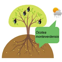
Ocotea monteverdensis: Conserving an Endangered Species --- Ocotea monteverdensis: Preservando una especie en peligro
O. m. naturally occurs as a dominant tree in primary forest remnants within its very limited range, between 1300 and 1500 m elevation between San Luis and Las Nubes, Costa Rica. Unfortunately, approximately 95% of this primary forest has been cut down.
---El O. m. se encuentra de manera natural como un árbol dominante en las zonas restantes de bosque primario entre un rango muy limitado, entre los 1300 y los 1500 m de elevación entre la zona de San Luis y las Nubes, en la zona de Monteverde, en Costa Rica. Desafortunadamente cerca del 95% de este bosque primario se ha cortado.

By Dev Joslin
In two previous blogs (1 - 2) , I have written about a very special, critically endangered tree species of the avocado family (Lauraceae) that is endemic to the Monteverde area. Ocotea monteverdensis (here referred to as O. m.) is an important food source for a number of large frugivorous birds, some of which are themselves threatened (resplendent quetzal, black guan, and three-wattled bellbird). O. m. naturally occurs as a dominant tree in primary forest remnants within its very limited range, between 1300 and 1500 m elevation between San Luis and Las Nubes, Costa Rica. Unfortunately, approximately 95% of this primary forest has been cut down.
In this blog issue, I would like to talk about the conservation of this species---Principal questions are:
(1) How can the estimated 770 reproductively-mature trees that remain be protected and kept healthy?
(2) How well is O. m. maintaining its population through the natural recruitment of young trees?
(3) How might the young replacement population numbers be enhanced by human efforts?
PROTECTION
Reasons for protection of the remaining mature trees are fairly obvious, including maintaining forest biodiversity, safeguarding the only seed source of this species for future generations, and sheltering an important food source for threatened frugivorous bird species. But on whose property are these remaining trees? How much of this land is permanently protected, or even temporarily protected? To address this question, Randy Chinchilla of MVI and I superimposed property lines over our map of individual tree locations within the Monteverde community:
The red dots mark the location of individual trees and the red lines are property lines. (Click to enlarge).
Click to enlarge.
It appears that the only parcels that are permanently protected are the Rachel and Dwight Crandell Memorial Reserve (protected by the MVI and FCC) and two small parcels protected by the Conservation League of Monteverde (ACM). Additionally there are other parcels currently protected by their owners, because they are either (a) part of privately-owned wildlife refuges for tourism (e.g., Curi-Cancha) or (b) are owned by persons with a strong commitment to conserving these forest remnants. Based on these criteria, it appears that about 5% of the trees are permanently protected, about 25% “temporarily protected,” and the remaining 70% lack any real protection at all.
Looking at parcel sizes, the trees are fairly evenly distributed among parcels greater than 25 hectares in size (30%), between 5 and 25 ha (38%), and less than 5 ha (32%). The current principal uses for these properties break out into the following categories: tourism (34%), dairy farming (25%), other farming (17%), conservation (16%), other or unknown (8%).
One possible approach to safeguarding the remaining mature trees might involve direct contact with the individual property owners, concentrating on properties with the largest numbers of individuals and largest forested parcels. Perhaps the most effective long-term approach embraces education of the community as a whole through the schools and educational programs for the public. With this in mind, three interns from the CIEE Sustainability Program—Aislyn Keyes, Rachel Lapp, and Morgan Cassidy—with help from teachers at the Creative Learning Center, this year produced educational films for local schools and the public:
YouTube LINKS:
Ocotea monteverdensis: https://www.youtube.com/watch?v=ryvSHl0-oEo Inglés
Ocotea monteverdensis:: https://www.youtube.com/watch?v=EQhMVKdHAUg Español
About birds: https://www.youtube.com/watch?v=9WYcYHVCXNs&list=PLrZXSocm8k3UmgONZbroM39iRZwQGu5Yn
NATURAL RECRUITMENT
Is O. m. currently sustaining its population through natural reproduction and recruitment alone? This is a very challenging question because of very limited available data and the difficulty of collecting it. Reaching dominant status in a primary forest is a very slow process, and we have no systematic surveys of the density of sapling and intermediate-sized O. m. trees in remaining primary forest remnants, nor in the secondary forests that currently make up an estimated 20% of the landscape across O. m.’s natural range. However, we do have limited data on the densities of seedlings under different forested conditions. I will attempt to draw some cautious conclusions using this limited data, non-systematic observations, and considerable speculation.
Click to enlarge.
Three recent studies have surveyed seedling density. Two studies by MVI interns quantified the density of seedlings of the Lauraceae family as a whole in forests close to the MVI property. Luis Beltran and Katie Johnson surveyed transects through both secondary forest and primary forest portions of the Crandell Reserve. Another MVI intern, Lillian Eden, similarly evaluated densities of Lauraceae seedlings in nearby secondary forests owned by MVI and by the Trostle family (across the road from MVI). The secondary forests in these two surveys differed significantly: Beltran and Johnson measured in secondary forest that had recovered from logging decades previously, whereas Eden looked at pine and cypress forests that had been planted in old pastures, about 40 years previously. Despite the presence of reproductively-mature O. m. trees in the vicinity of all these transects, only two O. m. seedlings total were found in plots in the secondary forest following logging (and zero in primary forest), but 12-13% of the Lauraceae seedlings under pine and cypress were O. m. seedlings.
Click to enlarge.
Two interns of the CIEE Sustainability Program in Monteverde in 2015 surveyed only O. m. seedling densities across a much wider area of the MV zone and across a much broader spectrum of forest in the MV zone than the above studies. The research of Jessica Sciara and Christie Fite covered transects in the vicinity of mature O. m. trees at sites ranging from the Stuckey farm in the Southeast across the Monteverde zone to the Camacho farm in the Northwest. Sciara and Fite looked at seedling densities in all three forest types covered above—primary forest, secondary forest developed following logging, and secondary forest following pasture.
The similarities between these independent results is striking, and perhaps contrary to intuition. Lauraceae seedlings in general, and O. m. seedlings in particular, appear to have difficulty establishing themselves in primary forest remnants. In contrast, lands formerly in pasture provide amenable settings for seedling germination and survival. Granted, it is risky to draw any firm conclusions from these studies where sampling was not systematic or totally representative, and where many variables were not controlled. Nevertheless, testable hypotheses can be generated which certainly appear most interesting.
Click to enlarge.
The work of Sciara and Fite was primarily focused on the relationship between O. m. seedling establishment and the density of the canopy cover above. Canopy openness was considered a surrogate for light intensity. Their results indicate the importance of a threshold of minimum canopy openness needed for O. m. establishment to succeed:
A portion of their study of seedling density was a comparison between areas immediately adjacent to human footpaths and areas interior to footpaths. The footpath areas had significantly (p = 0.01) less canopy cover (i.e., more light), and they tended to have higher seedling densities (p = 0.08) and taller seedlings (p = 0.06) with broader crowns (p = 0.02). In addition to the positive effect of more canopy openness and light along paths, Sciara and Fite also speculated that the effect could be a result of reduced competition for moisture and nutrients from understory plants that were less dense in and beside the paths.
Two O. m. seedlings (orange flags) growing in soil exposed by upturned roots of fallen tree.
I would be so bold as to speculate that this reduced competition from native understory plants partially explains the differences in seedling densities between primary forest, secondary forests following logging, and secondary forests following pastures. Understory shrubs, forbs, and saplings are most strongly established in primary forests, but very sparsely established in old pastures. In primary forest, or secondary forests following logging, O. m. seeds may require enough luck to be deposited in a small canopy opening where the understory vegetation has been disturbed, such as created by a small treefall like this one:
In contrast, abandoned pastures may have large old shade trees and/or planted pines or cypress that can provide the ideal light conditions both for the growth of O. m. seedlings and for the suppression of competition by pasture grasses and some pioneer forest species.
IMPLICATIONS FOR HUMAN EFFORTS AT RESTORING A YOUNG POPULATION
I believe the above limited results indicate that O. m. will have difficulty maintaining its population in the future without considerable human assistance. The poor establishment of seedlings in primary forest remnants and in secondary forests previously logged is not good news for the species’ rapid recovery. The results described above, however, do point to opportunities for encouraging natural regeneration and important parameters for locating the best settings for planting seedlings.
Aerial photo of a portion of Curi-Cancha Reserve. Pasture in lower center is surrounded by O. m. trees in full flower. (Click to enlarge).
It would appear that natural regeneration is most favored in (a) former pastureland where (b) grass competition has been reduced, (c) there is moderate shade and wind protection, (d) an O. m. seed source is nearby, and (e) large trees exist to provide perches for birds that disseminate seeds. To the right is a good example of this type of pasture (located in Curi Cancha).
The alternative of planting seedlings should of course occur chiefly within the natural range of the species with special attention to elevation, to the amount of shade (see Sciara and Fite’s results on crown density), to protection from desiccation by direct sun and wind, and to competition from grasses and other plants.
INFO-GRAPHICS ON HOW TO PROTECT O.M. Please click to enlarge.

Ocotea monteverdensis: Preservando una especie en peligro
In the following blog, we present the project "Mi Ocotea", a joint effort where several organizations have come together to work on the conservation of this species
por Dev Joslin
En dos artículos anteriores (1 - 2) he escrito sobre una especie de árbol muy especial y en peligro de extinción que pertenece a la familia de los aguacatillos (Lauracea) y que es endémico a la zona de Monteverde. El Ocotea monteverdensis (aquí llamado O. m.) es una fuente importante de alimento para varias especies de aves fructíferas, algunos de ellos que a su vez se encuentran en peligro (quetzal resplandeciente, pava negra, calandria). El O. m. se encuentra de manera natural como un árbol dominante en las zonas restantes de bosque primario entre un rango muy limitado, entre los 1300 y los 1500 m de elevación entre la zona de San Luis y las Nubes, en la zona de Monteverde, en Costa Rica. Desafortunadamente cerca del 95% de este bosque primario se ha cortado..
En este artículo me gustaría hablar sobre la conservación de este especie, las preguntas iniciales son:
(1) ¿Cómo pueden los estimados 770 árboles maduros restantes ser protegidos y mantener su salud?
(2) ¿Qué tan bien está la especie de O. m. manteniendo su población por medio del reclutamiento natural de árboles jóvenes?
(3) ¿Cómo se podrá mejorar la población de árboles jóvenes por medio de esfuerzos humanos?
Protección
Las razones por la cual es preciso proteger los árboles maduros restantes resulta relativamente obvio, que incluye el de ayudar a mantener la biodiversidad del bosque, el de salvaguardar la única fuente de semillas de esta especie para futuras generaciones y el proteger una fuente importante de alimento para especies de aves fructíferas. ¿Pero donde se encuentran estos árboles? ¿Cuantas de estas tierras se encuentran protegidas, o al menos temporalmente protegidas? Para poder responder a esta pregunta Randy Chinchilla del IMV y yo hemos sobreimpuesto líneas sobre nuestro mapa de la ubicación de árboles en la comunidad de Monteverde.
Los puntos rojos son los árboles de O.m. y las líneas son las divisiones de las propiedades. (Pulse sobre la imagen para agrandar).
Pulse sobre la imagen para agrandar.
Al parecer las únicas parcelas que están bajo protección permanente son la Reserva Crandell (protegido por el Instituto Monteverde y el FCC), y dos parcelas que están bajo la protección de la Asociación Conservacionista de Monteverde (ACM). Adicionalmente hay otras parcelas que están siendo actualmente protegidas por sus dueños, ya que son o (a) parte de refugios de vida Silvestre privados (ej, Curi-Cancha) o (b) los dueños son personas con un compromiso fuerte para mantener las zonas boscosas. Bajo este criterio parece que el 5% de los árboles están siendo protegidos de manera permanente y el 25% están siendo “temporalmente protegidos” y el 70% carece de protección.
Al ver el tamaño de las parcelas, los árboles están distribuidos de manera más o menos igualitaria en parcelas de más de 25 hectáreas en tamaño (30%), entre los 5 y 25ha (%38), y menos de 5ha (32%). Los usos principales de estos suelos se dividen en la siguientes categorías: turismo (34%), fincas lecheras (25%), usos agrícolas (17%), conservación (16%) y otros (%8).
Un acercamiento posible para salvaguardar los árboles restantes maduros puede ser el de entablar contacto directo con los dueños de cada una de las propiedades, concentrándose en la propiedades con la mayor cantidad de individuos y los que tienen parcelas de bosque grandes. Quizás el abordaje más efectivo a largo plazo abarca la educación de la comunidad como un todo a través de las escuelas y de programas educativos para el público general. Con esto en mente 3 pasantes del programa de sostenibilidad del CIEE - Aislyn Keyes, Rachel Lapp, and Morgan Cassidy- con ayuda de las maestras del Centro de Educación Creativa han producido una serie de cortos:
Enlaces de Youtube:
https://www.youtube.com/watch?v=ryvSHl0-oEo Inglés
https://www.youtube.com/watch?v=EQhMVKdHAUg Español https://www.youtube.com/watch?v=9WYcYHVCXNs&list=PLrZXSocm8k3UmgONZbroM39iRZwQGu5Yn
Promover el crecimiento natural
¿Está actualmente el O. m. sosteniendo su población a través de reproducción y reclutamiento natural solamente? Contestar esta pregunta es un reto ya que hay poca información y dificultades en colectar la que sí existe. El tener un estatus dominante en un bosque primario es un proceso muy lento, y no tenemos encuestas sistemáticas de la densidad de los árboles jóvenes ni medianos de la especie de O.m. que se encuentran en las zonas de bosque primario ni de los bosques secundarios que representan un 20% del área de distribución natural de la especie. A pesar de esto sí tenemos información limitada sobre la densidad de plántulas en diferentes condiciones de boscosidad. Por ende, haré el intento de hacer una conclusiones básicas utilizando la información que sí se tiene así como la de observaciones no sistemáticas y algo de especulación.
(Pulse en la imagen para agrandar).
Tres estudios recientes han estudiado la densidad de las plántulas. Dos estudios por pasantes del IMV cuantificaron la densidad de plántulas de la familia Laurácea como un todo en bosques cercanos a la propiedad del IMV. Luis Beltran y Katie Johnson estudiaron transectos por las zonas de bosque secundario y primario de la Reserva Crandell. Otra pasante del IMV, Lillian Eden, evaluó de manera similar la densidad de plántulas en bosques secundarios cercanos que pertenecían al IMV y a la familia Trostle (al otro lado del IMV). Los bosque secundarios de estos estudios variaban de manera significativa: Beltran y Johnson midieron el bosque secundario que se había recuperado de la tala en décadas anteriores, mientras que Eden estudio bosques de pino y ciprés que habían sido sembradas en pastizales viejos (hacía cerca de 40 años). A pesar de la presencia de árboles relativamente maduros de árboles O.m. en la vecindad de estos transectos, solo dos plántulas de O.m. fueron encontrados en los tramos de bosque secundario que habían crecido después de la explotación forestal (y ninguno en la zona de bosque primario), pero sí se vió que en la zona donde estaba el ciprés y el pino el 12-13% de las plántulas de Lauracea encontradas eran de la especie de O.m.
(Pulse en la imagen para agrandar).
Los pasantes del 2015 del programa de sostenibilidad del CIEE en Monteverde estudiaron la densidad únicamente de las plántulas del O.m. en una zona de Monteverde mucho más grande y a través de un espectro de bosques más amplio que en las muestras anteriores. La investigación de Jessica Sciara y de Christie Fite cubrió transectos en la vecindad de árboles maduros del O.m. en lugares que cubrían desde la finca de los Stuckey en el sur-este a través de Monteverde hasta la finca de los Camacho en el nor-oeste. Sciara y Fite vieron las densidades de las plántulas en los tres tipos de bosque que se mencionaron anteriormente – boque primario, boque secundario que de desarrolló después de la tala y bosque secundario que siguió después de ser una finca lechera.
Las similitudes entre cada uno de los estudios individuales es impresionante y posiblemente contradictorio a la intuición de muchos. En general las plántulas de los Lauraceae, y las del O.m. en particular, aparentan tener dificultades en establecerse en los restos de bosque primario. En contraste, terrenos que se usaban anteriormente como pastizales proveen un lugar ameno para la germinación de las semillas y su sobrevivencia. Concedido, es riesgosos el concluir conclusiones muy firmes de estos estudios donde el muestreo no era sistemático ni completamente representativo, y donde muchas de las variables no se podían controlar. Sin obstante, una hipótesis comprobable puede ser generado y que sería de mucho interés.
(Pulse en la imagen para agrandar).
El trabajo de Sciara y de Fite se enfocó principalmente en la relación entreel establecimiento de los vástagos de O.m. y la densidad de cobertura superior del dosel. La apertura del dosel era considerado un controlador de la intensidad de luz. Los resultados que tuvieron indican la importancia de un umbral mínimo de apertura en el dosel para que el establecimiento del O.m. pueda ser exitoso:
Una porción del estudio sobre la densidad de los vástagos era una comparación entre las áreas inmediatamente adecentes a los senderos y las áreas que se encontraban al interior fuera de estos senderos. Las zonas del sendero tenían un cobertura boscosa significativamente (p = 0.01) menor (y por ende más luz), y estos tendían a tener mayor densidad de vástagos (p= 0.08) y vástagos de mayor altura (p= 0.06) con coronas más amplias (p= 0.02). En adición a tener un efecto de ofrecer mayor apertura en el dosel y por ende más luz en los senderos, Sciara y Fite también especularon que el efecto podría resultar en una competencia menor por humedad y nutrientes con otras plantas del sotobosque ya que estos tenían menos densidad al lado de los senderos.
Dos vástagos de O.m. (cinta naranja) creciendo sobre suelo perturbado por las raíces de un árbol caído.
Me atrevería a especular de que esta disminución en la competencia del sotobosque explica parcialmente las diferencias entre las densidades entre el bosque primario, los bosques secundarios reforestados después de la tala, y los bosques secundarios después de la ganadería lechera. Arbustos de sotobosque y árboles juveniles se establecen de una manera más estable en bosques primarios, pero de manera mas escasa en pastizales. En el bosque primario, o en el bosque secundario después de la tala las semillas de O.m. puede que requieran de suficiente suerte para ser depositados en una apertura donde la vegetación haya sido perturbada, a modo de ejemplo una como de un árbol caído como este (ver imagen).
En contraste los pastizales abandonados puede que tengan árboles más viejos que se utilizaron para sombra y/o ciprés y pino sembrados que pueden ofrecer las condiciones de luminosidad ideales para ambos el crecimiento de las plántulas de O.m. y para la supresión de competencia por parte de pastos y de algunas especies de bosque pioneros.
Implicaciones para los esfuerzos humanos en la restauración de una población joven
Creo que a partir de los resultados (limitados) mencionados indican de que el O.M. va a tener dificultades en mantener su población en el futuro sin tener una importante asistencia humana. El establecimiento pobre de plántulas en las zonas de bosque primario restantes y en bosques secundarios de zonas de reforestación después de la tala no son buenas noticias para una recuperación rápida de la población. Los resultados descritos anteriormente, sin embargo, sí apuntan a algunas oportunidades para promover la regeneración natural y la de tener parámetros importantes para localizar las mejores localidades para sembrar las plántulas.
Foto aérea de una porción de la Reserva de Curi-Cancha. El pastizal en el centro está rodeado por árboles de O.M. en flor. (Pulse en la imagen para agrandar).
Aparentemente una regeneración natural es favorecido en (a) un antiguo pastizal donde (b) la competencia por pastos ha sido reducida, (c) hay sombra parcial y protección de vientos, (d) existe una fuente de semillas de O.m. cercanas y (e) existen árboles grandes que provén perchas para que los pájaros puedan diseminar semillas. En la fotografía (abajo) pueden ver un buen ejemplo de este tipo de pastizal (ubicado en Curi Cancha).
En el siguiente blog, les presentaremos el proyecto "Mi Ocotea", un esfuerzo donde varias organizaciones se han unido para trabajar en la conservación de esta especie.
Para ver una serie de gráficos sobre como proteger el O.m. favor de subir al comienzo de este artículo.
Algunos resultados previos del proyecto Aves y Ventanas en Monteverde - A preview of some of the results from the Birds and Windows Project in Monteverde
Las aves golpean contra los vidrios de las ventanas porque no saben que allí hay un obstáculo pues la transparencia y reflejo de los alrededores en los cristales las engaña completamente
---Birds will hit against the glass from windows because they are not aware that there is an obstacle in front of them as these are transparent and the reflection of the surrounding areas in them fool the birds completely.
En español (for English please scroll down).

Por: Rose Marie Menacho Odio
Las aves golpean contra los vidrios de las ventanas porque no saben que allí hay un obstáculo pues la transparencia y reflejo de los alrededores en los cristales las engaña completamente. Con la intención de estudiar qué especies de aves mueren al golpear contra las ventanas en la comunidad de Monteverde, Puntarenas, desde el mes de septiembre del 2014 y hasta el mes de marzo, 2016, solicité a vecinos de Monteverde que entregaran cualquier ave que encontraran había muerto por golpear contra vidrios en edificios y casas de Monteverde. Las personas que desearan colaborar con el proyecto podían llevar las aves y completar un formulario que Marlene Leitón en el Instituto Monteverde, Martha Garro y Yoryineth Méndez en la Reserva Bosque Nuboso de Monteverde y a Marvin Hidalgo, en la Estación Biológica de Monteverde tenían en su poder. En el formulario se pidió la siguiente información: el nombre de la persona que entregaba el aves, el lugar donde la había encontrado, el nombre del ave (si lo sabía), la fecha y hora y, si fuese posible, que enviaran fotos de la ventana a mi correo personal roseamena@yahoo.com. Las aves colectadas fueron identificadas y en este momento estoy preparándolas para su destino final: la colección del Museo Nacional de Costa Rica.

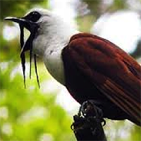
Durante el tiempo del estudio, más de 55 personas de la comunidad colaboraron con el proyecto y se recogieron 139 individuos de 47 especies de aves. La especie que se encontró en mayor número es el zorzal de Swainson (Catharus ustulatus), un ave migratoria que atraviesa el país en grandes cantidades durante el mes de abril, cuando viaja hacia el norte, y en los meses de octubre y noviembre, cuando se dirige hacia el sur. Por supuesto, durante esos meses es que murieron esas aves, llegando a un total de 26 individuos de sólo esta especie. Otras aves migratorias que fueron recolectadas en el tiempo de estudio fue el colibrí garganta de rubí (Archilochis colubris), reinita pechirayada (Cardellina canadensis), reinita cachetinegra (Geothlypis formosa), reinita trepadora (Mniotilta varia) yzorzal del bosque (Hylocichla mustelina) entre otras.

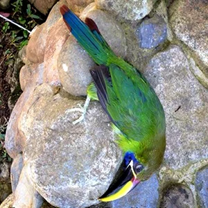
Por otra parte, las especies residentes que se encontraron en mayor número fueron el tucancillo verde (Aulacorhynchus prasinnus) y el jilguero (Myadestes melanops). Para cada una de estas especies se recogieron 14 individuos. Otras muchas especies residentes fueron encontradas, algunas de bellos colores, como el rualdo (Chlorophonia callophrys), el toledo (Chiroxiphia linearis) y el trogón vientrianaranjado (Trogon aurantiiventris). Asimismo, se reportó la colisión de pájaros campana (Procnias tricarunculatus), pavas negras (Chamaepetes unicolor) y un quetzal (Pharomachrus mocinno) que habían golpeado contra ventanas de edificios durante la época del estudio. Algunos de ellos sobrevivieron y otros murieron.
En forma preliminar, se encontró que las ventanas son una amenaza constante para la vida de las aves, aún en lugares como Monteverde, donde la densidad de edificios no es tan alta como en las ciudades. Algunos métodos que se están estudiando y se han encontrado efectivos para prevenir las colisiones se presentan en este enlace.
Aún espero analizar otros aspectos de las aves, tales como, dependencia del bosque, edad, sexo y la abundancia que presentan en la zona. También espero compartir con la comunidad algunos métodos para prevenir estas muertes en el futuro.
Quiero aprovechar para agradecer sinceramente a todos los vecinos y amigos de Monteverde que tomaron de su tiempo para colaborar con este proyecto. De igual forma, al Instituto Monteverde, la Reserva Bosque Nuboso de Monteverde, la Estación Biológica de Monteverde y la Escuela de Los Amigos, que han brindado su apoyo en todo momento. Espero continuar compartiendo con ustedes los resultados. Si desean conocer más del problema y soluciones, a nivel de Costa Rica, pueden visitar: https://avesyventanascostarica.wordpress.com/
Sobre la investigadora:
Mi nombre es Rose Marie Menacho Odio, soy bióloga y trabajo en la cátedra de Ecología y Educación Ambiental, de la Escuela de Ciencias Exactas y Naturales de la Universidad Estatal a Distancia de Costa Rica (UNED). También formo parte de la Junta Directiva de la Asociación Ornitológica de Costa Rica. Si gustan comunicarse conmigo pueden hacerlo escribiendo más abajo o al correo roseamena@yahoo.com.
Sitios recomendados:
https://abcbirds.org/get-involved/bird-smart-glass/

A preview of some of the results from the Birds and Windows Project in Monteverde
By: Rose Marie Menacho Odio

Birds will hit against the glass from windows because they are not aware that there is an obstacle in front of them as these are transparent and the reflection of the surrounding areas in them fool the birds completely. With the intention of studying which species die from impact against windows in the community of Monteverde, Puntarenas, from the months of September 2014 until March 2016, I asked the neighbors of Monteverde to give me all the birds they had found that had died from hitting windows in buildings and houses in the area. The people who wished to collaborate with the project could take the samples and complete the proper questionnaires either with Marlene Leitón from the Monteverde Institute, Martha Garro and Yoryineth Méndez at the Monteverde Cloud Forest Reserve, or with Marvin Hidalgo at the Monteverde Biological Station. The questionnaire included the following information: name of the person who handed in the bird, place where it was found, name of the bird (if known), date and time, and if possible digital photos of the window sent to my personal e-mail. All the collected birds where identified and are currently being prepared for their final destination: the collection of the National Museum of Costa Rica.

During the duration of the study more than 55 members of the community collaborated with the project and 139 samples were collected from 47 different bird species. The species that was most commonly found was the Swainson’s thrush (Catharus ustulatus), a migratory bird that crosses the country in large amounts during the months of April, when it travels north, and in the months of October and November, when it travels South. Of course it was during these months that these birds died, amounting to a total of 26 individuals of this single species. Other migratory birds that were collected at the time of the study were the Ruby-throated Hummingbird (Archilochis colubris), the Canada Warbler (Cardellina canadensis), the Kentucky Warbler (Geothlypis formosa), the Black-and-white Warbler (Mniotilta varia) and the Wood Trush (Hylocichla mustelina), amongst others.

On the other hand the resident species most found were the Emeral Toucanet (Aulacorhynchus prasinnus) and the Black-faced-Solitaire (Myadestes melanops). For each one of these species we collected 14 specimens. Many other resident species were found, some very colorful ones, like the Golden-browned Chlorophonia (Chlorophonia callophrys), the Long-tailed Manakin (Chiroxiphia linearis) and the Orange-bellied Trogon (Trogon aurantiiventris). We also had collision reports of Bellbirds (Procnias tricarunculatus), black guans (Chamaepetes unicolor) and a quetzal (Pharomachrus mocinno) that had hit against windows during the lapse of the study. Some of these survived, others died.

Preliminarily, it was found that windows pose a constant threat to birds, even in places like Monteverde, where the density of buildings is not as high as in other cities. Some of the collision-preventing methods that are being researched and that have been shown to be effective can be found here.
I still have hopes to be able to analyze other aspects of the birds, such as, forest dependency, age, sex, and the abundance that each species represents in the area. I also want to be able to share with the community some more of the methods for further death prevention.
I want to take the opportunity to thank all the friends and neighbors in Monteverde who took the time to collaborate with this project; as well as the Monteverde Institute, the Monteverde Cloud Forest Reserve, the Monteverde Biological Station and the Friends’ School who have showed their support at all moments. I hope to be able to continue sharing more results from the research with you. If you wish to know more about this problem and solutions for it, at a more national level, please visit: https://avesyventanascostarica.wordpress.com/
About the researcher:
My name is Rose Marie Menacho Odio, I’m a biologist and I work in the school of Natural Sciences of the National University for Distance Education (UNED). I’m also a board member of the Board of Directors of the Ornithological Association of Costa Rica. If you would like to get in contact with me you can do so by writing to my e-mail: roseamena@yahoo.com.
Recommended pages:
https://abcbirds.org/get-involved/bird-smart-glass/
The Bellbird and Ocotea monteverdensis, A Special Relationship - El pájaro campana y el Ocotea monteverdensis, una relación muy especial
Of course the relationship between fruit-bearing trees and fruit-eating birds is mutually beneficial. The latter get free food and the former get their seeds spread across the landscape. However, the quality of this “spreading of seeds” is not always the same. The bellbird and O. m. appear to have a special relationship in this regard.
--- Por supuesto la relación entre árboles que tiene fruto y los pájaros que comen de estos es mutualmente beneficioso. Los pájaros reciben fruta y el árbol logra esparcir sus semillas en lugares ideales. Sin embargo la calidad de esta propagación de semillas no es siempre la misma. El pájaro campana y el O.m. parece que tienen una relación especial en cuanto a esto.
In my last blog I wrote about Ocotea monteverdensis (referred to here as “O. m.”), a critically endangered tree found only in the Monteverde “zone.” It was noted that, when it is fruiting during June to August, it is eaten by a number of large and unique birds, several of which are also threatened and found only in wet highland forests (i.e., resplendent quetzal, black guan, three-wattled bellbird). In this blog I want to discuss the special relationship that exists between O. m. and the three-wattled bellbird.


The three-wattled bellbird (called here simply “the bellbird”) is endemic to Central America and ranges between southeastern Honduras and western Panama. There are several populations that have their own breeding areas and own migration routes. The largest populations are (1) one that resides in the Tilaran mountains, in the general vicinity of Monteverde, for six months out of the year (March – August), and (2) one that is chiefly found in the Talamanca region of Costa Rica and Panama and the surrounding foothills and lowlands. These two sub-populations even call with very different “bonks”! The work of Don Kroodsma, George Powell, Debra Hamilton, Vinodkumar Saranathan, and Julio Sanchez has shown that the bellbird has three confirmed dialects and a suspected fourth.
BONK LINKS:
Listen to the Monteverde dialect bellbird bonking on dead branch perch:
https://www.youtube.com/watch?v=Gnu8QbpImWw
Talamancan dialect bellbird bonking:
https://www.youtube.com/watch?v=GMoEOjsHw4E
Powell and Robin Bjork documented the complex migrations of the bellbird in Monteverde, chiefly designed to maximize the availability of the fruit it depends upon. The “Monteverde population” breeds chiefly on the Caribbean slope of the Tilaran Cordillera, in the wet foothills and highlands east of Monteverde, during February to May. By June, many of the trees that were fruiting where these bellbirds breed have stopped bearing fruit. After breeding, this population journeys to the Tilaran Pacific slope between 1200 m and 1500 m (that would be here in the “Monteverde zone”!). For about three months (June to August or September), it feeds on fruit of trees here that are on a different annual cycle of fruiting, from those where the bellbird just finished raising young. Most of this fruit consists of small avocados of Lauraceae species that regularly bear fruit during these months.

Picture of an avocado fruit.
Debra Hamilton and Victorino Molina (with assistance from guides, interns, and ornithological associations) have been conducting research and censuses of bellbirds as they pass through “the Monteverde zone” for about 2 decades. They have noted that the birds concentrate in different areas of “the zone” in different years. Assuming that these concentration patterns are determined by what fruit the birds are eating, Debra and Rhine Singleton started a 6-year study of the principal fruiting tree species in these areas between 1200 and 1500 m. They studied when these species were fruiting (both monthly and annual patterns) and how this related to where the bellbirds were concentrated from year to year, and month to month. Eladio Cruz, Juan Fuentes, I, and others assisted them in data collection for these six years. Most of the tree species were small avocadoes (Lauraceae family).
After months and months of tedious data analysis, Debra, Rhine, and I have concluded that the preferred fruit of the bellbird is that of our friend O. m. Whenever and wherever O. m. is fruiting, the bellbird can be found nearby. Our data shows that O. m. generally only bears abundant fruit here every three years, so that a distinct pattern of concentration of birds around areas of O. m. trees can be seen during these years. In other years, the birds move to different places in the zone. During those years, other species of fruit trees attract them.
Of course the relationship between fruit-bearing trees and fruit-eating birds is mutually beneficial. The latter get free food and the former get their seeds spread across the landscape. However, the quality of this “spreading of seeds” is not always the same. The bellbird and O. m. appear to have a special relationship in this regard.
The nature of this relationship was illustrated by Dan Wenny and Doug Levy when they studied an avocado species very closely related to Ocotea monteverdensis— Ocotea endresiana. This tree grows at a slightly higher elevation than O. m., up in the Monteverde cloud forest reserves. It is not only in the same genus, but in the same sub-group of species in the genus Ocotea. Wenny and Levy studied where various bird species that ate this fruit distributed the seeds. Toucans, guans, quetzals, mountain robins and others all dropped their seeds fairly close to the adult fruiting tree they were feeding on (within 20 m). Bellbirds, in contrast, habitually went to their “perching branch” to finish digesting their fruit, and regurgitated their seeds there.
REGURGITATING:
https://www.youtube.com/watch?v=hPJMcNQB_4Y
Bellbirds select perches that they claim and re-use for months at a time, and these perches typically are on mid-canopy, dead branches in slightly open gaps in the forest canopy. These locations just happen to be ideal for germination and growth of both Ocotea endresiana and O. m. Directly under parent trees, soil microbes pathogenic to the tree species (including seedlings) often concentrate. But bellbird perches typically are located further from parent trees (>50 m). And, perhaps more important, the canopy cover is frequently closed under the parent tree, but more open under the bellbird perch “mini-gap.” This means that newly germinating seedlings—and later when they are saplings—receive more light for growth and survival. Wenny and Levy found that seedlings were twice as likely to survive where bellbirds dropped seeds as where other birds did. They were also one-third less likely to be infected with pathogenic root fungi.


So one can see how O. m. trees and the bellbird may have co-evolved to be particularly mutually beneficial to each other. O. m., it would seem, has evolved to produce fruit that is nutritious, easily located, and the right size for the bellbird to swallow whole and digest slowly. And the bellbird has perhaps evolved to be exhibit behaviors that just happen to result in the distribution of O. m. seeds in ideal locations. Walking through the forests here, I sometimes find small clusters of O. m. saplings that are some distance (> 60 m) from any parent tree. These trees usually appear to be the same age. It is easy enough to imagine that a bellbird perched years before above those locations and regurgitated seeds there. Further research and documentation is needed!
Four 3-m-tall (about 5 years old) O. m. saplings (red flagging) growing in a cluster.
Semi-open canopy, with dead branches, above the same sapling cluster above:
In my next blog, I want to discuss how this endangered tree can be conserved and even encouraged to replenish its population. This involves both saving the few remaining mature trees (only about 750!) and promoting new seedling establishment.
About the author:
Dev Joslin is a scientist who enjoys research that combines his interests and expertise in forest ecology, soils, ornithology, and reforestation. With a masters and a Ph. D. in forestry and soil science, he conducted research for 30 years in North America and Europe on air pollution and climate change impacts on forests, soils, and streams. He has been an active birder and conservationist in Tennessee and Costa Rica for the past 26 years. He and his wife, Harriet, have lived in Monteverde for the past 11 years, during which time he has been active in community organisations, “gentleman farming,” and conservation research involving frugivorous birds and their relationships to wild avocados.
Dev is the main person responsible for helping to put the Ocotea monteverdensis on the critically endangered species list.
REFERENCES
POWELL, G., and R. BJORK (2004) Habitat Linkages and the Conservation of Tropical Biodiversity as Indicated by Seasonal Migrations of Three-Wattled Bellbirds. Bird Conservation International 4:161-174.
WENNY, D.G., and D. J. LEVEY. 1998. Directed seed dispersal by bellbirds in a tropical cloud forest. Proc. Natl. Acad. Sci. USA. 95: 6204–6207.
VAN DER WERFF, H. 2002. A synopsis of Ocotea (Lauraceae) in Central America and Southern Mexico. Annals of the Missouri Botanical Garden. 89: 429-451.

El pájaro campana y el Ocotea monteverdensis,
una relación muy especial
En mi último blog escribí sobre el Ocotea monteverdensis (mencionado aquí como “O.m.”), el cual es un árbol que está críticamente en peligro de extinción y que únicamente se encuentra en la “zona” de Monteverde. Aquí se notó que cuando está en fruta, de junio a agosto, este es comido por una cantidad de pájaros que son grandes y únicos, muchos de los cuales también están en peligro y que solo se encuentran en bosques húmedos altos (ej. El quetzal, pava negra, pájaro campana). En este nuevo blog me gustaría discutir la relación especial que existe entre los O.m. y el pájaro campana.


El Procnias tricarunculatus (aquí simplemente llamado “pájaro campana”) es endémico de Centroamérica y se encuentra entre el sureste de Honduras y el oeste de Panamá. Hay varias poblaciones que cuentan con sus propias zonas de apareamiento y sus propias zonas migratorias. Las poblaciones más grandes son (1) una que reside en las montañas de Tilarán, en la vecindad de Monteverde, por seis meses al año (marzo- agosto), y (2) otra que se encuentra principalmente en la región de Talamanca entre Costa Rica y Panamá y en sus respectivas estribaciones y tierras bajas. Estas sub-poblaciones hasta tienen llamados diferentes o “boinj”. El trabajo de Don Kroodsma, George Powell, Debra Hamilton, Vinodkumar Saranathan, y Julio Sanchez ha demostrado que el pájaro campana tiene tres dialectos confirmados y se sospecha de una cuarta.
Enlaces para los “boinjs”:
Pájaro campana en Monteverde hacienda su sonido de “boinj” mientras está perchado en una rama muerta.
https://www.youtube.com/watch?v=Gnu8QbpImWw
Pájaro campana de Talamanca haciendo su sonido “boinj”: https://www.youtube.com/watch?v=GMoEOjsHw4E
Powell y Robin Bjork documentaron la complejidad de las migraciones del pájaro campana, estas son principalmente diseñadas para maximizar la disponibilidad de fruta de la cual depende. La “población de Monteverde” se reproduce principalmente en la vertiente caribeña de la cordillera de Tilarán, en las estribaciones húmedas y las tierras altas del este de Monteverde, de febrero a mayo. Al llegar al mes de junio, muchos de los árboles que estaban en fruta donde estos pájaros se reproducen, habrán dejado de producir. Después de la época de cría, esta población viaja hacia la vertiente pacífica de Tilarán entre los 1200m y los 1500m (eso sería aquí, en la “zona de Monteverde”). Por cerca de tres meses (junio a agosto o septiembre) estos se alimentan de las frutas de los árboles que están allí, las cuales se encuentran en un ciclo anual distinto que aquel donde el pájaro campana acaba de terminar de criar a sus pichones. La mayor parte de esta dieta consiste en pequeños aguacates de las especies de Lauraceae que regularmente producen frutas durante estos meses.
Foto del fruto de un aguacatillo.
Debra Hamilton y Victorino Molina (con ayuda de guías, pasantes y asociaciones ornitológicas) han estado conduciendo censos de las poblaciones de los pájaros campana cuando estos pasan por la “zona de Monteverde” por cerca de dos décadas. Al hacer esto notaron de que los pájaros se concentran en partes distintas de la “zona” en diferentes años. Asumiendo que estos patrones de concentración eran determinados por el tipo de fruta del cual se alimentaban los pájaros, Deb y Rhine Singleton comenzaron una investigación de seis años sobre las principales especies de árboles frutales entre los 1200 y 1500m. Ellos estudiaron cuando estas especies estaban en fruta (los patrones mensuales y los anuales) y como estos se relacionaban a donde los pájaros campana se concentraban año a año y mes a mes. Eladio Cruz, Juan Fuentes, yo y otros asistimos en la recolecta de información durante estos seis años. La mayoría de estas especies eran aguacatillos (familia Lauraceae).
Después de meses y meses de una labor tediosa en análisis de datos, Deb, Rhine y yo hemos concluido que la fruta favorita del pájaro campana es la de nuestro amigo el O.m. Cuando sea y donde sea que el O.m. están en fruto el pájaro campana se puede encontrar en su cercanía. Nuestra información muestra que el O.m. suele solo tener fruta en abundancia cada tres años, así que en estos periodos se puede encontrar un patrón distintivo de concentración de los pájaros. En otros años los pájaros campana se trasladan a diferentes lugares de la zona. Durante esos años otras especies de árboles frutales son los que los atraen.
Por supuesto la relación entre árboles que tiene fruto y los pájaros que comen de estos es mutualmente beneficioso. Los pájaros reciben fruta y el árbol logra esparcir sus semillas en lugares ideales. Sin embargo la calidad de esta propagación de semillas no es siempre la misma. El pájaro campana y el O.m. parece que tienen una relación especial en cuanto a esto.
La naturaleza de esta relación fue ilustrado por Dan Wenny y Doug Levy al estudiar una especie de aguacatillo que es muy cercana al Ocotea monteverdensis, y este es el Ocotea endresiana. Este árbol crece a una elevación ligeramente más alta que el O.m., en las reservas del bosque nuboso de Monteverde. Esta especie no es solamente el mismo género, pero además se encuentra en el mismo sub-grupo de especies del género Ocotea. Wenny y Levy estudiaron la ubicación donde varias especies de pájaros que se alimentaban de esta fruta distribuían las semillas. Tucanes, pavas, quetzales, zorzales y otros sueltan las semillas cerca del árbol frutal adulto de donde se alimentan (dentro de los 20m.). Los pájaros campana, en contraste, habitualmente iban a su “rama de percha” para terminar de digerir su fruta, y regurgitaban sus semillas ahí.
Pájaro regurgitando semillas:
https://www.youtube.com/watch?v=hPJMcNQB_4Y
Los pájaros campana seleccionan perchas de las cuales ellos se apoderan y reutilizan por meses, estas perchas habitualmente se encuentran a medio dosel, en ramas muertas ubicadas en aperturas del bosque. Estas ubicaciones son justamente ideales para la germinación y crecimiento de ambas: el Ocotea endresiana y el O. m. Justo debajo de los árboles madre suelen concentrarse los microbios de suelo que son patógenos a estas especies de árboles (incluyendo cuando se encuentran como plántulas). Las perchas del pájaro campana usualmente se encuentran lejos de los árboles madre (>50m). Y, seguramente de manera más importante, la cobertura boscosa es más cerrada debajo de los árboles madre, pero más abierta debajo de la percha del pájaro campana por su ubicación en una apertura boscosa. Esto significa que semillas recién germinadas – y luego cuando son árboles jóvenes- van a recibir más luz para su crecimiento y sobrevivencia. Wenny y Levy encontraron que los árboles tenían el doble de oportunidades de sobrevivencia de donde los pájaros campana dejaban las semillas en relación a donde eran dejados por otros pájaros. También tenían una tercera parte menos de posibilidades de ser infectados por el hongo de raíz patógeno.


Así que uno puede ver como los árboles O.m. y el pájaro campana han co-evolucionado para beneficiarse mutuamente el uno del otro. El O.m., al parecer, ha evolucionado para producir fruta llena de nutrientes, fácil de encontrar, y el tamaño apropiado para que el pájaro la pueda comer entero y digerir lentamente. Y el pájaro campana ha evolucionado para tener costumbres que resultan en la distribución de las semillas del O.m. en locaciones ideales. Al caminar por los bosques en esta zona he podido encontrar grupos de árboles juveniles que se encuentran a más de 60 metros del árbol madre. Estos árboles aparentan ser de la misma edad, por lo tanto es lo suficientemente fácil de imaginar que un pájaro estaba en esta zona regurgitando semillas. Hace falta más investigación y documentación para poder demostrar esto apropiadamente.
Cuatro árboles juveniles de O.m. de 3 metros de alto (aprox. 5 años de edad) marcados con cinta roja creciendo en un grupo:
Dosel parcialmente abierto, con ramas muertas por encima del grupo de árboles juveniles.
En mi siguiente blog quiero discutir como este árbol en peligro puede ser conservado y hasta fomentado para reponer su población. Esto implica rescatando los árboles maduros restantes (solo son como 750) y promoviendo el establecimiento de plántula.
Sobre el autor:
Dev Joslin es un científico que disfruta la investigación y combina sus intereses y pericia en ecología forestal, suelos, ornitología y reforestación. Con una maestría y un doctorado en ciencias forestales y ciencias de suelos el ha conducido investigación por 30 años en América del Norte y Europa en el impacto de la contaminación de aires y el cambio climático en los bosques, suelos y quebradas. Él ha sido un pajarero y conservacionista active en Tennessee y Costa Rica por los últimos 26 años. Él y su esposa, Harriet, han vivido en Monteverde por 11 años en los cuales han participado activamente en organizaciones comunitarias, “agricultura de caballeros”, y investigación de conservación involucrando pájaros fructíferos y su relación con el aguacatillo Silvestre.
Dev es además la principal persona responsable en ayudar a colocar el Ocotea monteverdensis en la lista de críticamente en peligro de extinción.
REFERENCIAS:
POWELL, G., and R. BJORK (2004) Habitat Linkages and the Conservation of Tropical Biodiversity as Indicated by Seasonal Migrations of Three-Wattled Bellbirds. Bird Conservation International 4:161-174.
WENNY, D.G., and D. J. LEVEY. 1998. Directed seed dispersal by bellbirds in a tropical cloud forest. Proc. Natl. Acad. Sci. USA. 95: 6204–6207.
VAN DER WERFF, H. 2002. A synopsis of Ocotea (Lauraceae) in Central America and Southern Mexico. Annals of the Missouri Botanical Garden. 89: 429-451.
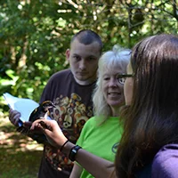
Programa de MOSI en el IMV - MOSI Program at the MVI
Programa MOSI (Monitoreo de Sobrevivencia Invernal) en pájaros migratorios del Neotrópico --- MOSI Program (Interval Survival Monitoring) in migrant neotropical birds.
En español (for English please scroll down)

MoSI (Monitoreo de Sobrevivencia Invernal) es un programa de monitoreo de pájaros neotropicales terrestres que se enfoca en el monitoreo de pájaros migratorios a través de las Americas con estaciones en los neotrópicos del norte. La meta del programa es el de poder evaluar las tazas de sobrevivencia de la hibernación y las condiciones físicas de los pájaros en su llegada a sus zonas de invernada. Los pájaros migratorios del neotrópico viajan un promedio de 3000 millas hasta llegar a sus zonas de invernada donde permanecen al menos la mitad del año. Debido a la disminución de muchas especies migratorias, la "Bird Population Organization" (Organización de Poblaciones de Aves) empezaron un proyecto de investigación para estudiar la sobreviviencia de invernación. Si la sobrevivencia es baja en los trópicos, entonces los esfuerzos de conservación se deben de enfocar en la necesidades de las aves en estas zonas, en lugar de enfocarse en las necesidades en sus zonas de reproducción en latitudes más altas.
En Monteverde, Costa Rica se trabaja de noviembre a marzo intentando poner anillos de identificación a la mayor cantidad posible de pájaros migratorios y residentes. Pueden ver el siguiente video para escuchar sobre la experiencia de una de las pasantes que colaboró junto con Deb Hamilton en el proyecto. La estación de MoSI de Monteverde es uno de las 29 estaciones situadas entre México y el norte de Sur América. Se colocaron once redes siguiendo todos los protocolos de redes de niebla en laReserva Crandell detrás del Instituto Monteverde. A las especies migratorias que se encontraron se les colocaron anillos informativos del U.S. Fish and Wildlife y se soltaron ilesos con el fin de que se les pudiera seguir el rastro en caso de que los re-capturaran en Norte América.
Esta es una gran oportunidad educacional no solo para los miembros del equipo de MoSI, sino también para algunos miembros de la comunidad y las escuelas visitantes (programa de EAP y Goucher - Mt. Holyoke, entre otros) que tienen la oportunidad de ver el proceso en persona y poder aprender de los procesos migratorios de diferentes especies. Este proyecto ha dado la oportunidad a los participantes de entender un poco más sobre la importancia del conservación de hábitat en los bosques tropicales de Costa Rica.

English (Para español favor de subir) --
MoSI (Interval Survival Monitoring) is a Neotropical migrant landbird monitoring program that focuses on migratory birds throughout the Americas with stations in the northern Neotropics. The goal of this program is to assess overwintering survival rates and physical conditions of birds passing through and arriving at wintering grounds.
Neotropical migratory birds fly an average of 3000 miles to reach their wintering grounds where they live for at least one half of the year. Due to the decline of many migratory species, the Bird Population Organization started a research project to assess the migratory bird’s overwintering survival. If survival is low in the tropics, conservation efforts will need to focus on the birds’ survival needs here, rather than in their reproductive areas at higher latitudes.
In Monteverde, Costa Rica people work together from November through March to band as many migratory and resident passerines as possible. You can see a video about the experience of one of the participating interns here. The Monteverde MoSI station is one of 29 stations situated from Mexico to northern South America. Eleven nets were set up using standard mist netting protocols within the Crandell Reserve behind the Monteverde Institute. Migratory species that were captured were banded with U.S. Fish and Wildlife bands and released unharmed so they could be tracked if they are re-captured in North America.
This is great educational opportunity not only for theMoSI team but also for the community and visiting schools (EAP program and Goucher - Mt. Holyoke, amongst others) that get an opportunity to experience bird banding in person and learn about the migrating process for different bird species. This project also gives participants an opportunity to experience the importance of habitat conservation in tropical rainforests of Costa Rica.
