
XI Neotropical Ornithological Conference | VI Costa Rican Ornithological Conference


Luisa Moreno and Debra Hamilton presented results of research on bird community changes over the last 30-46 years in the Monteverde region. Of primary interest is the reduction in mixed species feeding flock species and changes in insectivorous species. These results indicate changes in the guild compositions of avian communities as a possible result of climate change.

Debra also presented special considerations regarding the conservation of the Three-wattled Bellbird, as a result of specific reproductive strategies and dietary restrictions because of varying fruit availability. The dietary selection work was published by Debra and colleagues, Rhine Singleton and J. Devereaux Joslin in Biotropica in 2017. A Spanish version of this article is available upon request at the MVI.
Luisa Moreno participated in the MoSI (Overwintering Survival of Neotropical Birds) round table, organized by Bird Population Organization of Point Reyes, and presented the MVI’s results in this program over the last 6 years.


Luisa Moreno y Debra Hamilton presentaron los resultados de la investigación sobre los cambios en la comunidad de aves en los últimos 30-46 años en la región de Monteverde. De sumo interés es la reducción de especies mixtas que se alimentan de especies de bandadas y los cambios en especies insectívoras. Estos resultados indican cambios en las composiciones de los gremios de las comunidades aviares como un posible resultado del cambio climático.

Debra también presentó consideraciones especiales con respecto a la conservación del Pájaro Campana, como resultado de estrategias reproductivas específicas y restricciones dietéticas debido a la variable disponibilidad de fruta. El trabajo de selección dietética fue publicado por Debra y sus colegas, Rhine Singleton y J. Devereaux Joslin en Biotropica en 2017. Una versión en español de este artículo está disponible a pedido en el IMV.
Luisa Moreno participó en la mesa redonda MoSI (Supervivencia invernal de aves neotropicales), organizada por la Organización de Población de Aves de Point Reyes, y presentó los resultados del IMV en este programa durante los últimos 6 años.

Data- Tropical Storm Nate -Datos de la Tormenta tropical Nate
Tropical Storm Nate contributed 17% of our annual rainfall – in just two days
---La tormenta tropical Nate contribuyó con el 17% de nuestra precipitación anual, en solo dos días.
In English, para español favor de bajar, gracias.
By: Debra Hamilton and Luisa Moreno
Monteverde Institute
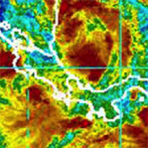
One prediction of global climate change is an intensification of weather events. While the rigorous scientific process does not permit a single event to constitute a conclusion, Tropical Storm Nate should be included in the accounts of multiple anomalies that are occurring throughout the world. Here we would like to share the precipitation and wind data from our weather station at the Monteverde Institute.
Tropical Storm Nate began on Wednesday, October 4th with a rainfall of 155.4 mm (6.12 inches) for that day. The precipitation amount for Thursday, October 5th was 364.0 mm (14.33”) for a total rainfall of 519.4 mm (20.45”) over the two days of the storm. This rainfall was accompanied by winds of 35.4 km/hour from the west on the 4th and 45.1 km per hour from the WNW on the 5th. The following day, October 6th, was relatively dry with 17 mm of precipitation but still windy with 37 km/hour winds, then coming from the ESE.
This rain fell on soils that were already saturated from the 687.1 mm (27.05 inches) of rain received in the month of September and the 102.3mm that fell between October 1st and the 3rd.

A tropical depression is seen off the Atlantic coast of Central America in an infrared satellite image captured at 1:15 p.m. ET on Oct. 4, 2017. NOAA (https://www.cbsnews.com/news/tropical-storm-nate-depression-hurricane-us-gulf-coast/)
Annual precipitation in the zone ranges roughly between 3000-4500 mm of precipitation. We would expect the lower end of the rainfall at 1400m of elevation, meaning that Tropical Storm Nate contributed 17% of our annual rainfall – in just two days. Total rainfall from September 1st through October 7th was 1.33 meters of precipitation.
Since October 7th, we have only received a total of 18.9 mm – another unusual situation possibly related to the Madden-Julian oscillation. This eastward moving oscillation has an effect that increases rain on one side (rising air side) and suppresses the rain potential on the back side (falling air side) (https://www.climate.gov/news-features/blogs/enso/what-mjo-and-why-do-we-care). At the moment, we are in the suppressed rain stage. By late October, however, the oscillation will have moved from the Caribbean and will not be a factor for decreased precipitation (http://www.cpc.ncep.noaa.gov/products/precip/CWlink/MJO/mjoupdate.pdf).
Impermeable clay layers in our terrain become slippery slopes as rain penetrates through the top layers of our soil. Small particles act as ball bearings as the water moves laterally across the clay layer, carrying the complete upper soil and vegetation down in landslides. Many areas have been greatly affected. Karen Gordon described the San Luis Valley as an area where a giant cat with long nails scratched the mountain slopes as it walked through.
We applaud all of the individuals and organizations that worked diligently during this storm to restore the well-being of the communities, we commend the residents of the zone for their collaboration and resilience, and we hold close to our hearts all those that lost property and income in this event.
En español, para inglés favor de subir.
Datos – Tormenta Tropical Nate
Por: Debra Hamilton and Luisa Moreno
Monteverde Institute
Una predicción del cambio climático global es una intensificación de los fenómenos meteorológicos. Si bien el riguroso proceso científico no permite que un solo evento represente una conclusión, la Tormenta Tropical Nate debería incluirse en las cuentas de múltiples anomalías que ocurren en todo el mundo. Aquí nos gustaría compartir los datos de precipitación y viento de nuestra estación meteorológica en el Instituto Monteverde.
La tormenta tropical Nate comenzó el miércoles 4 de octubre con una precipitación de 155,4 mm (6,1 pulgadas) para ese día. La cantidad de precipitación para el jueves 5 de octubre fue de 364.0 mm (14.33 ") para una precipitación total de 519.4 mm (20.45") durante los dos días de la tormenta. Esta lluvia fue acompañada por vientos de 35.4 km/ hora desde el oeste el 4 y 45.1 km por hora desde el ONO el día 5. El día siguiente, 6 de octubre, fue relativamente seco con 17 mm de precipitación, pero todavía con vientos de 37 km / hora, luego procedente del ESE.
Esta lluvia cayó sobre suelos que ya estaban saturados de agua de los 687.1 mm (27.05 pulgadas) de lluvia recibidas en el mes de septiembre y los 102.3 mm que cayeron entre el 1 y el 3 de octubre.

A tropical depression is seen off the Atlantic coast of Central America in an infrared satellite image captured at 1:15 p.m. ET on Oct. 4, 2017. NOAA (https://www.cbsnews.com/news/tropical-storm-nate-depression-hurricane-us-gulf-coast/)
La precipitación anual en la zona varía aproximadamente entre los 3000-4500 m. Es de esperar que la parte inferior de la lluvia llegue a 1400 m de elevación, lo que significa que la tormenta tropical Nate contribuyó con el 17% de nuestra precipitación anual, en solo dos días. La precipitación total desde el 1 de septiembre hasta el 7 de octubre fue de 1,33 metros de precipitación.
Desde el 7 de octubre, solo hemos recibido un total de 18.9 mm, otra situación inusual posiblemente relacionada con la oscilación Madden-Julian. Esta oscilación en movimiento hacia el este tiene un efecto que aumenta la lluvia en un lado (lado del aire ascendente) y suprime el potencial de lluvia en el lado posterior (lado del aire que cae) (https://www.climate.gov/news-features/blogs/enso / what-mjo-and-why-do-we-care). Por el momento, estamos en la etapa de lluvia reprimida. A fines de octubre, sin embargo, la oscilación se habrá movido desde el Caribe y no será un factor de disminución de la precipitación (http://www.cpc.ncep.noaa.gov/products/precip/CWlink/MJO/mjoupdate.pdf).
Las capas de arcilla impermeables en nuestro terreno se vuelven pendientes resbaladizas a medida que la lluvia penetra a través de las capas superiores de nuestro suelo. Las partículas pequeñas actúan como cojinetes de bolas a medida que el agua se mueve lateralmente a través de la capa de arcilla, llevando la capa de tierra superior completa y la vegetación hacia abajo en deslizamientos de tierra. Muchas áreas se han visto muy afectadas. Karen Gordon describió el Valle de San Luis como un área donde un gato gigante con largas uñas arañaba las laderas de las montañas mientras caminaba.
Aplaudimos a todos los individuos y organizaciones que trabajaron diligentemente durante esta tormenta para restaurar el bienestar de las comunidades, felicitamos a los residentes de la zona por su colaboración y capacidad de recuperación, y tenemos cerca de nuestros corazones a todos aquellos que perdieron propiedades y ingresos en este evento.
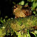
Rastreos del Pájaro Aceite (Steatornis caripensis, Steatornitidae) en Costa Rica - Lifetracks Oilbird, Costa Rica.
RASTREOS DEL PÁJARO ACEITE (STEATORNIS CARIPENSIS, STEATORNITIDAE) EN COSTARICA - LIFETRACKS OILBIRD, COSTA RICA
- Siga los pasos por Costa Rica del único pájaro volador con ecolocación que come frutas. --- Follow the footsteps through Costa Rica of the only flying bird that feeds off of fruits that also has echolocation.

Rastreos del Pájaro Aceite (Steatornis caripensis, Steatornitidae) en Costa Rica.
by:
David A. Rodríguez 1,2

1Guía Naturalista, egresado de la Universidad Técnica Nacional.
2Biólogo con énfasis en Ecología y Desarrollo Sostenible,
Universidad Latina de Costa Rica.
chiroxiphia@hotmail.com
El Guácharo (Steatornis caripensis) es una de las 918 especies de aves que se han registrado en Costa Rica (Garrigues et al, 2017), es una especie monotípica ya que es la única en su familia. Aunque esta familia, Steatornitidae, se encuentra emparentada con la familia Nyctibiidae y Caprimulgidae, se diferencia en muchos aspectos de los otros miebros del orden Caprimulgiformes, donde están clasificadas estas familias (Stiles y Skucth, 1989). En la más reciente actualización, la Auk (2016) coloca a esta ave en un orden propio, por lo que se logró determinar que difiere mucho de la taxonomía donde estuvo clasificado. En este nuevo orden, Steatornithiformes solo permanece el único ancestro que se a encontró en Wyoming, Pferica nivea (Olson, 1987).
Esta ave se encuentra en Guyana, Trinidad, Venezuela, Colombia, Ecuador, Perú y Bolivia, con algunos registros esporádicos en Centro América (del Risco y Echeverri, 2011).

Fig. 1. Distribución del Guácharo (Steatornis caripensis). Tomado de: http://neotropical.birds.cornell.edu/portal/species/distribution?p_p_spp=223931
Los registros del S. caripensis en Costa Rica han venido aumentando desde el 2009, gracias a la información recopilada se a determinado que esta especie viene a Costa Rica entre los meses de junio a setiembre. Sin los datos que puedan haber en el Museo de Historia Natural de la Universidad de CostaRica y dos otras observaciones que no se tiene claro las fechas en que se registraron, estos son los lugares y los años en que se ha registrado el S. caripensis en Costa Rica:
1.Milla Mills, 1986
2.Rara Avis (sin información del año)
3.Monteverde, 2010-2013-2016
4.Mirador de Quetzales, 2012
5.Turrialba, 2013
6.P.N. Volcán Tenorio, 2013
7.Barrio Luján, San José, 2013
8.Parque Internacional La Amistad (PILA), 2014
9.Corcovado, 2015
10. P.N. Rincón de La Vieja, 2015
11. Santa Rosa, Piedras Blancas, 2015
Datos obtenidos de: Stiles y Skutch 1989, Bolaños Redondo et al 2015, eBird 2017. Además de comunicaciones personales por parte de funcionarios del Museo Nacional de Costa Rica, 2017; así como también, observaciones personales.
Historia Natural:
Mide aproximadamente 46 cm, con 1 metro de envergadura. Además presenta dimorfismo sexual, en donde los machos son más grandes y el color café es más oscuro. Posee unas grandes bribrisas (plumas alrededor del pico) que se cree que le ayuda al ave a encontrar los huevos o polluelos que están en el nido, y además son monógamos (Snow, 1976).
Con hábitos nocturno, se cree que el Guácharo empezó a diferenciarse de sus parientes más cercanos, debido a su dieta. Al parecer, poco a poco empezó a alimentarse de frutos, debido a este comportamiento, sus nidos que estaban en el suelo eran más vulnerables a la depredación, ya que cuando regurgitaban la semillas, estas hacian más evidente su localización. Con el transcurso del tiempo, el Guácharo empezó a buscar sitios más seguros donde poder anidar, hasta que empezó a colonizar cuevas. Para poder adaptarse a las condiciones naturales de estos nichos, el ave se vio obligada a buscar algún tipo de locomoción que le permitiera volar en condiciones completamente oscuras (Carlos Bosque comp. pers).
El científico estadounidense Donald Griffin, que en 1938 fue el que describió la ecolocalización en murciélagos, fue el mismo investigador que comprobó el mismo desarrollo evolutivo en S. caripensis (Griffin, 1953). Este mecanismo funciona cuando el animal envía ondas de sonido, dichas ondas detectan los objetos que estén en el lugar al que han sido enviadas, luego se devuelven e ingresan a los oídos con la información necesaria para que el animal conozca lo que tiene al frente. Gracias a una prueba en donde se colocaron obstáculos en un cuarto oscuro y se liberaba un individuo, se descubrió que mientras el ave permanecía con los oídos tapados, no era capaz de esquivar dichos objetos. Este fue el comienzo de las investigaciones realizadas para determinar la ecolocalización en Guácharos (Carlos Bosque com. pers).
El S. caripensis es vegetariano, aparentemente subsiste a base de frutos ricos en lípidos de árboles como palmas y lauráceas (Stiles y Skutch, 1989) y burseráceas (Bosque et al. 1995). De hecho, se sugiere que gracias a este comportamiento en la dieta, lo llevó a evolucionar características que ninguna otra ave en el mundo las posee, ya que este es el único ave volador que cuya dieta consiste primordialmente de frutos (Snow, 1976). Quizá la habilidad más interesante de esta ave es que utiliza la ecolocalización para orientarse, comportamiento que poseen menos de 20 especies de aves en el mundo (Brinkløv et al, 2013).
Aunque existen registros esporádicos cada año en nuestro país, se tiene la hipótesis de que a Monteverde llega cada 3 años, en busca de alimento. Desde el 2010 se tiene registros documentados en la zona de Monteverde, en donde se han visto individuos alimentándosen de Ocotea monteverdensis, árbol endémico de Monteverde y que solo se encuentra en la zona de vida Bosque Premontano Húmedo. La fructificación de O. monteverdensis se da cada tres años, lo que coincide con la llegada de esta ave a Monteverde. Debido a su endemismo, esta especie de aguacatillo se encuentra en peligro de extinción, recientemente Dev Joslin realizó un estudio para conocer la abundancia de este árbol, encontrando un aproximado de menos de 800 individuos de O. monteverdensis, lo que suguiere que con la protección de estos árboles, se podría ayudar a la permanecia del Guácharo durante el tiempo que deseen estar.
Acerca del estudio realizado en Monteverde.
Con el apoyo del Instituto Max Planck y del Instituto Monteverde se comenzó este nuevo proyecto, el cual consiste en conocer de donde vienen y para donde se van los Guácharos que llegan a Monteverde. El Instituto Max Planck donó 2 transmisores satelitales que trabajan con páneles solares, de 20 g cada uno. Estos GPS se colocan con un harness de teflón sobre el ave, cuando están funcionando mandan una señal al satélite ARGOS, después esta señal es retransmitida a una base de datos, llamada Movebank. Con la señal que se retransmite en la base de datos, se puede llegar a conocer la ubicación de los individuos.

El lugar donde se llevó el estudio fue en el Refugio de Vida Silvestre de Monteverde. Se capturaron dos individuos, el primero fue el 16 de agosto del 2016, mientras que el segundo fue el 29 de agosto del mismo año. El primer individuo no presentó ningún problema a la hora de volar con el GPS puesto, sin embargo todavía se está a la espera de que se genere algún dato. Mientras que con el segundo individuo, se tuvo que liberar sin el GPS, ya que no quisó volar mientras lo tenía puesto.

Se tenía previsto que los GPS no funcionaran de la mejor manera, ya que necesitan la luz del sol para optener la energía necesaria para trabajar y debido a los hábitos que tienen estas aves de pasar el día en cuevas, es probable que el GPS se halla descargado. Con respecto al individuo que no quizo volar con el GPS puesto, se espera que para el 2019, que es la fecha en que se estima que el S. caripensis regrese a Monteverde, se cuente con una nueva tecnología por parte del Instituto Max Planck y los radiotransmisores serán de 4 g, lo que suguiere que al ser mucho más livianos, las aves puedan volar sin ningún problema.
Este estudio representa el primero que se realiza con esta especie de ave en Costa Rica, si bien no se ha logrado los datos esperados, se han generado muchos otros que nos ayudan a continuar investigando más acerca de su historia natural. Se espera que pronto logremos conocer de donde vienen y para donde se van, hay que recalcar que es una ave sumamente importante para la ecología del bosque ya que es un dispersor de semillas por excelencia y si analizamos bien, vemos que nos está ayudando a replantar una especie de aguacatillo endémico de Monteverde.
Personas involucradas hasta el momento,
Jorge Lizano, Cristian Chaves, Vino de Backer, Robert Dean, Rolando Mata, Guías del Refugio, Adrián Arroyo, Reserva Curi-Cancha, Instituto Monteverde, Instituto Max Planck, Victorino Molina, Juan Diego Vargas, Macklin Smith, Roberto Guido, Jorge Marín, Ghisselle Alvarado, Silvia Bolaños, Selena Avendaño, Randy Chinchilla y Debra Hamilton.
Referencias:
Bolaños Redondo, et al. 2015. Avistamiento del Guácharo (Steatornis caripensis, Caprimulgiformes, Steatornithidae) en el parque Internacional La Amistad. BRENESIA 83-84: 91-92.
Bosque, C., R. Ramírez y D. Rodríguez. 1995. The diet of the Oilbird in Venezuela. The Neotropical Ornithological Society.
Brinkløv, Signe., M. Brock Fenton., J. M. Ratcliffe. 2013. Echolocation in Oilbirds and Swiftlets. Frontiers in Physiology.
Chesser, R.T., K. J. Burns, C. Cicero, et al. 2016. Fifty-seventh Supplement to the American Ornithologists’ Union Check-list of North American Bird.
del Risco, Andrés A., y Alejandra Echeverri. 2011. Oilbird (Steatornis caripensis), Neotropical Birds Online (T. S. Schulenberg, Editor). Ithaca: Cornell Lab of Ornithology; retrieved from Neotropical Birds Online: http://neotropical.birds.cornell.edu/portal/species/overview?p_p_spp=223931. Visto el 02.02.17.
Garrigues, Richard., M. Araya-Salas, P. Camacho-Varela, J. Chaves-Campos, A. Martínez-Salinas, M. Montoya, G. Obando-Calderón y O. Ramírez-Alán. 2017. Lista Oficial de las Aves de Costa Rica – Actualización 2017. Comité de Especies Raras y Registros Ornitológicos de Costa Rica (Comité Científico), Asociación Ornitológica de Costa Rica. Zeledonia 19-2. San José, Costa Rica
Holdrige, L.R.1967. Life Zone Ecology. Centro Científico Tropical. San José, Costa Rica.
Olson, Storrs. 1987. An early Eocene Oilbird from the Green River formation of Wyoming (Caprimulgiformes: Steatornithidae)
Snow, D. 1976. The web of adatation: Bird Studies in the American Tropics. Cornell University Press.
Stiles, F.G., y A.F, Skutch. 1989. A guide to the birds of Costa Rica. Cornell University Press. New York, EE.UU.

Lifetracks Oilbird (Steatornis caripensis, Steatornitidae), Costa Rica.

David A. Rodríguez 1,2
1Nature guide, graduated from the UTN, Costa Rica.
2Biologist with a mayor in ecology and sust. development.
Universidad Latina de Costa Rica.
chiroxiphia@hotmail.com
The Oilbird (Steatornis caripensis) is one of the 918 species of birds that have been registered in Costa Ricas (Garrigues et al, 2017), it’s a monotypical species as it’s the only one in its family. However this family, Steatornitidae, is related to the Nyctibiidae and Caprimulgidae, they can be differentiated in many aspects from other members of the Caprimulgiformes order, which is where these families are classified (Stiles y Skucth, 1989). In the most current update, the Auk (2016) sets this bird in it’s own order, therefor it was possible to determine that it’s very different from the taxonomy where it was previously classified. In this new order the Steatornithiformes’s only ancestor was one found in Wyoming, the Pferica nivea (Olson, 1987).
This bird can be found in Guyana, Trinidad, Venezuela, Colombia, Ecuador, Perú and Bolivia, with some sporadic registers in Central America (del Risco y Echeverri, 2011).

Fig. 1. Oilbird distribution (Steatornis caripensis). Map from: http://eotropical.birds.cornell.edu/portal/species/distribution?p_p_spp=223931
The records of the S. caripensis in Costa Rica have been on the rise since 2009. Thanks to the gathering of data, it has been possible to determine that the species comes to Costa Rica between the months of June and September. With exception of a few records, which are records from the Natural History Museum of the University of Costa Rica and two other observations in which the dates of registration are not clear, the following are the places and years in which the S. caripensis has been registered in Costa Rica:
1.Milla Mills, 1986
2.Rara Avis (n.d))
3.Monteverde, 2010-2013-2016
4.Mirador de Quetzales, 2012
5.Turrialba, 2013
6.P.N. Volcán Tenorio, 2013
7.Barrio Luján, San José, 2013
8.Parque Internacional La Amistad (PILA), 2014
9.Corcovado, 2015
10. P.N. Rincón de La Vieja, 2015
11. Santa Rosa, Piedras Blancas, 2015
The data is from: Stiles y Skutch 1989, Bolaños Redondo et al 2015, eBird 2017. As well as from personal communications with staff members of the National Museum of Costa Rica, 2017; as well as personal observations.
Natural History:
It measures approximately 46cm, with a 1-meter wingspan. It also has sexual diphormism, in which the males are larger y are a darker shade of brown. These birds posses large vibrissae (feather around the beak) that are thought to help the bird find the eggs or chicks in the nest, these birds are monogamous. (Snow, 1976).
With nocturnal habits, it’s believed that the Oil Bird started to become different from its closer relatives due to its diet. It seems to be that little by little it started feeding off of fruit, and due to this behavior, their nests which were located on the ground became vulnerable to predation, since the regurgitated seeds made their location more obvious. As time passed by the Oil Bird started looking for safer places to nest, until it started colonizing caves. So in order to adapt to the natural conditions of these niches, the bird was forced to seek a type of locomotion that would allow it fly in conditions of total darkness (Carlos Bosque, personal communication).
The American scientist, Donal Griffin, who in 1938 was the person to discover echolocation in bats, was the same researcher who demonstrated the same evolutionary development in the S. caripensis (Griffin, 1953). The way the mechanism works is that animal sends sound waves, these waves detect objects that are in the same place as where the sound was sent, afterwards they return and go into the ear with the necessary information so that the animal is capable of recognizing what’s in front of it. Thanks to a test where the Oil Bird was placed in a dark room with obstacles, it was possible to demonstrate that as long as the bird had its ears covered, it was not able to avoid the obstacles. This was the beginning of the different investigations that have been made in relation to the ecolocation of the Oil Bird. (Carlos Bosque com. pers).
The S. caripensis is vegetarian and apparently subsists in lipid rich fruits from trees like palms, lauráceas (Stiles y Skutch, 1989) and burseráceas (Bosque et al. 1995). In fact, it’s suggested that thanks to this behavior in their diet it has allowed them to evolve different characteristics that no other bird in the world possesses, such as it being the only flying fruit eating bird with echolocation (Snow, 1979). Perhaps the most interesting ability that this bird has is precisely the echolocation which less than 20 species of birds in the world have. (Brinkløv et al, 2013).
Even though there are sporadic registers every year in our country, there is a hypothesis that it comes every three years to Monteverde in search of food. Since 2010 there are documented sightings in Monteverde where the individuals have been found eating Ocotea monteverdensis, an endemic tree of Monteverde and that can only be found in the life zone of the Humid Premontane Forest. This tree bears fruit every three years and this coincides with the arrival of this bird to Monteverde. Due to its endemism, this species of Lauraceae is endangered. Reciently Dev Joslin realized a study to find out about the abundance of this tree and found less than 800 fruiting species of the O. monteverdensis. All this suggests that by protecting these trees it might be possible to support the stay of the Oil Bird in the area.
About the research made in Monteverde.
This project was started with the support of the Max Planck Institute and the Monteverde Institute. The projects consists in finding out where do the Oil Birds that come to Monteverde come from, and where are they going. The Max Planck Institute donated 2 satellite transmitters that functioned with solar panels, each weighing 20 grams. These GPS locators where placed with a Teflon harness over the bird, and if working properly, they send a signal to the ARGOS satellite, and afterwards this signal is retransmitted to a database, called Movebank. With the signal that retransmits in the data base, it is possible to find out the location of the birds.

The place where the study was made was at the Monteverde Wildlife Refuge. Two individual were captured, the first on August 16th and the second on August 29th, 2016. The first individual had no issue flying with the harness and GPS on it, however, no data has been generated by the transmitter. While the second individual has to be freed without the GPS because it refused to fly while it had it on.

It was anticipated that the GPS would not work in its best way as it needs sunlight in order to get the energy it needs to function properly and these birds have the habit of spending the day in the caves, therefor it’s possible that the transmitters lost charge. In relation to the bird that refused to fly with the GPS on it, it’s expected that by 2019, which is the date in which the S. caripensis is estimated to return to Monteverde, a new technology will be available from the Max Planck Institute and the radio transmitter will be 4g, which is much lighter and should not affect the birds flight.
This research represents the first one that has been done with this bird species in Costa Rica, even though we haven’t gotten the information we expected, we have gotten others which will allow us to continue investigation more about its natural history. We hope to be able to understand soon where these birds come from and where they are going. It’s important to point out that this bird is very important for the forest’s ecology as it’s an excellent disperser and it’s also helping to replant and endemic species of Lauraceae in the area.
People involved so far,
Jorge Lizano, Cristian Chaves, Vino de Backer, Robert Dean, Rolando Mata, Guías del Refugio, Adrián Arroyo, Reserva Curi-Cancha, Instituto Monteverde, Instituto Max Planck, Victorino Molina, Juan Diego Vargas, Macklin Smith, Roberto Guido, Jorge Marín, Ghisselle Alvarado, Silvia Bolaños, Selena Avendaño, Randy Chinchilla and Debra Hamilton.
References:
Bolaños Redondo, et al. 2015. Avistamiento del Guácharo (Steatornis caripensis, Caprimulgiformes, Steatornithidae) en el parque Internacional La Amistad. BRENESIA 83-84: 91-92.
Bosque, C., R. Ramírez y D. Rodríguez. 1995. The diet of the Oilbird in Venezuela. The Neotropical Ornithological Society.
Brinkløv, Signe., M. Brock Fenton., J. M. Ratcliffe. 2013. Echolocation in Oilbirds and Swiftlets. Frontiers in Physiology.
Chesser, R.T., K. J. Burns, C. Cicero, et al. 2016. Fifty-seventh Supplement to the American Ornithologists’ Union Check-list of North American Bird.
del Risco, Andrés A., y Alejandra Echeverri. 2011. Oilbird (Steatornis caripensis), Neotropical Birds Online (T. S. Schulenberg, Editor). Ithaca: Cornell Lab of Ornithology; retrieved from Neotropical Birds Online: http://neotropical.birds.cornell.edu/portal/species/overview?p_p_spp=223931. Visto el 02.02.17.
Garrigues, Richard., M. Araya-Salas, P. Camacho-Varela, J. Chaves-Campos, A. Martínez-Salinas, M. Montoya, G. Obando-Calderón y O. Ramírez-Alán. 2017. Lista Oficial de las Aves de Costa Rica – Actualización 2017. Comité de Especies Raras y Registros Ornitológicos de Costa Rica (Comité Científico), Asociación Ornitológica de Costa Rica. Zeledonia 19-2. San José, Costa Rica
Holdrige, L.R.1967. Life Zone Ecology. Centro Científico Tropical. San José, Costa Rica.
Olson, Storrs. 1987. An early Eocene Oilbird from the Green River formation of Wyoming (Caprimulgiformes: Steatornithidae).
Snow, D. 1976. The web of adatation: Bird Studies in the American Tropics. Cornell University Press.
Stiles, F.G., y A.F, Skutch. 1989. A guide to the birds of Costa Rica. Cornell University Press. New York, EE.UU.
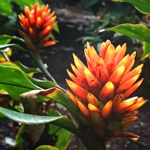
Promoviendo el uso de plantas nativas - PRONATIVAS - Promoting native plant species
Las áreas boscosas presentan una gran diversidad en términos de composición, pero no debemos ni podemos olvidar de relacionar todas las áreas urbanas y rurales tanto privadas como públicas en las que el ser humano se desenvuelve, ligándolas respetuosamente con las áreas naturales del país y región.
--- Forested areas represent a large diversity when it comes to their composition, however we should not forget to relate all urban and rural areas, both public and private, in which humans exist, linking them in a respectful way with the natural areas of the country and region.

Diversas iniciativas a nivel nacional, regional y local hacen de este país un lugar privilegiado. Las áreas boscosas presentan una gran diversidad en términos de composición, pero no debemos ni podemos olvidar de relacionar todas las áreas urbanas y rurales tanto privadas como públicas en las que el ser humano se desenvuelve, ligándolas respetuosamente con las áreas naturales del país y región.
Se debe apoyar a la naturaleza como si misma, fuera de nuestro control absoluto e intentar entenderla un poco mejor, pero sobre todo se debe respetarla desde su base. Por lo que temas como el uso de especies nativas, la relación de las mismas con el entorno, el uso del agua para riego, la no extracción de plantas de los bosques, la adecuada utilización de métodos de reproducción de plantas nativas, la no utilización y eliminación de plantas no nativas-agresivas-problemáticas, son factores que forman parte de la base de esta organización: ProNativas, cuya misión es crear conciencia sobre estos y otros temas relativos.
Somos una organización sin fines de lucro que pretende educar a todas las personas en general sobre la importancia del uso y adecuada reproducción de especies de plantas nativas con carácter ornamental y su utilización en nuestras creaciones paisajísticas tanto de zonas urbanas y rurales como privadas y públicas. Todas estas creaciones que como individuos sociales debemos desarrollar buscando beneficios sensitivos, naturales y morales. Esto utilizando criterios sostenibles y respetuosos con el medio ambiente y todos sus componentes económicos, naturales y sociales.
Una iniciativa de la Bióloga local de la zona de Monteverde, Willow Zuchowski, autora de sendos libros relacionados con el tema y con una gran pasión y entrega bajo estos principios adoptados por la organización. Persona que junto con Lorenzo Vargas se han mantenido en pie de esfuerzo y lucha, de manera comprometida con la ideología de la organización.
Para mayor información puede acceder nuestra página web www.pronativascr.org en donde encontrará bastante información sobre el tema, igualmente contactarnos por correo electrónico (negrinif@gmail.com), o por teléfono directamente (8825-8424 cel: Felipe Negrini)
por: Felipe Negrini Sanjuan
ProNativas
*Nota de la editora:
Monteverde tiene dos viveros de Pronativas donde se reproducen las plantas nativas de manera sostenible, una en Bajo del Tigre (Bosque Eterno de los Niños) y una en el Instituto Monteverde. Si gustan plantas para sus jardines en la localidad de Monteverde pueden contactarse con Pronativas para coordinar.


The different and diverse initiatives that take place on a national, regional and local level allow this country to be a privileged one. Forested areas represent a large diversity when it comes to their composition, however we should not forget to relate all urban and rural areas, both public and private, in which humans exist, linking them in a respectful way with the natural areas of the country and region.
Nature should be supported as it is, out of our total control, and we should try to be more understanding of it, but above all, respect it as it is. This is why this organization’s mission, Pronativas, has to do with creating awareness on themes such as the use of native species of plants, the relationship they have with their surrounding areas, the use of water in plant irrigation, the non-extraction of plants from the forest, the adequate use of native plant reproduction, and the non-use and elimination of non-native aggressive plants.
We are a non-for-profit organization that aims to educate all people in general about the importance of the use and adequate reproduction of native plant species with ornamental potential and characteristics and their use in landscaping creations in urban and rural, private and public, areas. All these creations that as social individuals we should develop in looking for benefits that are sensitive, natural and ethical. This can be accomplished by using criteria that is sustainable and respectful with our environment and all its economical, natural and social components.
This is an initiative started by a biologist residing in the Monteverde zone, Willow Zuchowski, author of several books related to the subject, and with a great passion and dedication to these principles that have been adopted by the organization. She has, along the side of Lorenzo Vargas, struggled to maintain the ideology of the organization.
For more information you can visit our website www.pronativascr.org where you can get plenty of data on these themes, you can also reach us through e-mail (negrinif@gmail.com), or by telephone (506- 8825-8424 Felipe Negrini).
by: Felipe Negrini Sanjuan
ProNativas
*Note from the editor:
Monteverde has two Pronativas greenhouses where native plants are grown in a sustainable manner, one in Bajo de Tigre (Children’s Eternal Rainforest) and one at the Monteverde Institute. If you would like plants for gardens in the Monteverde area please contact Pronativas in order to coordinate.
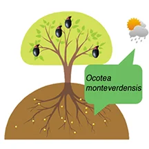
Ocotea monteverdensis: Conserving an Endangered Species --- Ocotea monteverdensis: Preservando una especie en peligro
O. m. naturally occurs as a dominant tree in primary forest remnants within its very limited range, between 1300 and 1500 m elevation between San Luis and Las Nubes, Costa Rica. Unfortunately, approximately 95% of this primary forest has been cut down.
---El O. m. se encuentra de manera natural como un árbol dominante en las zonas restantes de bosque primario entre un rango muy limitado, entre los 1300 y los 1500 m de elevación entre la zona de San Luis y las Nubes, en la zona de Monteverde, en Costa Rica. Desafortunadamente cerca del 95% de este bosque primario se ha cortado.

By Dev Joslin
In two previous blogs (1 - 2) , I have written about a very special, critically endangered tree species of the avocado family (Lauraceae) that is endemic to the Monteverde area. Ocotea monteverdensis (here referred to as O. m.) is an important food source for a number of large frugivorous birds, some of which are themselves threatened (resplendent quetzal, black guan, and three-wattled bellbird). O. m. naturally occurs as a dominant tree in primary forest remnants within its very limited range, between 1300 and 1500 m elevation between San Luis and Las Nubes, Costa Rica. Unfortunately, approximately 95% of this primary forest has been cut down.
In this blog issue, I would like to talk about the conservation of this species---Principal questions are:
(1) How can the estimated 770 reproductively-mature trees that remain be protected and kept healthy?
(2) How well is O. m. maintaining its population through the natural recruitment of young trees?
(3) How might the young replacement population numbers be enhanced by human efforts?
PROTECTION
Reasons for protection of the remaining mature trees are fairly obvious, including maintaining forest biodiversity, safeguarding the only seed source of this species for future generations, and sheltering an important food source for threatened frugivorous bird species. But on whose property are these remaining trees? How much of this land is permanently protected, or even temporarily protected? To address this question, Randy Chinchilla of MVI and I superimposed property lines over our map of individual tree locations within the Monteverde community:
The red dots mark the location of individual trees and the red lines are property lines. (Click to enlarge).
Click to enlarge.
It appears that the only parcels that are permanently protected are the Rachel and Dwight Crandell Memorial Reserve (protected by the MVI and FCC) and two small parcels protected by the Conservation League of Monteverde (ACM). Additionally there are other parcels currently protected by their owners, because they are either (a) part of privately-owned wildlife refuges for tourism (e.g., Curi-Cancha) or (b) are owned by persons with a strong commitment to conserving these forest remnants. Based on these criteria, it appears that about 5% of the trees are permanently protected, about 25% “temporarily protected,” and the remaining 70% lack any real protection at all.
Looking at parcel sizes, the trees are fairly evenly distributed among parcels greater than 25 hectares in size (30%), between 5 and 25 ha (38%), and less than 5 ha (32%). The current principal uses for these properties break out into the following categories: tourism (34%), dairy farming (25%), other farming (17%), conservation (16%), other or unknown (8%).
One possible approach to safeguarding the remaining mature trees might involve direct contact with the individual property owners, concentrating on properties with the largest numbers of individuals and largest forested parcels. Perhaps the most effective long-term approach embraces education of the community as a whole through the schools and educational programs for the public. With this in mind, three interns from the CIEE Sustainability Program—Aislyn Keyes, Rachel Lapp, and Morgan Cassidy—with help from teachers at the Creative Learning Center, this year produced educational films for local schools and the public:
YouTube LINKS:
Ocotea monteverdensis: https://www.youtube.com/watch?v=ryvSHl0-oEo Inglés
Ocotea monteverdensis:: https://www.youtube.com/watch?v=EQhMVKdHAUg Español
About birds: https://www.youtube.com/watch?v=9WYcYHVCXNs&list=PLrZXSocm8k3UmgONZbroM39iRZwQGu5Yn
NATURAL RECRUITMENT
Is O. m. currently sustaining its population through natural reproduction and recruitment alone? This is a very challenging question because of very limited available data and the difficulty of collecting it. Reaching dominant status in a primary forest is a very slow process, and we have no systematic surveys of the density of sapling and intermediate-sized O. m. trees in remaining primary forest remnants, nor in the secondary forests that currently make up an estimated 20% of the landscape across O. m.’s natural range. However, we do have limited data on the densities of seedlings under different forested conditions. I will attempt to draw some cautious conclusions using this limited data, non-systematic observations, and considerable speculation.
Click to enlarge.
Three recent studies have surveyed seedling density. Two studies by MVI interns quantified the density of seedlings of the Lauraceae family as a whole in forests close to the MVI property. Luis Beltran and Katie Johnson surveyed transects through both secondary forest and primary forest portions of the Crandell Reserve. Another MVI intern, Lillian Eden, similarly evaluated densities of Lauraceae seedlings in nearby secondary forests owned by MVI and by the Trostle family (across the road from MVI). The secondary forests in these two surveys differed significantly: Beltran and Johnson measured in secondary forest that had recovered from logging decades previously, whereas Eden looked at pine and cypress forests that had been planted in old pastures, about 40 years previously. Despite the presence of reproductively-mature O. m. trees in the vicinity of all these transects, only two O. m. seedlings total were found in plots in the secondary forest following logging (and zero in primary forest), but 12-13% of the Lauraceae seedlings under pine and cypress were O. m. seedlings.
Click to enlarge.
Two interns of the CIEE Sustainability Program in Monteverde in 2015 surveyed only O. m. seedling densities across a much wider area of the MV zone and across a much broader spectrum of forest in the MV zone than the above studies. The research of Jessica Sciara and Christie Fite covered transects in the vicinity of mature O. m. trees at sites ranging from the Stuckey farm in the Southeast across the Monteverde zone to the Camacho farm in the Northwest. Sciara and Fite looked at seedling densities in all three forest types covered above—primary forest, secondary forest developed following logging, and secondary forest following pasture.
The similarities between these independent results is striking, and perhaps contrary to intuition. Lauraceae seedlings in general, and O. m. seedlings in particular, appear to have difficulty establishing themselves in primary forest remnants. In contrast, lands formerly in pasture provide amenable settings for seedling germination and survival. Granted, it is risky to draw any firm conclusions from these studies where sampling was not systematic or totally representative, and where many variables were not controlled. Nevertheless, testable hypotheses can be generated which certainly appear most interesting.
Click to enlarge.
The work of Sciara and Fite was primarily focused on the relationship between O. m. seedling establishment and the density of the canopy cover above. Canopy openness was considered a surrogate for light intensity. Their results indicate the importance of a threshold of minimum canopy openness needed for O. m. establishment to succeed:
A portion of their study of seedling density was a comparison between areas immediately adjacent to human footpaths and areas interior to footpaths. The footpath areas had significantly (p = 0.01) less canopy cover (i.e., more light), and they tended to have higher seedling densities (p = 0.08) and taller seedlings (p = 0.06) with broader crowns (p = 0.02). In addition to the positive effect of more canopy openness and light along paths, Sciara and Fite also speculated that the effect could be a result of reduced competition for moisture and nutrients from understory plants that were less dense in and beside the paths.
Two O. m. seedlings (orange flags) growing in soil exposed by upturned roots of fallen tree.
I would be so bold as to speculate that this reduced competition from native understory plants partially explains the differences in seedling densities between primary forest, secondary forests following logging, and secondary forests following pastures. Understory shrubs, forbs, and saplings are most strongly established in primary forests, but very sparsely established in old pastures. In primary forest, or secondary forests following logging, O. m. seeds may require enough luck to be deposited in a small canopy opening where the understory vegetation has been disturbed, such as created by a small treefall like this one:
In contrast, abandoned pastures may have large old shade trees and/or planted pines or cypress that can provide the ideal light conditions both for the growth of O. m. seedlings and for the suppression of competition by pasture grasses and some pioneer forest species.
IMPLICATIONS FOR HUMAN EFFORTS AT RESTORING A YOUNG POPULATION
I believe the above limited results indicate that O. m. will have difficulty maintaining its population in the future without considerable human assistance. The poor establishment of seedlings in primary forest remnants and in secondary forests previously logged is not good news for the species’ rapid recovery. The results described above, however, do point to opportunities for encouraging natural regeneration and important parameters for locating the best settings for planting seedlings.
Aerial photo of a portion of Curi-Cancha Reserve. Pasture in lower center is surrounded by O. m. trees in full flower. (Click to enlarge).
It would appear that natural regeneration is most favored in (a) former pastureland where (b) grass competition has been reduced, (c) there is moderate shade and wind protection, (d) an O. m. seed source is nearby, and (e) large trees exist to provide perches for birds that disseminate seeds. To the right is a good example of this type of pasture (located in Curi Cancha).
The alternative of planting seedlings should of course occur chiefly within the natural range of the species with special attention to elevation, to the amount of shade (see Sciara and Fite’s results on crown density), to protection from desiccation by direct sun and wind, and to competition from grasses and other plants.
INFO-GRAPHICS ON HOW TO PROTECT O.M. Please click to enlarge.

Ocotea monteverdensis: Preservando una especie en peligro
In the following blog, we present the project "Mi Ocotea", a joint effort where several organizations have come together to work on the conservation of this species
por Dev Joslin
En dos artículos anteriores (1 - 2) he escrito sobre una especie de árbol muy especial y en peligro de extinción que pertenece a la familia de los aguacatillos (Lauracea) y que es endémico a la zona de Monteverde. El Ocotea monteverdensis (aquí llamado O. m.) es una fuente importante de alimento para varias especies de aves fructíferas, algunos de ellos que a su vez se encuentran en peligro (quetzal resplandeciente, pava negra, calandria). El O. m. se encuentra de manera natural como un árbol dominante en las zonas restantes de bosque primario entre un rango muy limitado, entre los 1300 y los 1500 m de elevación entre la zona de San Luis y las Nubes, en la zona de Monteverde, en Costa Rica. Desafortunadamente cerca del 95% de este bosque primario se ha cortado..
En este artículo me gustaría hablar sobre la conservación de este especie, las preguntas iniciales son:
(1) ¿Cómo pueden los estimados 770 árboles maduros restantes ser protegidos y mantener su salud?
(2) ¿Qué tan bien está la especie de O. m. manteniendo su población por medio del reclutamiento natural de árboles jóvenes?
(3) ¿Cómo se podrá mejorar la población de árboles jóvenes por medio de esfuerzos humanos?
Protección
Las razones por la cual es preciso proteger los árboles maduros restantes resulta relativamente obvio, que incluye el de ayudar a mantener la biodiversidad del bosque, el de salvaguardar la única fuente de semillas de esta especie para futuras generaciones y el proteger una fuente importante de alimento para especies de aves fructíferas. ¿Pero donde se encuentran estos árboles? ¿Cuantas de estas tierras se encuentran protegidas, o al menos temporalmente protegidas? Para poder responder a esta pregunta Randy Chinchilla del IMV y yo hemos sobreimpuesto líneas sobre nuestro mapa de la ubicación de árboles en la comunidad de Monteverde.
Los puntos rojos son los árboles de O.m. y las líneas son las divisiones de las propiedades. (Pulse sobre la imagen para agrandar).
Pulse sobre la imagen para agrandar.
Al parecer las únicas parcelas que están bajo protección permanente son la Reserva Crandell (protegido por el Instituto Monteverde y el FCC), y dos parcelas que están bajo la protección de la Asociación Conservacionista de Monteverde (ACM). Adicionalmente hay otras parcelas que están siendo actualmente protegidas por sus dueños, ya que son o (a) parte de refugios de vida Silvestre privados (ej, Curi-Cancha) o (b) los dueños son personas con un compromiso fuerte para mantener las zonas boscosas. Bajo este criterio parece que el 5% de los árboles están siendo protegidos de manera permanente y el 25% están siendo “temporalmente protegidos” y el 70% carece de protección.
Al ver el tamaño de las parcelas, los árboles están distribuidos de manera más o menos igualitaria en parcelas de más de 25 hectáreas en tamaño (30%), entre los 5 y 25ha (%38), y menos de 5ha (32%). Los usos principales de estos suelos se dividen en la siguientes categorías: turismo (34%), fincas lecheras (25%), usos agrícolas (17%), conservación (16%) y otros (%8).
Un acercamiento posible para salvaguardar los árboles restantes maduros puede ser el de entablar contacto directo con los dueños de cada una de las propiedades, concentrándose en la propiedades con la mayor cantidad de individuos y los que tienen parcelas de bosque grandes. Quizás el abordaje más efectivo a largo plazo abarca la educación de la comunidad como un todo a través de las escuelas y de programas educativos para el público general. Con esto en mente 3 pasantes del programa de sostenibilidad del CIEE - Aislyn Keyes, Rachel Lapp, and Morgan Cassidy- con ayuda de las maestras del Centro de Educación Creativa han producido una serie de cortos:
Enlaces de Youtube:
https://www.youtube.com/watch?v=ryvSHl0-oEo Inglés
https://www.youtube.com/watch?v=EQhMVKdHAUg Español https://www.youtube.com/watch?v=9WYcYHVCXNs&list=PLrZXSocm8k3UmgONZbroM39iRZwQGu5Yn
Promover el crecimiento natural
¿Está actualmente el O. m. sosteniendo su población a través de reproducción y reclutamiento natural solamente? Contestar esta pregunta es un reto ya que hay poca información y dificultades en colectar la que sí existe. El tener un estatus dominante en un bosque primario es un proceso muy lento, y no tenemos encuestas sistemáticas de la densidad de los árboles jóvenes ni medianos de la especie de O.m. que se encuentran en las zonas de bosque primario ni de los bosques secundarios que representan un 20% del área de distribución natural de la especie. A pesar de esto sí tenemos información limitada sobre la densidad de plántulas en diferentes condiciones de boscosidad. Por ende, haré el intento de hacer una conclusiones básicas utilizando la información que sí se tiene así como la de observaciones no sistemáticas y algo de especulación.
(Pulse en la imagen para agrandar).
Tres estudios recientes han estudiado la densidad de las plántulas. Dos estudios por pasantes del IMV cuantificaron la densidad de plántulas de la familia Laurácea como un todo en bosques cercanos a la propiedad del IMV. Luis Beltran y Katie Johnson estudiaron transectos por las zonas de bosque secundario y primario de la Reserva Crandell. Otra pasante del IMV, Lillian Eden, evaluó de manera similar la densidad de plántulas en bosques secundarios cercanos que pertenecían al IMV y a la familia Trostle (al otro lado del IMV). Los bosque secundarios de estos estudios variaban de manera significativa: Beltran y Johnson midieron el bosque secundario que se había recuperado de la tala en décadas anteriores, mientras que Eden estudio bosques de pino y ciprés que habían sido sembradas en pastizales viejos (hacía cerca de 40 años). A pesar de la presencia de árboles relativamente maduros de árboles O.m. en la vecindad de estos transectos, solo dos plántulas de O.m. fueron encontrados en los tramos de bosque secundario que habían crecido después de la explotación forestal (y ninguno en la zona de bosque primario), pero sí se vió que en la zona donde estaba el ciprés y el pino el 12-13% de las plántulas de Lauracea encontradas eran de la especie de O.m.
(Pulse en la imagen para agrandar).
Los pasantes del 2015 del programa de sostenibilidad del CIEE en Monteverde estudiaron la densidad únicamente de las plántulas del O.m. en una zona de Monteverde mucho más grande y a través de un espectro de bosques más amplio que en las muestras anteriores. La investigación de Jessica Sciara y de Christie Fite cubrió transectos en la vecindad de árboles maduros del O.m. en lugares que cubrían desde la finca de los Stuckey en el sur-este a través de Monteverde hasta la finca de los Camacho en el nor-oeste. Sciara y Fite vieron las densidades de las plántulas en los tres tipos de bosque que se mencionaron anteriormente – boque primario, boque secundario que de desarrolló después de la tala y bosque secundario que siguió después de ser una finca lechera.
Las similitudes entre cada uno de los estudios individuales es impresionante y posiblemente contradictorio a la intuición de muchos. En general las plántulas de los Lauraceae, y las del O.m. en particular, aparentan tener dificultades en establecerse en los restos de bosque primario. En contraste, terrenos que se usaban anteriormente como pastizales proveen un lugar ameno para la germinación de las semillas y su sobrevivencia. Concedido, es riesgosos el concluir conclusiones muy firmes de estos estudios donde el muestreo no era sistemático ni completamente representativo, y donde muchas de las variables no se podían controlar. Sin obstante, una hipótesis comprobable puede ser generado y que sería de mucho interés.
(Pulse en la imagen para agrandar).
El trabajo de Sciara y de Fite se enfocó principalmente en la relación entreel establecimiento de los vástagos de O.m. y la densidad de cobertura superior del dosel. La apertura del dosel era considerado un controlador de la intensidad de luz. Los resultados que tuvieron indican la importancia de un umbral mínimo de apertura en el dosel para que el establecimiento del O.m. pueda ser exitoso:
Una porción del estudio sobre la densidad de los vástagos era una comparación entre las áreas inmediatamente adecentes a los senderos y las áreas que se encontraban al interior fuera de estos senderos. Las zonas del sendero tenían un cobertura boscosa significativamente (p = 0.01) menor (y por ende más luz), y estos tendían a tener mayor densidad de vástagos (p= 0.08) y vástagos de mayor altura (p= 0.06) con coronas más amplias (p= 0.02). En adición a tener un efecto de ofrecer mayor apertura en el dosel y por ende más luz en los senderos, Sciara y Fite también especularon que el efecto podría resultar en una competencia menor por humedad y nutrientes con otras plantas del sotobosque ya que estos tenían menos densidad al lado de los senderos.
Dos vástagos de O.m. (cinta naranja) creciendo sobre suelo perturbado por las raíces de un árbol caído.
Me atrevería a especular de que esta disminución en la competencia del sotobosque explica parcialmente las diferencias entre las densidades entre el bosque primario, los bosques secundarios reforestados después de la tala, y los bosques secundarios después de la ganadería lechera. Arbustos de sotobosque y árboles juveniles se establecen de una manera más estable en bosques primarios, pero de manera mas escasa en pastizales. En el bosque primario, o en el bosque secundario después de la tala las semillas de O.m. puede que requieran de suficiente suerte para ser depositados en una apertura donde la vegetación haya sido perturbada, a modo de ejemplo una como de un árbol caído como este (ver imagen).
En contraste los pastizales abandonados puede que tengan árboles más viejos que se utilizaron para sombra y/o ciprés y pino sembrados que pueden ofrecer las condiciones de luminosidad ideales para ambos el crecimiento de las plántulas de O.m. y para la supresión de competencia por parte de pastos y de algunas especies de bosque pioneros.
Implicaciones para los esfuerzos humanos en la restauración de una población joven
Creo que a partir de los resultados (limitados) mencionados indican de que el O.M. va a tener dificultades en mantener su población en el futuro sin tener una importante asistencia humana. El establecimiento pobre de plántulas en las zonas de bosque primario restantes y en bosques secundarios de zonas de reforestación después de la tala no son buenas noticias para una recuperación rápida de la población. Los resultados descritos anteriormente, sin embargo, sí apuntan a algunas oportunidades para promover la regeneración natural y la de tener parámetros importantes para localizar las mejores localidades para sembrar las plántulas.
Foto aérea de una porción de la Reserva de Curi-Cancha. El pastizal en el centro está rodeado por árboles de O.M. en flor. (Pulse en la imagen para agrandar).
Aparentemente una regeneración natural es favorecido en (a) un antiguo pastizal donde (b) la competencia por pastos ha sido reducida, (c) hay sombra parcial y protección de vientos, (d) existe una fuente de semillas de O.m. cercanas y (e) existen árboles grandes que provén perchas para que los pájaros puedan diseminar semillas. En la fotografía (abajo) pueden ver un buen ejemplo de este tipo de pastizal (ubicado en Curi Cancha).
En el siguiente blog, les presentaremos el proyecto "Mi Ocotea", un esfuerzo donde varias organizaciones se han unido para trabajar en la conservación de esta especie.
Para ver una serie de gráficos sobre como proteger el O.m. favor de subir al comienzo de este artículo.
Algunos resultados previos del proyecto Aves y Ventanas en Monteverde - A preview of some of the results from the Birds and Windows Project in Monteverde
Las aves golpean contra los vidrios de las ventanas porque no saben que allí hay un obstáculo pues la transparencia y reflejo de los alrededores en los cristales las engaña completamente
---Birds will hit against the glass from windows because they are not aware that there is an obstacle in front of them as these are transparent and the reflection of the surrounding areas in them fool the birds completely.
En español (for English please scroll down).

Por: Rose Marie Menacho Odio
Las aves golpean contra los vidrios de las ventanas porque no saben que allí hay un obstáculo pues la transparencia y reflejo de los alrededores en los cristales las engaña completamente. Con la intención de estudiar qué especies de aves mueren al golpear contra las ventanas en la comunidad de Monteverde, Puntarenas, desde el mes de septiembre del 2014 y hasta el mes de marzo, 2016, solicité a vecinos de Monteverde que entregaran cualquier ave que encontraran había muerto por golpear contra vidrios en edificios y casas de Monteverde. Las personas que desearan colaborar con el proyecto podían llevar las aves y completar un formulario que Marlene Leitón en el Instituto Monteverde, Martha Garro y Yoryineth Méndez en la Reserva Bosque Nuboso de Monteverde y a Marvin Hidalgo, en la Estación Biológica de Monteverde tenían en su poder. En el formulario se pidió la siguiente información: el nombre de la persona que entregaba el aves, el lugar donde la había encontrado, el nombre del ave (si lo sabía), la fecha y hora y, si fuese posible, que enviaran fotos de la ventana a mi correo personal roseamena@yahoo.com. Las aves colectadas fueron identificadas y en este momento estoy preparándolas para su destino final: la colección del Museo Nacional de Costa Rica.

Durante el tiempo del estudio, más de 55 personas de la comunidad colaboraron con el proyecto y se recogieron 139 individuos de 47 especies de aves. La especie que se encontró en mayor número es el zorzal de Swainson (Catharus ustulatus), un ave migratoria que atraviesa el país en grandes cantidades durante el mes de abril, cuando viaja hacia el norte, y en los meses de octubre y noviembre, cuando se dirige hacia el sur. Por supuesto, durante esos meses es que murieron esas aves, llegando a un total de 26 individuos de sólo esta especie. Otras aves migratorias que fueron recolectadas en el tiempo de estudio fue el colibrí garganta de rubí (Archilochis colubris), reinita pechirayada (Cardellina canadensis), reinita cachetinegra (Geothlypis formosa), reinita trepadora (Mniotilta varia) yzorzal del bosque (Hylocichla mustelina) entre otras.

Por otra parte, las especies residentes que se encontraron en mayor número fueron el tucancillo verde (Aulacorhynchus prasinnus) y el jilguero (Myadestes melanops). Para cada una de estas especies se recogieron 14 individuos. Otras muchas especies residentes fueron encontradas, algunas de bellos colores, como el rualdo (Chlorophonia callophrys), el toledo (Chiroxiphia linearis) y el trogón vientrianaranjado (Trogon aurantiiventris). Asimismo, se reportó la colisión de pájaros campana (Procnias tricarunculatus), pavas negras (Chamaepetes unicolor) y un quetzal (Pharomachrus mocinno) que habían golpeado contra ventanas de edificios durante la época del estudio. Algunos de ellos sobrevivieron y otros murieron.
En forma preliminar, se encontró que las ventanas son una amenaza constante para la vida de las aves, aún en lugares como Monteverde, donde la densidad de edificios no es tan alta como en las ciudades. Algunos métodos que se están estudiando y se han encontrado efectivos para prevenir las colisiones se presentan en este enlace.
Aún espero analizar otros aspectos de las aves, tales como, dependencia del bosque, edad, sexo y la abundancia que presentan en la zona. También espero compartir con la comunidad algunos métodos para prevenir estas muertes en el futuro.
Quiero aprovechar para agradecer sinceramente a todos los vecinos y amigos de Monteverde que tomaron de su tiempo para colaborar con este proyecto. De igual forma, al Instituto Monteverde, la Reserva Bosque Nuboso de Monteverde, la Estación Biológica de Monteverde y la Escuela de Los Amigos, que han brindado su apoyo en todo momento. Espero continuar compartiendo con ustedes los resultados. Si desean conocer más del problema y soluciones, a nivel de Costa Rica, pueden visitar: https://avesyventanascostarica.wordpress.com/
Sobre la investigadora:
Mi nombre es Rose Marie Menacho Odio, soy bióloga y trabajo en la cátedra de Ecología y Educación Ambiental, de la Escuela de Ciencias Exactas y Naturales de la Universidad Estatal a Distancia de Costa Rica (UNED). También formo parte de la Junta Directiva de la Asociación Ornitológica de Costa Rica. Si gustan comunicarse conmigo pueden hacerlo escribiendo más abajo o al correo roseamena@yahoo.com.
Sitios recomendados:
https://abcbirds.org/get-involved/bird-smart-glass/

A preview of some of the results from the Birds and Windows Project in Monteverde
By: Rose Marie Menacho Odio

Birds will hit against the glass from windows because they are not aware that there is an obstacle in front of them as these are transparent and the reflection of the surrounding areas in them fool the birds completely. With the intention of studying which species die from impact against windows in the community of Monteverde, Puntarenas, from the months of September 2014 until March 2016, I asked the neighbors of Monteverde to give me all the birds they had found that had died from hitting windows in buildings and houses in the area. The people who wished to collaborate with the project could take the samples and complete the proper questionnaires either with Marlene Leitón from the Monteverde Institute, Martha Garro and Yoryineth Méndez at the Monteverde Cloud Forest Reserve, or with Marvin Hidalgo at the Monteverde Biological Station. The questionnaire included the following information: name of the person who handed in the bird, place where it was found, name of the bird (if known), date and time, and if possible digital photos of the window sent to my personal e-mail. All the collected birds where identified and are currently being prepared for their final destination: the collection of the National Museum of Costa Rica.

During the duration of the study more than 55 members of the community collaborated with the project and 139 samples were collected from 47 different bird species. The species that was most commonly found was the Swainson’s thrush (Catharus ustulatus), a migratory bird that crosses the country in large amounts during the months of April, when it travels north, and in the months of October and November, when it travels South. Of course it was during these months that these birds died, amounting to a total of 26 individuals of this single species. Other migratory birds that were collected at the time of the study were the Ruby-throated Hummingbird (Archilochis colubris), the Canada Warbler (Cardellina canadensis), the Kentucky Warbler (Geothlypis formosa), the Black-and-white Warbler (Mniotilta varia) and the Wood Trush (Hylocichla mustelina), amongst others.

On the other hand the resident species most found were the Emeral Toucanet (Aulacorhynchus prasinnus) and the Black-faced-Solitaire (Myadestes melanops). For each one of these species we collected 14 specimens. Many other resident species were found, some very colorful ones, like the Golden-browned Chlorophonia (Chlorophonia callophrys), the Long-tailed Manakin (Chiroxiphia linearis) and the Orange-bellied Trogon (Trogon aurantiiventris). We also had collision reports of Bellbirds (Procnias tricarunculatus), black guans (Chamaepetes unicolor) and a quetzal (Pharomachrus mocinno) that had hit against windows during the lapse of the study. Some of these survived, others died.

Preliminarily, it was found that windows pose a constant threat to birds, even in places like Monteverde, where the density of buildings is not as high as in other cities. Some of the collision-preventing methods that are being researched and that have been shown to be effective can be found here.
I still have hopes to be able to analyze other aspects of the birds, such as, forest dependency, age, sex, and the abundance that each species represents in the area. I also want to be able to share with the community some more of the methods for further death prevention.
I want to take the opportunity to thank all the friends and neighbors in Monteverde who took the time to collaborate with this project; as well as the Monteverde Institute, the Monteverde Cloud Forest Reserve, the Monteverde Biological Station and the Friends’ School who have showed their support at all moments. I hope to be able to continue sharing more results from the research with you. If you wish to know more about this problem and solutions for it, at a more national level, please visit: https://avesyventanascostarica.wordpress.com/
About the researcher:
My name is Rose Marie Menacho Odio, I’m a biologist and I work in the school of Natural Sciences of the National University for Distance Education (UNED). I’m also a board member of the Board of Directors of the Ornithological Association of Costa Rica. If you would like to get in contact with me you can do so by writing to my e-mail: roseamena@yahoo.com.
Recommended pages:
https://abcbirds.org/get-involved/bird-smart-glass/
Research on climate change in the treetops of the Tropical Montane Cloud Forest - Investigación sobre el cambio climático en la cima de los árboles del bosque tropical montano.
Research on climate change in the treetops of the Tropical Montane Cloud Forest - By: Dr. Sybil Gotsch - Our research program is focused on understanding how an important community of plants in the Tropical Montane Cloud Forest (TCMF), epiphytes, is affected by drought and will be affected by climate change.
Investigación sobre el cambio climático en la cima de los árboles del bosque tropical montano. Por: Dr. Sybil Gotsch - Nuestro programa de investigación está enfocado en entender cómo una comunidad importante de plantas del bosque nuboso tropical montano (BNTM), las epífitas, son afectadas por sequía y cómo serán afectadas por el cambio climático
English (Para español favor de bajar).
RESEARCH ON CLIMATE CHANGE IN THE TREETOPS OF THE TROPICAL MONTANE CLOUD FOREST
By: Dr. Sybil Gotsch
The epiphyte community in this region is both abundant and diverse. This community is comprised of approximately 800 species of vascular plants in addition to many species of mosses and other bryophytes. The image above highlights many of the different life forms common in the canopy, from woody shrubs and treelets (lower right) to small orchids (center) and mosses (lower left). Photo Credit: Sybil Gotsch
Our research program is focused on understanding how epiphytes, non-parasitic plants that live on other plants (e.g. bromeliads and orchids but also many species of shrubs and other woody plants), are affected by drought and will be affected by projected changes in climate. These plants are important to the ecosystem in a number ways. Epiphytes capture, store and cycle water that collects on their leaves, they supply nutrients to the forest and provide food and habitat to hundreds of other species (Figure 1). These important plants are one of the reasons the TMCF is so lush and teeming with life. Unfortunately, this iconic community is vulnerable to changes in climate. Most epiphytes lack roots that reach the ground; these plants are mostly unable to tap into water and nutrients in soil making them dependent on inputs of water and nutrients from the atmosphere. While clouds are a ubiquitous feature of the TMCF, the elevation at which the clouds pass over the mountains is rising so contact between the clouds and the treetop epiphyte community might decrease which may cause stress to the plants and a ripple effect throughout the ecosystem.
Figure 1. Ecosystem roles of the epiphyte community (or epiphytic materials, labeled EM in the figure) and the hypothesized reduction in ecosystem services due to a loss of epiphytes. Water and nutrient deposition (1), water cycling and nutrient retention (2) and food resources and habitat are all reduced in the absence of epiphytes. Decreases in interception and cycling due to a loss of epiphytes will lead to an increase in stem flow (4, right) and throughfall (5, right) in disturbed epiphyte communities and eventually lead to increases in surface run-off. (6, right) These changes in ecosystem function can have large-scale impacts on the tropical montane cloud forest ecosystem. Taken from Gotsch, Amici and Nadkarni 2016. Image Credit: F. Van Osch.
Since 2012, my students and I have been working on the physiology and ecology of epiphytes in the Monteverde region. When we started this project, we realized that much was still unknown about the form and function of these unique plants and so we started there. In the first couple of years we focused on some basic biology questions: What are some of the different strategies employed by epiphytes to withstand their unique environment? Can epiphytes directly absorb cloud water into their leaves as a way to reduce water stress? What microclimatic conditions drive patterns of water movement in epiphytes?
My students, collaborators and I have published one manuscript documenting our findings and a second is in review. We have found that this community relies heavily on clouds for their functioning. During a six-month period in 2014, we found that our study species conducted foliar water uptake 30% of the time. This is a process whereby plants absorb water from the atmosphere into their leaves. This process may aid plants in replenishing water lost during dry periods. In addition, we have found that the most important microclimatic driver of water movement in these plants is habitat moisture. These plants transpire more and replenish their internal stores of water more during wet periods. This is surprising since transpiration is generally thought to be driven by solar radiation or evaporative demand. In this community, epiphytes quickly shut down transpiration during dry periods in an attempt to hold on to stored water. While this water retention strategy has enabled these plants to withstand the variable TMCF canopy environment, there is a trade-off to this behavior. Solar radiation triggers the opening of stomata (pores) on the leaves, which allows carbon dioxide to enter the leaf and be converted into food (sugars) for the plant. If these stomates are closed to prevent water loss, a by product of that behavior is that food production will also be limited which may limit many other processes including growth, reproduction and the production of defense compounds.
Usually my students and I are here from May to August when classes are not in session. This year, though, I am on Junior Faculty Leave (a kind of sabbatical for untenured faculty) from Franklin and Marshall College and my team and I are here all year! We are taking advantage of this opportunity to conduct research in the dry season, something rarely possible for us. In December, we started a drought experiment in two greenhouses: one near the lab at the Monteverde Reserve and another on MVI property near the entrance to Curi Cancha. In these greenhouses we have epiphytes from upper and lower elevation sites. We are conducting a series of drought experiments throughout the dry season to see which communities (upper vs. lower elevation) of epiphytes are more vulnerable to the stress and which species are most resilient. In addition, we have installed and are now maintaining six transpiration stations throughout the region to the study the effect of microclimate on water movement through these plants in the dry season. We have two stations in the Monteverde Reserve, two in Curi Cancha, and two at the University of Georgia Field station in San Luis.
If you would like more information about the research we are conducting, please see the Gotsch Lab Website: www.sybilgotsch.com or stop by when you see us in the greenhouses or on the trails!

The 2016 dry season field team. Upper Left: Jess Murray and Andrew Glunk measure water potential of epiphyte leaves that were collected in the canopy and lowered to the ground. This measure gives us a sense of water use and water stress in canopy plants. Lower left: Keylor Muñoz, and Lex Darby install a transpiration station in the Curi Cancha Reserve to study water cycling in this lower elevation forest where cloud inundation is less frequent than in the Monteverde Reserve. Right: Sybil Gotsch finishes the installation of a transpiration station in the University of Georgia Field Station forest, which is our driest research site. Photo credits: Sybil Gotsch and Keylor Muñoz.
Dr. Sybil Gotsch is an Assistant Professor of Biology at Franklin and Marshall College in Lancaster, PA. Sybil is a tropical plant ecophysiologist. Ecophysiology is a field concerned with the form and function of organisms in relation to their external environment. Sybil studies the Tropical Montane Cloud Forest canopy community and is in particular interested in understanding how canopy plants (epiphytes) are affected by seasonal drought as well as changes in cloud base heights and precipitation.

Investigación sobre el cambio climático en la cima de los árboles del bosque tropical montano.
Por: Dr. Sybil Gotsch
La comunidad epífita en esta región es ambas cosas: abundante y diversa. La comunidad está compuesta por aproximadamente 800 especies de plantas vasculares además de muchas otras especies de musgo y otras briofitas. La siguiente imagen ilustra muchas de las diferentes formas de vida que son comunes en el dosel, desde arbustos leñosos y árboles pequeños (en la derecha inferior) a orquídeas pequeñas (centro) y musgos (izquierda inferior). Crédito fotográfico: Sybil Gotsch.
Nuestro programa de investigación está enfocado en entender cómo una comunidad importante de plantas del bosque nuboso tropical montano (BNTM), las epífitas, son afectadas por sequía y cómo serán afectadas por el cambio climático. Las epífitas son plantas no-parásitas que viven en otras plantas (ej. bromelias y orquídeas pero también pueden ser arbustos y otras plantas leñosas). Estas plantas son importantes para nuestro ecosistema por varias razones. Las epífitas capturan, guardan, y circulan agua que se colecta en sus hojas, suplen de nutrientes al bosque, y proveen de alimento y hábitat a cientos de otras especies (figura 1). Estas plantas importantes son una de las razones por la cual el BNTM es tan exuberante y lleno de vida. Desgraciadamente, esta comunidad icónica es vulnerable a los cambios de clima. La mayoría de las epífitas carecen de raíces que lleguen hasta el suelo; estas plantas son incapaces de alcanzar agua y nutrientes del suelo, haciéndolas dependientes de el agua y nutrientes provenientes de la atmósfera. Mientras que las nubes son una característica ubicua del BNTM, la altura base de las nubes está subiendo, así que el contacto entre las nubes y la comunidad epífita de la cima de los árboles puede disminuir y a la vez este puede causar estrés sobre las plantas y producir un efecto domino a través del ecosistema.
Figura 1.Roles eco-sistemáticos de la comunidad epífita (o materiales epífitas, denominado ME en la figura) y la reducción hipotética en servicios eco-sistemáticos debido a la pérdida de epífitas. Disposición de agua y nutrientes (1), ciclo del agua y nutrientes (2) y recursos de agua y hábitat van a ser todos reducidos en la ausencia de epífitas. Disminución en la intercepción y el ciclismo debido a una pérdida de epífitas llevará a un aumento en el flujo de tallo (4, derecha) y escurrimiento (5, derecha) en comunidades epífitas perturbadas y que eventualmente llevará a un aumento de escorrentía superficial. (6, derecha). Estos cambios en las funciones eco-sistemáticas pueden tener impactos a gran escala en el ecosistema del bosque nuboso tropical montano. Tomado de Gotsch, Amici y Nadkarni, 2016. Crédito de imagen: F. Van Osch (traducido para este artículo).
Desde el 2012, mis estudiantes y yo hemos estado trabajando en la fisiología y la ecología de las epífitas en la región de Monteverde. Cuando comenzamos con este proyecto, nos dimos cuenta que mucho era aún desconocido sobre la forma y función de estás plantas únicas y por lo tanto comenzamos por ahí. En los primeros años nos enfocamos en unas preguntas biológicas básicas: ¿Cuáles son algunas de las diferentes estrategias utilizadas por las epífitas para soportar su ambiente único? ¿Pueden las epífitas absorber agua de nubes directamente como una manera de reducir estrés hídrico? ¿Cuáles condiciones microclimáticas dirigen los patrones de movimiento de agua en la epífitas?
Mis estudiantes, colaboradores y yo hemos publicado un artículo documentando nuestros hallazgos y tenemos un segundo articulo más en revisión. Hemos encontrado que esta comunidad depende en gran medida en las nubes para su funcionamiento. Durante un periodo de 6 meses en el 2014 encontramos que nuestra especie de estudio realizaba absorción de agua foliar solo el 30% de el tiempo. Este es un proceso mediante el cual las plantas absorben agua de la atmósfera por sus hojas. Este proceso puede ayudar a las plantas a reponer el agua perdida durante periodos de sequía. Adicionalmente, hemos encontrado que el dirigente micro-climático más importante en estas plantas es la humedad del hábitat. Estas plantas transpiran más y reponen sus reservas de agua más durante los periodos más húmedos. Esto es sorprendente ya que habitualmente se considera que la transpiración es provocada por radiación solar o demanda de evaporación. En esta comunidad, las epífitas detienen la transpiración rápidamente durante periodos secos con el fin de retener agua. Mientras que esta estrategia para retener agua ha permitido a estas plantas suportar la variabilidad de la vida sobre el dosel, existen desventajas a esta característica. La radiación solar causa el abrir de los estomas (poros) en la hojas, los cuales permiten que el dióxido de carbono entre a las hojas y sea convertido en alimento (azucares) para la planta. Si estos estomas se cierran para evitar la pérdida de agua, una consecuencia de ese comportamiento es que la producción de alimento también será limitada, lo cuál podría limitar otros procesos como el crecimiento, reproducción y la producción de componentes de defensa.
Habitualmente mis estudiantes y yo estamos aquí de mayo a agosto cuando las clases no están en sesión. Este año, sin embargo, ¡tome un tiempo sabático (Junior Faculty Leave) de Franklin and Marshall College y mi equipo y yo estaremos aquí todo el año! Estamos aprovechando esta oportunidad para elaborar investigación en la época seca, algo que es pocas veces una oportunidad para nosotros. En diciembre comenzamos un experimento de sequía en dos viveros: uno cerca del laboratorio en la Reserva Monteverde y la otra en la propiedad del Instituto Monteverde cerca de la entrada de Curi Cancha. En estos viveros tenemos epífitas provenientes de lugares de elevaciones altas y bajas. Estamos haciendo una serie de experimentos a través de la estación seca para ver cuales de las comunidades de epífitas (de elevación alta vs. elevación baja) son más susceptibles a estrés y cuales son los más resilientes. Adicionalmente, hemos instalado y actualmente mantenemos seis estaciones a través de la región para estudiar el ciclo del agua en epífitas comunes residentes de diferentes microclimas. Tenemos dos estaciones en la Reserva Monteverde, dos en Curi Cancha, y dos en la estación de campo de la Universidad de Georgia en San Luis.
Si le gustaría tener más información sobre la investigación que Sybil y su equipo están haciendo, por favor visite la página web del laboratorio Gotsch: www.sybilgotsch.com o pasen a vernos cuando nos vean en los viveros o en los senderos.

El equipo de campo de la estación seca, 2016/ Izquierda superior: Jess Murray y Andrew Glunk midiendo el potencial hídrico de las hojas de las epífitas que fueron recolectados en el dosel y luego llevadas al suelo. Esta medición nos da una idea del uso del agua y el estrés de agua en plantas de dosel. Izquierda inferior: Keylor Muñoz y Lex Darby instalan una estación de transpiración en la Reserva Curi Cancha para estudiar el ciclo de agua en este bosque de elevación baja donde la inundación de nubes es menos frecuente que en la Reserva Monteverde. A la derecha: Sybil Gotsch termina la instalación de una estación de transpiración en el bosque de la estación de campo de la Universidad de Georgia, la cual es nuestra estación de investigación más seca. Créditos de fotos: Sybil Gotsch y Keylor Muñoz
Sobre la autora:
La Dr. Sybil Gotsch es una profesora asistente en la Universidad de Franklin y Marshall College en Lancaster, Pensilvania. Sybil es una ecofisióloga de plantas tropicales. Ecofisiología es un campo que trata con la forma y funcionalidad de organismos en relación con su entorno externo. Sybil estudia en el dosel de la comunidad del boque tropical nubosos montano y tiene un interés particular en entender como las plantas de dosel (epífitas) son afectadas por sequías estacionarias así como cambios en la base de la altura de las nubes y precipitación.
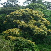
An Exceptional Tree and a Symbol of Monteverde--- Un árbol excepcional y un símbolo de Monteverde
AN EXCEPTIONAL TREE, AND A SYMBOL OF MONTEVERDE---UN ÁRBOL EXCEPCIONAL Y UN SÍMBOLO DE MONTEVERDE
English (para español favor de bajar)
For the past 3 years or so I have been captivated by a tree with a long name, Ocotea monteverdensis. (Some of my friends say I’m obsessed.) Why, you may ask, this one particular tree species? Is it because it grows to a huge size (1.7 m in diameter, 35 m tall) and is stunningly beautiful when flowering (or even when it is not in flower)?


Perhaps it is because it is endemic to (that is, only found in) the Monteverde area? Or because it is an important source of fruit for a number of large, unique, and threatened birds of our area (resplendent quetzals, three-wattled bellbirds, black guans, oilbirds)?


Or maybe because I discovered that there are less than 1,000 mature trees left on the planet, so that the IUCN has red-listed it as critically endangered (http://www.iucnredlist.org/details/48724260/0). Or maybe because we have learned that when the three-wattled bellbird passes through Monteverde in June, July, and August, every third year this tree provides the bellbirds their favorite fruit. Perhaps it is because it is currently growing in patches of remaining forest, almost all of which are not protected, and it requires special climate, light and soil conditions to reproduce itself. Well, actually, it is for ALL of the above reasons.
O.K., the name Ocotea monteverdensis is so very long. Can’t we call it something shorter? Well, some local people call it “quizzará blanco” or “quizzará amarillo”. Not much better, huh. For this blog I am going to call it “O. m.”
O. m. is a member of the plant family Lauraceae, also known as the laurel or avocado family. Species are found all over the world, with over 100 species in Costa Rica. Cloud forests and other wet mountain forests have the most species, with over 70 species found in the Monteverde area alone. Like the avocado we eat, species of this family have fruit with a single seed and a soft, fleshy rind that many birds and mammals like to eat. While some species have fruit as big as the domesticated avocado found in markets, most have much smaller fruit, 1- 3 cm in length.
The fruit of O. m. is on average 1.85 cm in length and is among the largest of the locally known “aguacatillos” or “small avocados.” It is known to be eaten by about 10 bird species, all of whom have large enough gapes to get the fruits (with seeds) whole into their mouths. Like many aguacatillos, O. m. fruit is held in a red cupule to make it more noticeable to birds. O. m. leaves are fairly long and narrow, a shiny dark green, and have prominent leaf veins. Newly growing stems are a rusty red color and are quite hairy.


WHERE IS IT FOUND and HOW MANY ARE LEFT?
We know from specimens collected by botanists since the 1970’s that O. m. is found almost entirely on the Pacific side of the Tilaran Mountains of C. R. between 1200 and 1500 m elevation, in a 2-km-wide band between the towns of Los Nubes and San Luis that includes its center of concentration around Monteverde (http://www.tropicos.org/Name/17804917?tab=specimens).
A few individuals, separate from the main population, have also been recorded from lower elevations of the Caribbean side of the Cordillera de Tilarán and a single tree has been reported from 75 km to the northwest, on the Pacific slope of the Rincon de la Vieja volcano within the Cordillera de Guanacaste. Further exploration for separate populations from the Monteverde group is needed.
Much of the primary forests that covered this species’ small natural range have been cut down to create pastures, coffee plantations, roads, and towns. Mature O. m. trees that are capable of producing fruit are now only found in fragments of that remaining forest. Even in secondary forests that may be growing back in abandoned pastures, it seems to have a difficult time reproducing.

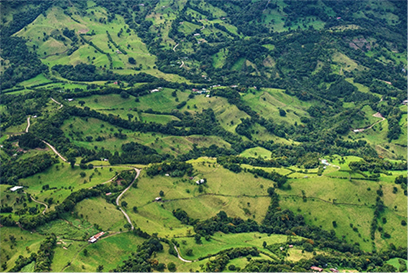
*Above two aerial photos by Giancarlo Pucci of Magical Trees Foundation.
Earlier this past year (2015), I realized that June and July was going to be a major flowering period for O. m. (which only flowers every three years on average). And it dawned on me that the best way to locate most of the remaining trees would be to take aerial photographs across the entire range of the species. When flowering, O. m.’s yellow flowers usually cover the entire crown and contrast nicely with surrounding green leaves of neighboring trees. Ana Gabriela Hindelang connected me with a man who loves to photograph trees, loves to do aerial photography, and cares about conservation—Giancarlo Pucci*. Giancarlo agreed to work with me and a pilot of a small plane to find a day when they could fly over the MV zone and photograph the O. m. trees in flower. But throughout June and early July there was too much cloud cover and/or too much wind for a flight. Finally on July 7, the clouds lifted and Giancarlo, Ana, and the pilot were able to take off from San Jose and fly over the zone for several hours to produce 130 spectacular high-resolution photographs. Some were overviews of large areas of our zone; others were close-ups:


*Above two aerial photos by Giancarlo Pucci of Magical Trees Foundation.
Each O. m. tree shows up because of its thousands of very small, golden yellow flowers. Using these photos, I worked with Randy Chinchilla of the Monteverde Institute to count the number of mature O. m. trees that flowered that year, and to make a map of every tree we could identify from the aerial photos.
If you look closely at the map, you will notice that almost all the O. m. trees are between 1300 and 1500 m elevation on this, the Pacific side of the Tilaran Mountains. The climate of this moist portion of the so-called premontane wet forest zone gets a lot of rain from June through November and very little the rest of the year (total about 2500 mm per year). During this dry season (December-May), this particular elevational belt does, however, receive considerable mist for days at a time, and the temperature seldom exceeds 27 C.
During the mapping process, we were able to estimate the number of mature O. m. trees remaining on the planet. We counted approximately 600 trees in the photos. “Ground-truthing” the photos indicated that 95% of the trees were correctly identified. There is still the issue of how many trees we missed because they were not flowering or because they did not have enough flowers to detect them. Using previous knowledge of the location of 50 or so trees in the zone, we estimate that we failed to locate 15% with the aerial photos. I also journeyed to locations not captured by these aerial photos (at the ends of its range) and took photos with a camera from vista points. By this method, I estimate that 50 mature trees remain in the area of Los Nubes and 50 more trees exist in a tract known as “Buen Amigo” in Alto San Luis. Combining these methods, I estimate that there are 770 remaining mature O. m. trees on the planet.
NEXT BLOG: Special Relationship between Ocotea monteverdensis and the three-wattled bellbird
About the author:
Dev Joslin is a scientist who enjoys research that combines his interests and expertise in forest ecology, soils, ornithology, and reforestation. With a masters and a Ph. D. in forestry and soil science, he conducted research for 30 years in North America and Europe on air pollution and climate change impacts on forests, soils, and streams. He has been an active birder and conservationist in Tennessee and Costa Rica for the past 26 years. He and his wife, Harriet, have lived in Monteverde for the past 11 years, during which time he has been active in community organisations, “gentleman farming,” and conservation research involving frugivorous birds and their relationships to wild avocados.
Dev is the main person responsible for helping to put the Ocotea monteverdensis on the critically endangered species list.

UN ÁRBOL EXCEPCIONAL Y UN SÍMBOLO DE MONTEVERDE
Durante los últimos 3 años aproximadamente he sido cautivado por un nombre particularmente largo, Ocotea monteverdensis, algunos de mis amigos inclusive dicen que estoy obsesionado. Quizás se pregunten, por qué est especie de árbol en particular? ¿Es por qué crece a un tamaño gigante (1.7m de diámetro y 35 m de alto) y es sumamente hermoso cuando florece (y aún cuando no lo hace)?


¿Quizás es porque es endémico (o sea que solo se encuentra) en la zona de Monteverde? ¿O será porque es una fuente importante de fruta para varios pájaros grandes, únicos y en riesgo de nuestra zona (quetzal, pájaro campana, pava negra, guácharo)?


¿O quizás es porque descubrí que hay menos de 1000 árboles maduros restantes en el planeta, así que la IUCN lo colocó en la lista es especies criticas en peligro de extinción (http://www.iucnredlist.org/details/48724260/0)? ¿O quizás es debido a que aprendimos que cuando el pájaro campana atraviesa Monteverde en junio, julio y agosto, cada tercer año este árbol provee a estas aves su fruta favorita? ¿Será por qué actualmente crece en parches de bosque pequeños, del cual casi ninguno está protegido, y que necesita un tipo de clima, luz y condiciones de suelo especiales para reproducirse? Bueno, pues en realidad es por todas estas razones.
Está bien, el nombre Ocotea monteverdensis es muy largo. ¿Podemos ponerle un nombre más corto? Algunas personas locales le dicen “quizzará blanco” o “quizzará amarillo”. ¿No es mucho mejor verdad? Así que para esta nota le llamaremos “O.m.”
O. m. es miembro de la familia de plantas Lauraceae, también conocido como laurel o familia de aguacate. Especies de esta familia se encuentran por todo el mundo, con más de 100 especies en Costa Rica. Los bosques nubosos y otros bosques de montaña húmeda son las que más especies tienen, por ejemplo, en la zona de Monteverde se han identificado más de 70 distintas. Como el aguacate que comemos, especies de esta familia tienen una fruta que contiene una única semilla y una pulpa carnosa y suave del cual muchas aves y animales les gusta alimentarse. Mientras que algunas especies tienen una fruta igual de grande al aguacate domesticado que encontramos en nuestros supermercados, casi todos tienen una fruta más pequeña de 1-3 cm de largo.
La fruta del O. m. tiene aproximadamente 1.85 cm de largo y es de los más grandes de los comúnmente llamados “agacatillos” o sea, “aguacates pequeños”. Se conoce por ser comido por aproximadamente 10 especies de pájaros, todos los cuales tienen aberturas en la boca lo suficientemente grandes como para poder comer los frutos enteros (con sus semillas). Como muchos aguacatillos la fruta del O.m. es sostenido por una cúpula roja para hacerlo más notable para los pájaros. Las hojas del O.m. son relativamente largos y angostos y tienen venas prominentes. Los tallos jóvenes son de un color rojo oxidado y son bastante peludos.


¿DONDE SE PUEDE ENCONTRAR? y ¿CUANTOS QUEDAN?
Sabemos por medio de especímenes colectados por botánicos desde los 1970’s que el O.m. es encontrado casi en su totalidad del lado pacífico de las montañas de la Cordillera de Tilarán, Costa Rica entre 1200 y 1500 metros de elevación, en una tira de 2km de ancho entre las comunidades de Las Nubes y San Luis y que incluye su centro de concentración alrededor de Monteverde (http://www.tropicos.org/Name/17804917?tab=specimens).
Algunos poco individuos, separados de la población principal, han sido documentados en elevaciones más bajas del lado caribeño de la Cordillera de Tilarán y una única especie ha sido reportada a 75km noroeste del lado pacifico del Volcán Rincón de la Vieja dentro de la Cordillera de Guanacaste. Es necesario hacer más exploración para estudiar casos aislados de poblaciones del grupo de Monteverde.
Muchos de los bosques primarios que estaban dentro del pequeño rango de esta especie han sido cortados para crear pastizales, plantaciones de café, carreteras y pueblos. Árboles maduros de los árboles O.m. capaces de producir fruta se encuentran ahora únicamente en los fragmentos restantes de este bosque. En los bosques secundarios que se encuentran creciendo en pastizales abandonados, estos parecen tener dificultades de reproducirse.


*Las fotografías aéreas son de Giancarlo Pucci de la Fundación árboles mágicos.
A principios del 2015 me percaté de que junio y julio iba a ser un periodo de floración grande para los árboles de O.m. (la cual florece únicamente cada tres años en promedio). En ese momento de me ocurrió que la mejor manera de ubicar la mayoría de los árboles restantes sería de tomar fotografías aéreas por el rango total de la ubicación de estas especies. Al florecer las flores amarillas de los O.m. usualmente cubren la totalidad de la corona y contrastan muy bien con las hojas verdes de los árboles que las rodean. Ana Gabriela Hindelang me contacto con un hombre que le encanta fotografiar árboles y además de hacer fotografía aérea y que también tiene un interés por la conservación – Giancarlo Pucci. Giancarlo acordó trabajar conmigo y con una piloto de un pequeño avión para encontrar el mejor día para sobrevolar sobre el área de Monteverde y fotografiar los árboles de O.m. en floración. Sin embargo, durante junio y Julio hubo mucha cobertura nubosa y/o demasiado viento para el vuelo. Finalmente el 7 de Julio los árboles se levantaron y Giancarlo, Ana y el piloto lograron salir de San José y volar sobre el área por varias horas y producir 130 fotografías de alta resolución espectaculares. Algunas fueron tomas abiertas, otras más de cerca.


*Las fotografías aéreas son de Giancarlo Pucci de la Fundación árboles mágicos.
Cada uno de estos O.m. se puede ver gracias a miles de flores muy pequeñas de color amarillo dorado. Usando estas fotografías trabajé con Randy Chinchilla del Instituto Monteverde para contar la cantidad de árboles maduros de O.m. que florecieron ese año y de mapear cada uno de los árboles que pudimos identificar de las fotos aéreas.
Si ven de cerca al mapa notarán que casi todos los árboles de O.m. están entre los 1300 y los 1500m de elevación en este, el lado pacífico de las montañas de Tilarán. El clima de esta porción húmeda de tal llamado bosque pre-montano húmedo recibe mucha lluvia de junio a noviembre con muy poca agua el resto del año (un total de 2500mm por año). Sin embargo, durante esta estación seca (diciembre –mayo), esta faja elevacional en particular sí recibe una neblina considerable que puede durar varios días a la vez y la temperatura casi nunca excede los 27 C.
Durante el proceso de mapeo, fuimos capaces de estimar el número de árboles maduros de O.m. que quedan en el planeta. Contamos aproximadamente unos 600 árboles en las fotografías. En la verificación de campo pudimos corroborar el que 95% de los árboles fueron identificados correctamente. Todavía está el factor de cuantos árboles no vimos por falta de floración o porque no tuvieron suficientes flores para ser detectados. Usando conocimiento previo de la ubicación de unos 50 o más árboles de la zona estimamos de que fallamos en ubicar un 15% con las fotografías aéreas. Además transité a varias locaciones no capturadas por estas fotografías aéreas (en los extremos de la gama) y tome fotografías con una cámara desde miradores. Por medio de este método estimo que 50 árboles maduros permaneces en la zona de las Nubes y que 50 árboles más existen en un paso conocido como “Buen Amigo” en el alto de San Luis. Combinando estos métodos yo estimo que quedan 770 árboles maduros de O.m. en el planeta.
Próximo blog: La relación especial entre el Ocotea monteverdensis y el pájaro campana.
Sobre el autor:
Dev Joslin es un científico que disfruta la investigación y combina sus intereses y pericia en ecología forestal, suelos, ornitología y reforestación. Con una maestría y un doctorado en ciencias forestales y ciencias de suelos el ha conducido investigación por 30 años en América del Norte y Europa en el impacto de la contaminación de aires y el cambio climático en los bosques, suelos y quebradas. Él ha sido un pajarero y conservacionista active en Tennessee y Costa Rica por los últimos 26 años. Él y su esposa, Harriet, han vivido en Monteverde por 11 años en los cuales han participado activamente en organizaciones comunitarias, “agricultura de caballeros”, y investigación de conservación involucrando pájaros fructíferos y su relación con el aguacatillo Silvestre.
Dev es además la principal persona responsable en ayudar a colocar el Ocotea monteverdensis en la lista de críticamente en peligro de extinción.
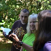
Programa de MOSI en el IMV - MOSI Program at the MVI
Programa MOSI (Monitoreo de Sobrevivencia Invernal) en pájaros migratorios del Neotrópico --- MOSI Program (Interval Survival Monitoring) in migrant neotropical birds.
En español (for English please scroll down)

MoSI (Monitoreo de Sobrevivencia Invernal) es un programa de monitoreo de pájaros neotropicales terrestres que se enfoca en el monitoreo de pájaros migratorios a través de las Americas con estaciones en los neotrópicos del norte. La meta del programa es el de poder evaluar las tazas de sobrevivencia de la hibernación y las condiciones físicas de los pájaros en su llegada a sus zonas de invernada. Los pájaros migratorios del neotrópico viajan un promedio de 3000 millas hasta llegar a sus zonas de invernada donde permanecen al menos la mitad del año. Debido a la disminución de muchas especies migratorias, la "Bird Population Organization" (Organización de Poblaciones de Aves) empezaron un proyecto de investigación para estudiar la sobreviviencia de invernación. Si la sobrevivencia es baja en los trópicos, entonces los esfuerzos de conservación se deben de enfocar en la necesidades de las aves en estas zonas, en lugar de enfocarse en las necesidades en sus zonas de reproducción en latitudes más altas.
En Monteverde, Costa Rica se trabaja de noviembre a marzo intentando poner anillos de identificación a la mayor cantidad posible de pájaros migratorios y residentes. Pueden ver el siguiente video para escuchar sobre la experiencia de una de las pasantes que colaboró junto con Deb Hamilton en el proyecto. La estación de MoSI de Monteverde es uno de las 29 estaciones situadas entre México y el norte de Sur América. Se colocaron once redes siguiendo todos los protocolos de redes de niebla en laReserva Crandell detrás del Instituto Monteverde. A las especies migratorias que se encontraron se les colocaron anillos informativos del U.S. Fish and Wildlife y se soltaron ilesos con el fin de que se les pudiera seguir el rastro en caso de que los re-capturaran en Norte América.
Esta es una gran oportunidad educacional no solo para los miembros del equipo de MoSI, sino también para algunos miembros de la comunidad y las escuelas visitantes (programa de EAP y Goucher - Mt. Holyoke, entre otros) que tienen la oportunidad de ver el proceso en persona y poder aprender de los procesos migratorios de diferentes especies. Este proyecto ha dado la oportunidad a los participantes de entender un poco más sobre la importancia del conservación de hábitat en los bosques tropicales de Costa Rica.

English (Para español favor de subir) --
MoSI (Interval Survival Monitoring) is a Neotropical migrant landbird monitoring program that focuses on migratory birds throughout the Americas with stations in the northern Neotropics. The goal of this program is to assess overwintering survival rates and physical conditions of birds passing through and arriving at wintering grounds.
Neotropical migratory birds fly an average of 3000 miles to reach their wintering grounds where they live for at least one half of the year. Due to the decline of many migratory species, the Bird Population Organization started a research project to assess the migratory bird’s overwintering survival. If survival is low in the tropics, conservation efforts will need to focus on the birds’ survival needs here, rather than in their reproductive areas at higher latitudes.
In Monteverde, Costa Rica people work together from November through March to band as many migratory and resident passerines as possible. You can see a video about the experience of one of the participating interns here. The Monteverde MoSI station is one of 29 stations situated from Mexico to northern South America. Eleven nets were set up using standard mist netting protocols within the Crandell Reserve behind the Monteverde Institute. Migratory species that were captured were banded with U.S. Fish and Wildlife bands and released unharmed so they could be tracked if they are re-captured in North America.
This is great educational opportunity not only for theMoSI team but also for the community and visiting schools (EAP program and Goucher - Mt. Holyoke, amongst others) that get an opportunity to experience bird banding in person and learn about the migrating process for different bird species. This project also gives participants an opportunity to experience the importance of habitat conservation in tropical rainforests of Costa Rica.

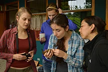
Conservet = veterinary science including conservation issues / Conservet= veterinaria que include conceptos de concervación
Conservet is an on-site workshop that introduces veterinary students and veterinarians to conservation medicine concepts in the context of Costa Rica.
--- --- “Conservet” es un taller en locación que introduce estudiantes de veterinaria y veterinarios a conceptos de medicina de conservación en el contexto de Costa Rica.
(Para español favor de bajar).
Conservet is an on-site workshop that introduces veterinary students and veterinarians to conservation medicine concepts in the context of Costa Rica. The overall objective of expanding the veterinary science view to include conservation issues is met through lectures, group discussions and problem-solving exercises. Students participated in hands-on immersion in field study methods among different forms of life, including birds, mosquitoes, frogs, and bats. This year, eight Conservet participants spent two weeks at the Texas A&M Soltis Center in San Isidro de Peñas Blancas and one week with the Monteverde Institute in order to learn more about the complexities of environmental functions and what consequences can occur when these natural processes are disrupted by regional and global disturbances, like agricultural practices or climate change. In these photos, students practice taking different measurements of bird physiology in addition to swabbing them for samples that can be sent to SENASA. The course is the creation of Dr. Raymond Tarpley (Conservet) and was co taught by Dr. Kurt Volle (Buffalo Zoo). The course involved many local and national experts and collaborations with Texas A&M University, the Monteverde Institute, SENASA, Costa Rican Health Ministry, the Bat Jungle, the ASIS Center, Universidad Nacional, ICE, Luna Nueva, and the Toucan Rescue Ranch.
The future goal of Conservet is to provide services for SENASA in the detection of human and wildlife health issues. Minor Cordero, SENAA Regional Director and Eduardo Venegas (SENASA representative) met with Raymond Tarpley (Conservet), Debra Hamilton and Fern Perkins (Monteverde Institute), Dr. Carlos Salguero (Ministry of Health), Dr. Rodrigo Marín (National Center for Vector Control) to highlight concerns and develop a plan for collaborative work in 2016. The idea is to develop a plan for the near future where this course can provide assistance in monitoring the vector mosquitos for diseases such as chinkungunya, dengue, Nile fever, etc.
For more information you can visit their website: www.conservet.org

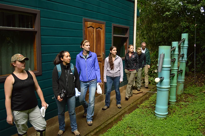


Photographs by/ fotos por: Michael Vinicio Rodriguez Delgado
--- “Conservet” es un taller en locación que introduce estudiantes de veterinaria y veterinarios a conceptos de medicina de conservación en el contexto de Costa Rica. El objetivo general es de poder expender la ciencia de veterinaria para incluir retos en la conservación es hecha a través de charlas, discusiones de grupo y ejercicios de resolución de problemas. Los estudiantes participaron en estudios de campo participativas entre diferentes tipos de vida, incluyendo pájaros, mosquitos, ranas, y murciélagos. Este año, ocho participantes de Conservet pasaron dos semanas en el Soltis Center de Texas A&M en San Isidro de Peñas Blancas y una semana con el Instituto Monteverde para así poder aprender más sobre las complejidades de las funciones medios ambientales y las consecuencias que estas sufren cuando estos procesos naturales son interrumpidos por disturbios regionales y globales, como practicas agrícolas o cambio climático. En estas fotografías, los estudiantes están practicando el tomar diferentes medidas fisiológicas en pájaros además de tomar muestras que se pueden enviar luego a SENASA. El curso es la creación de DR. Raymond Tarpley (Conservet) y se enseño en conjunto con Dr. Kurt Volle (zoológica de Búfalo). El curso cuenta con la participación de muchos colaboradores nacionales y locales en conjunto con Texas A&M, el Instituto Monteverde, SENASA, el Ministerio de Salud de Costa Rica, la Jungla de Murciélagos, el centro ASIS, la Universidad Nacional, ICE, Finca Luna Nueva, y el Rancho de investigación Tucán.
La meta a futuro de Conservet es el de proveer servicios a SENASA en apoyo a la detección de posibles situaciones de salud en humanos y vida silvestre. Minor Cordero, director regional de la SENAA y Eduardo Venegas (representante de SENASA) se reunieron con Raymond Tarpley (Conservet), Debra Hamilton y Fern Perkins (Instituto Monteverde), Dr. Carlos Salguero (Ministerio de Salud), Dr. Rodrigo Marín (director del centro nacional de control de vectores) para resaltar preocupaciones y desarrollar un plan para trabajo colaborativo para el 2016. La idea es el poder apoyar esfuerzos en monitorio de los mosquitos vectores de enfermedades como chinkungunya, dengue, fiebre de nilo, etc.
Para más información pueden visitar su página web: www.conservet.org
El papel humano en la producción y tratamiento de aguas grises - The Human Role in the Production and Treatment of Greywater
El papel humano en la producción y tratamiento de aguas grises - The Human Role in the Production and Treatment of Greywater
Este es un resumen del trabajo hecho por la pasante del Instituto Monteverde Shelby Bates.
--- This is a summary of the work done by the Monteverde Institute's Intern Shelby Bates. (For an English version please scroll to the bottom of the page.).

Shelby y Orlando frente a la biojardinera del Instituto Monteverde. --- Shelby and Orlando in front of the MVI's biogarden.
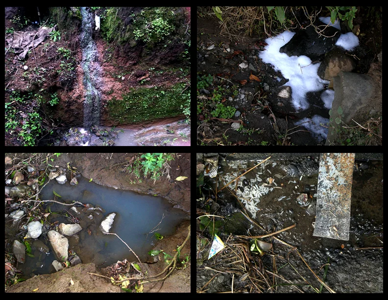
Fotografías tomadas en Monteverde de ejemplos de Aguas Grises - Greywater examples from Monteverde
Aguas Grises: Peligros y Soluciones. (Artículo para Agua Pura).
En Costa Rica, cada persona consume un promedio de 244 litros de agua por día. Aproximadamente un 87% de este consumo se transforma en aguas grises. Según el último Informe del Estado de la Nación, solo el 3,6% de las aguas residuales del país, recibe un tratamiento apropiado. Por el momento, Monteverde tampoco cuenta con la infraestructura correcta para el manejo de aguas grises.
Las aguas grises se originan en los fregaderos, lavatorios, duchas y lavanderías. No incluyen las aguas negras, las cuales provienen de los inodoros y son tratados en los tanques sépticos. La incorporación de aguas grises en diversas fuentes de agua puede causar muchos problemas de salud, al igual que al medio ambiente y a la economía turística. Cuando estos flujos de agua no se tratan adecuadamente, son convertidos en focos de enfermedades como Salmonella y Campylobacter. Además, contaminan ríos, aguas subterráneas y mares, causando la mortalidad de organismos que dependen de aguas limpias para sobrevivir. Finalmente, causan un impacto negativo en relación a la apariencia de la ciudad, cuando vemos basura y jabón cayendo directamente a nuestras calles y ríos.
¿Cómo podemos reducir el impacto de las aguas grises en nuestra comunidad? Lo primero y más importante, es disminuir el consumo de agua, ya que así reducimos la formación de aguas grises. Por ejemplo, podemos tomar duchas más cortas y podemos cerrar la llave cuando se enjabonan los platos o cuando nos lavamos los dientes y manos. Debemos también reducir la cantidad de materia orgánica en nuestras aguas grises. Para esto podemos separar los sólidos y grasas antes de lavar los platos y/o podemos implementar filtros en el desagüe. Otro consejo es utilizar productos amigables con el ambiente, como los jabones biodegradables y los productos naturales. Por último, existen sistemas alternativos para el tratamiento de las aguas grises, como es el caso de las biojardineras. En general, las pequeñas acciones en nuestras casas pueden ayudar a disminuir los efectos negativos de las aguas grises en Monteverde.
Para concluir, debemos de ser más sensibles ante los problemas del recurso hídrico. Los cambios en los patrones de lluvia, posiblemente causados por el cambio climático, y el aumento de la población mundial, han contribuido a la escasez de agua potable disponible. Es importante recordar que las aguas de Monteverde afectan a muchas otras personas y sistemas de vida en altitudes inferiores, y por lo tanto debemos ser responsables con su uso y tratamiento. Cuando pensamos en otras personas y en la naturaleza, podemos trabajar en equipo para mejorar las condiciones de vida de todos.
Aquí en Monteverde, se esta dando el primer paso para responder a la problemática de aguas grises a través de el establecimiento de la Comisión Especial de Manejo de Aguas Residuales (la RED). En próximos artículos, se tratarán con mayor detalle temas específicos ya mencionados.
Por: Orlando Calvo y Shelby Bates

Además del artículo y el taller la pasantía de Shelby se encargó de hacer los rótulos para la bíojardinera del Instituto Monteverde.
Shelby además escribió un blog sobre su experiencia en Costa Rica y el Instituto Monteverde que pueden leer aquí.


English version=
Grey water: Dangers and Solutions.
In Costa Rica, each person consumes an average of 244 liters of water per day. Approximately 87% of this consumption is transformed into grey water. According to the most recent State of the Nation report, only 3.6% of residual waters in the country receive adequate treatment. For the moment, Monteverde also does not have the correct infrastructure to manage grey water.
Grey water originates in bathroom sinks, washing machines, showers, and kitchen sinks. These waters do not include black water, which comes from toilets and which is treated in septic tanks. The incorporation of grey water in different water sources can cause many health problems, in addition to environmental and tourism issues. When these water flows are not adequately treated, they convert into breeding grounds for diseases like Salmonella and Campylobacter. Moreover, they contaminate rivers, subterranean waters and seas, causing the death of organisms that depend on clean water to survive. Finally, they cause a negative impact with respect to the appearance of the city, when we see trash and soap falling directly into our streets and rivers.
How can we reduce the impact of grey water in our community? Firstly and most importantly, it is important to diminish your consumption of water, which will reduce the formation of grey water. For example, we can take shorter showers and we can turn off the water when we soap up plates or when we brush our teeth and wash our hands. We should also reduce the quantity of organic material in our grey water. To do this, we can separate out solids and greases before washing our plates, and/or we can implement filters in the drain. Another suggestion is to use environmentally-friendly products like biodegradable soaps and natural products. Lastly, alternative systems for grey water treatment exist, like in the case of biogardens. In general, small actions in our homes can help diminish the negative effects of grey water in Monteverde.
To conclude, we need to be more sensitive issues surrounding water. Changes in rain patterns, possibly caused by climate change, and the increase of the world’s population, have contributed to the scarcity of available potable water. It is important to remember that Monteverde’s waters affect many other people and life systems in lower altitudes, and therefore we need to be responsible with our use and treatment of water. When we think about other people and nature, we are better able to work as a team to better others’ conditions of life.
Here in Monteverde, the first step to respond to the issue of grey water has been taken thanks to the establishment of the Special Commission of the Management of Grey Water (RED). In upcoming articles, subjects already mentioned in this article will be explained in greater detail.
Orlando Calvo and Shelby Bates Monteverde Institute
Dr. Thomas Simon - Climate Change and Disappearing States - Cambio Climático y Estados en Desaparición
El Dr. Thomas Simon dará la charla “Estados en Desaparición"
---Dr. Thomas Simon will give the lecture “Disappearing States"
The talk will be in English with simultáneos translation into Spanish. / Charla en inglés con traducción simultánea al español.
Para descripción en español favor de bajar:
Description:
Dr. Thomas Simon will give the lecture “Disappearing States: Ecological Canaries in the Coalmines of the Seas?” on Monday, December 8th, at 11:00am in the Monteverde Institute auditorium.
Dr. Thomas Simon is professor of International Law at the Johns Hopkins University Center for Chinese and American Studies. He has also acted as Professor of International Studies, Philosophy, and Legal Studies at various institutions. In addition to his work as a professor, Dr. Simon is the author of six books and countless articles on the subjects of peace, social justice, discrimination, minorities´ rights, genocide, and torture. The Monteverde Institute is proud to host him for this talk on political and social impacts of climate change.
ABSTRACT
The disappearing nation of the Maldives and its sister island states (Kiribati and Tuvalu) pose a challenge to philosophy, policy, and law. Many of those who take a holistic ecological perspective see these, much like the canaries in the coalmines, as early warnings signs of the cataclysmic effects of climate change. The current international system is based on the creation of states with fixed populations and defined territories. International law has no mechanisms for dealing with the extinction of states. Drastic problems call for drastic solutions such as recognizing states without territories. Policy makers should not treat nuclear war as gang violence. Similarly, they should not approach climate change as if it were like pollution.
Yet, a piecemeal, environmental approach does provide a solution to disappearing states. Amending the Law of the Sea Convention to freeze baselines at current levels would have an enormous impact since it would assure these states as well as those with threatened coastal communities with rights to the living and nonliving resources within their Exclusive Economic Zones (EEZ). Kiribati has nearly the same size EEZ as Japan and nearly four times the EEZ size of China, which, in turn, has about the same size EEZ as the Maldives and Tuvalu. International refugee law would not have to find a new classification for the environmentally displaced citizens of these islands. With funds from selling the rights to these resources, these citizens would have sufficient funds to relocate almost anywhere.
The canary in the coalmine does not symbolize a dire warning of ecological catastrophe but rather a potent warning of how fear conjured by over-dramatizing challenges turns us into meek canaries.
A big thank you to Cabañas los Pinos in Monteverde hosting Dr. Thomas Simon.
Español:
El Dr. Thomas Simon dará la charla “Estados en Desaparición: Indicadores del Porvenir de los Mares?” el lunes 8 de diciembre a las 11:00am en el auditorio del Instituto Monteverde.
El Dr. Thomas Simon es profesor de derecho internacional en el Centro para Estudios Chinos y Americanos de la Universidad de Johns Hopkins. También ha sido profesor de estudios internacionales, filosofía y estudios legales en varias instituciones. Además de su trabajo como profesor, el Dr. Simon es el autor de seis libros y numerosos artículos en los temas de paz, justicia social, discriminación, derechos de minorías y tortura. Al Instituto Monteverde le da orgullo ser anfitrión para su charla sobre impactos políticos y sociales del cambio climático.
Esta charla presenta el caso de naciones y estados (que se presumen tener poblaciones fijas y territorios definidos, por ejemplo las Maldivas) en desaparición debido a niveles marinos crecientes provocados por el cambio climático. Leyes internacionales no tienen mecanismos para lidiar con la desaparición de estados. El Dr. Simon propone una solución que definiría linderos que garantizan los derechos a recursos para poblaciones destinadas a volverse refugiados climáticos.
n agradecimiento muy grande a Cabañas los Pinos por hospedar al Dr. Thomas Simon.
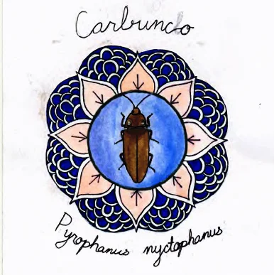
Enseñando bioluminiscencia por el arte - Teaching Bioluminescence through Art
ENSEÑANDO BIOLUMNISCENCIA POR EL ARTE - TEACHING BIOLUMINESCENCE THROUGH ART- Proyecto hecho por/ Project made by: Melina Baron-Deutsch
Proyecto hecho por/ Project made by: Melina Baron-Deutsch
Supervisora/ Intern supervisor: Carla Willoughby

Enseñando a los estudiantes del CEC en Santa Elena-Teaching children at the CEC School in Santa Elena
Melina estuvo un par de meses en el Instituto para hacer una pasantía que tenía que ver en cómo enseñar ciencia por medio del arte. Ella opto por hacer un librito gráfico atractivo y enseñar por medio del diseño de mandalas a los niños sobre los insectos, en particular sobre los insectos bioluminosos. Aquí les compartimos un poco sobre su trabajo. --------
Melina spent a couple of months at the Monteverde Institute working project about teaching science through art. After doing some research she decided to create a Zine (a little artistic booklet) and to teach students by drawing mandalas with insects. Here you will be able to see some of her work.


Vean el librito que hizo Melina, una buena idea para combinar arte y ciencia. ---
Look at the Zine Melina created, it's a great idea for teaching art and science.


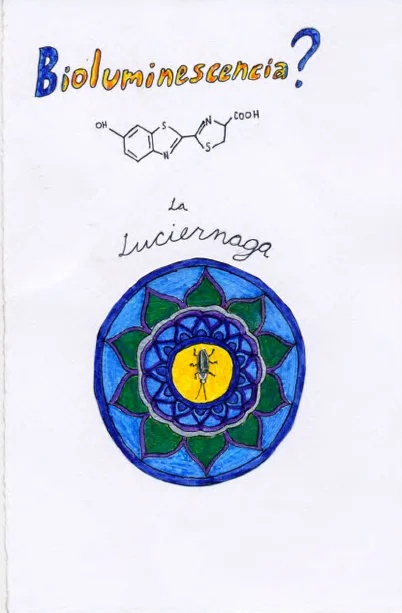


Hojas de Monteverde- Agua y como ayudar a cuidarla
En la nueva edición de Hojas de Monteverde nos hemos enfocado en el tema de agua. Además contamos con la participación de ilustraciones de niños de la zona, no se lo pierdan!
En la nueva edición de Hojas de Monteverde nos hemos enfocado en el tema de agua. Además contamos con la participación de ilustraciones de niños de la zona, no se lo pierdan! Aquí pueden ver la versión digital y en el Instituto Monteverde podrán recoger una copia impresa.
///
In the new Community newsletter we have focused on "Water" due to the fact that we are in the dry season and water is one of our main resources. So far the "Hojas de Monteverde" newsletter is only in Spanish, however you can sign up to our bilingual newsletter here: newsletter sign up.


Synthetic and Organic Lettuce Fertilizers- Fertilizantes orgánicos y sintéticos
We are always trying to down grade costs. Farmers, especially, who focus on maximizing their yields and profits for the labor, energy, and supplies they put in, need reliable, cost-efficient sources of fertilizer.
We invite you to read this work made by our EAP Spring student Sarah Vetter. This was made on a two week research, if you would like more information on the article (or you want to read the full article) you can to write to: info@mvinsitute.org
Lettuce Growth in Response to Weather & Soil Nutrients & pH
Sara L. Vetter -Department of Environmental Science - University of California, Los Angeles -EAP Tropical Biology and Conservation Program, Spring 2013
ABSTRACT
Organic fertilizers can prove just as efficient as or even better in aiding in plant growth than synthetic fertilizers. I observed how lettuce seedlings would differ in growth of leaf width and length between treatments with and without the two types of fertilizers. I looked at nutrient and pH content of each treatment before and after planting, and analyzed the effects of weather on leaf production. For organic fertilizer I utilized vermi-compost cow manure, regular cow manure, and goat manure, products of a local La Cruz de Abangares farm. For synthetic fertilizer, I chose Urea and 10-30-10, ones commonly used by farmers of the same area. I measured leaf growth of the largest leaf of each seedling for each treatment for each area. For the indoor plot the seedlings of the vermi-compost cow manure treatment grew significantly taller (4.25 cm) than those of the goat manure (1.81 cm) and the control (2.12 cm). I found seedlings of the 10-30-10 treatment (4.06 cm) to have grown significantly more than goat manure as well. For the outdoor plot, goat manure (2.08 cm) and Urea (1.85 cm) showed a significantly greater change in width than the 10-30-10 treatment (0.75 cm). The vermi-compost treatment appeared to have had good soil structure and perhaps undetected reserves of micronutrients released by earth worms. For the outdoor plot the goat manure treatment may have had undetected nitrogen and salt reserves, while the Urea treatment high nitrogen content. Weather may have influenced the release of nutrients in some treatments in a way that caused seedling growth to differ in the indoor and outdoor plots. A partially unifying factor in the results between the outdoor and indoor plots appears to have been the presence of nitrogen in the starting treatment.

Photo for illustrative purposes/ Foto para uso ilustrativo.
RESUMEN
Los fertilizantes orgánicos pueden ser igual de eficaces o incluso mejores que los fertilizantes sintéticos en ayudar en el crecimiento de plantas. Estudié diferencias en el crecimiento de plántulas de lechuga en cuanto a la anchura de la hoja y la longitud entre los tratamientos con y sin los dos tipos de fertilizantes. Medí los nutrientes y el contenido de pH de cada tratamiento antes y después de la siembra, y analicé los efectos del clima en la producción de la hoja. Para obtener fertilizante orgánico utilicé estiércol de vaca ya compostado por lombrices, estiércol de vaca regular, y estiércol de cabra, productos de una finca en La Cruz de Abangares. Por fertilizantes sintéticos, elegí Urea y 10-30-10, utilizadas por los agricultores de la misma zona. Medí crecimiento de la hoja de la hoja más grande de cada planta para cada tratamiento para cada área. Para la parcela del interior las plántulas del vermi-compost de estiércol de vaca crecieron significativamente más altas (4,25 cm) que las del estiércol de cabra (1,81 cm) y el control (2,12 cm). Las del tratamiento 10-30-10 (4,06 cm) crecieron más que las de estiércol de cabra también. Para la parcela al aire libre, el estiércol de cabra (2,08 cm) y urea (1,85 cm) mostraron un cambio significativamente mayor en anchura que el tratamiento 10-30-10 (0,75 cm). El tratamiento vermi-compost parecía haber tenido una buena estructura del suelo y reservas de micronutrientes tal vez no detectados en la prueba. En la parcela exterior del tratamiento del estiércol de cabra puede haber tenido de nitrógeno y reservas de sal que no se detectaron, mientras urea presentó un alto contenido en nitrógeno. El clima puede haber influido en la liberación de nutrientes en algunos tratamientos de una manera que hizo que el crecimiento de plántulas difiriera en las parcelas cubiertas y al aire libre. Un factor unificador parcialmente en los resultados entre las parcelas al aire libre y de interior parece haber sido la presencia de nitrógeno en el tratamiento inicial.


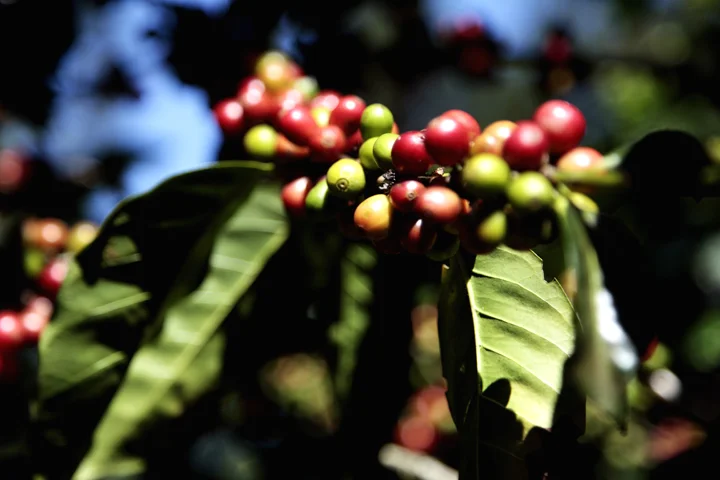
Combating Coffee Rust (Hemileia vastatrix)- Combatiendo la Roya
Combating Coffee Rust: Coffee Rust (Hemileia vastatrix) damages coffee leaves and leads to defoliation, and can seriously reduce yields. While chemical fungicides have been effective, they introduce dangers to human health and the environment. Naturally occurring hyperparasitic fungi do not present the same risks, and may be a more sustainable alternative.
Coffee Rust (Hemileia vastatrix) damages coffee leaves and leads to defoliation, and can seriously reduce yields. While chemical fungicides have been effective, they introduce dangers to human health and the environment. Naturally occurring hyperparasitic fungi do not present the same risks, and may be a more sustainable alternative. We studied two such parasites: Trichoderma asperellum and Lecanicillium lecanii. We compared the effects of the two fungi on rust-infected trees in a coffee plantation. Trees sprayed with L. lecanii experienced 50% fewer necrotic lesions and 40% less discoloration than those treated with T. asperellum. We also conducted a lab experiment where we applied each fungus directly on leaves infected with H. vastatrix and found that L. lecanii colonized 25% more leaves than T. asperellum. Our results indicate that L. lecanii controls rust infections more effectively than T. asperellum.
RESUMEN
La Roya (Hemileia vastatrix)
daña las hojas del café, lleva a la defoliación y puede reducir
considerablemente los rendimientos. Si bien los fungicidas químicos han sido
eficaces, introducen peligros para la salud humana y el medio ambiente.
Los hongos hiperparasíticos que ocurren naturalmente no presentan
los mismos riesgos, y puede ser una alternativa más sostenible. Estudiamos dos
de esos parásitos: Trichoderma
asperellum y Lecanicillium lecanii. Comparamos los efectos de los dos
hongos en plantas de café afectadas con roya. Los árboles rociados con L. lecanii experimentaron un menor aumentar de
lesiones necróticas(50%) y 40% menos decoloración de hojas que Trichoderma asperellum o
el control. También llevamos a cabo un experimento de laboratorio donde
aplicamos cada hongo directamente en hojas infectado con H. vastatrix, y encontramos que L. lecanii colonizó más hojas (25%) que T. asperellum. Nuestros
resultados indican que L.
lecanii controla las
infecciones de roya más eficazmente que T. asperellum.
BY:
Jonathan Martindill, University of California, Davis- Land, Air, and Water Resources
AND:
Sydney Fozard ,University of California, Santa Barbara -Ecology, Evolution, and Marine Biology
EAP Tropical Community Ecology, Spring 2013 -7 June 2013
For complete report write to/ Para el reporte completo escriban a: info@mvinstitute.org


Hugelkultur in Monteverde
Hugelkulture in Monteverde guidelines.
We cannot talk about sustainability without including the fundamental theme of agriculture, growing that which we eat. With this in mind and with a great amount of effort form our students; the Monteverde Institute is testing different vegetable-garden types in our campus. So far we have an example of HugelKulture and a Keyhole garden in progress. Both of these projects follow sustainable guidelines and have their bases on Permaculture practices.
Here you can find a "how to" guideline built by one of our interns, Peter Wells.
Hugelkultur in Monteverde
A Hugelkultur is raised bed that mimics forest decomposition. This technique is native to Austria where is has been used for hundreds for years, for more information on this system, research the work of Sepp Holzer and his Permaculture farm in the Alps. With good construction and adequate precipitation, a hugelkultur is a self sustaining system. With occasional maintenance, it requires no additional fertilizer, chemicals, irrigation, or tillage. Here is how to make one.

Sample of a Hugelkulture Garden

Start with a couple of large, rotting trees or logs as a base.

2 Pile smaller deadwood and branches on top. Let sit in rain or soak to help retain moisture.

3 Cover with compost (manure is a plus).

3.5 Cover the mound in good soil and finally, leaves or straw.

The mound can be any length and as high as two meters
This system 3 major functions:
It is a water reserve in times of drought.
It is a beneficial harbor for microbial, fungal, insect, and animal life.
It is a nutrient mine for the plants that grow on it and drastically improves soil health.
Peter Wells, 2013. Instituto Monteverde.
COMIRES Monteverde
-Waste management committee -Comité de manejo Integral de Residuos Sólidos
Three years ago in Monteverde there was no recycling program for the community. There were certain hotels and businesses that offered their customers this option, however it was not open to the community. In 2010 a group of members form the community got together with the local governmental counsel and different local entities, including a representative of the Monteverde Institute, to try to create a long term program for solid waste Management (not only recycling) designed to help with the different community sectors: tourism, schools, community, businesses. This program is run by the local government with help from volunteers and has now all but finished the investigation on how solid waste is managed in Monteverde and has come up with a program design. While this was happening this committee, called COMIRES Monteverde has been organizing monthly recycling pick-ups, helped build the recycling center, and searched for funds to start an educational system. //// Hace Tres años en Monteverde no había un programa de reciclaje para la comunidad. Habían ciertos hoteles y empresas que sí le ofrecían esta opción a sus clientes, sin embargo no eran abiertas a la comunidad. En el 2010 una grupo de miembros de la comunidad se reunió con representantes del gobierno local y diferentes entidades locales, incluyendo un representando del Instituto Monteverde, para solicitar crear un programa a largo plazo para el manejo de residuos sólidos (no solo reciclaje) diseñado para abarcar los diferentes sectores de nuestra comunidad: turismo, escuelas, comunidad, empresas. Este programa es manejado por parte del gobierno local con ayuda de los voluntarios y está apunto de terminar su investigación en cómo son manejados los residuos sólidos en Monteverde y contiene un diseño del programa de manejo. Mientras se hacia este estudio el comité, llamado COMIRES Monteverde a estado organizando recolecciones mensuales, a ayudado a construir el Centro de Reciclaje y ayudado encontrar los fondos para el programa educacional.


Video sustainable agriculture/ Video agricultura sostenible
Student project- Proyecto estudiantil
